Wheatham Hill
| Wheatham Hill | |
|---|---|
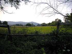 View across farmland to Steep Farm and Wheatham Hill | |
| Highest point | |
| Elevation | 249 m (817 ft) [1] |
| Prominence | 125 m (410 ft) [1] |
| Parent peak | Lewesdon Hill [1] |
| Listing | HuMP |
| Coordinates | 51°02′38″N 0°57′36″W / 51.04402°N 0.960055°WCoordinates: 51°02′38″N 0°57′36″W / 51.04402°N 0.960055°W |
| Geography | |
| Location | Hampshire, England |
| Parent range | North Hampshire Downs, East Hampshire Hangers |
| OS grid | SU731277 |
| Topo map | OS Landranger 186, 197; Explorer 133. |
At 249 metres (817 ft), Wheatham Hill is one of the highest hills in the county of Hampshire, England. It is part of the North Hampshire Downs
Much of the hill is covered in mixed forest and there is a trig point at 244 metres. There is a minor track over the summit.[2] It is located in a Special Area of Conservation known as the East Hampshire Hangers.[3]
On the southeastern spur of the hill in the woods is a tumulus, evidence of prehistoric settlement in the area.[2]
Stoner Hill (233 metres (764 ft)) is a subsidiary summit of Wheatham Hill (249 metres (817 ft)).[4][2]
References
- 1 2 3 Summit Listings by Relative Height by Jonathan de Ferranti. Accessed on 2 Apr 2013.
- 1 2 3 Ordnance Survey 1:50,000 Landranger series 186.
- ↑ East Hampshire Hangers at jncc.defra.gov.uk. Accessed on 2 Apr 2013.
- ↑ Varley, Telford (1922). Hampshire, Cambridge County Geographies, Cambridge University Press, Cambridge, 2013 paperback edition, p. 17. ISBN 978-1-107-62028-5. Varley's use of the term "North Downs" is taken to mean the main "Hampshire Downs", not the "North Downs" of Surrey and Kent.
This article is issued from Wikipedia - version of the 11/22/2016. The text is available under the Creative Commons Attribution/Share Alike but additional terms may apply for the media files.