Stoodleigh
| Stoodleigh | |
 Stoodleigh parish church |
|
 Stoodleigh |
|
| OS grid reference | SS9218818980 |
|---|---|
| Civil parish | Stoodleigh |
| District | Mid Devon |
| Shire county | Devon |
| Region | South West |
| Country | England |
| Sovereign state | United Kingdom |
| Post town | TIVERTON |
| Postcode district | EX16 9 |
| Dialling code | 01884 |
| Police | Devon and Cornwall |
| Fire | Devon and Somerset |
| Ambulance | South Western |
| EU Parliament | South West England |
| UK Parliament | Tiverton and Honiton |
Coordinates: 50°57′34″N 3°32′10″W / 50.9595°N 3.5362°W
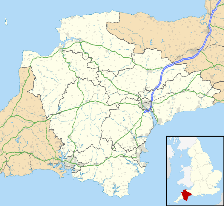
Stoodleigh is a village and civil parish in the Mid Devon district of Devon, England, located 6 miles (10 km) north of Tiverton and 5 miles (8 km) south of Bampton. It is situated 800 feet (240 m) above the Exe Valley, close to the Devon / Somerset border. The centre of the village is a conservation area.[1]
In the past it formed part of Witheridge Hundred and it is within the Tiverton Deanery of the Church of England.[2]
Castle Close
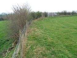
Castle Close is a circular earthwork, close to Stoodleigh, that is most likely to be an Iron Age Hill fort or enclosure.[3]
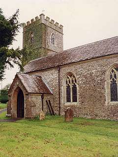
Church of St Margaret's
The Church of St Margaret's was constructed in the 15th century and was extensively restored in 1782.[4] It contains a Norman font which is likely to have come from an earlier church in the parish where the first recorded incumbent was installed in 1264.[1]
References
- 1 2 "About Stoodleigh", Stoodleigh.org
- ↑ "Stoodleigh community page", Devon County Council
- ↑ R.R.Sellman; Aspects of Devon History, Devon Books 1985 – ISBN 0-86114-756-1 – Chapter 2; The Iron Age in Devon. Map Page 11 of Iron Age hill forts in Devon includes Castle Close.
- ↑ "Stoodleigh St. Margaret's", Rootsweb.com
External links
![]() Media related to Stoodleigh at Wikimedia Commons
Media related to Stoodleigh at Wikimedia Commons
 | Towns
| |