Strathcona-Westmin Provincial Park
| Strathcona-Westmin Provincial Park | |
|---|---|
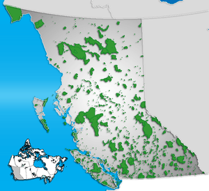 Location of Strathcona-Westmin Provincial Park in British Columbia | |
| Location | British Columbia, Canada |
| Nearest city | Gold River |
| Coordinates | 49°33′53″N 125°33′12″W / 49.56472°N 125.55333°WCoordinates: 49°33′53″N 125°33′12″W / 49.56472°N 125.55333°W |
| Area | 33 km² |
| Established | 1965 |
| Governing body | BC Parks |
Strathcona-Westmin Provincial Park is a 33 km² provincial park on Vancouver Island in British Columbia, Canada. It is located at the southern extremity of Buttle Lake and is completely surrounded by the much larger and more extensively protected Strathcona Provincial Park.
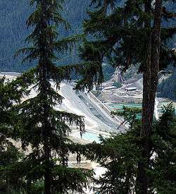
Strathcona-Westmin Provincial Park contains the copper, gold and zinc-producing Myra Falls Operations, which is owned by NVI Mining Ltd., a wholly owned subsidiary of Breakwater Resources Limited.
The area was separated out of the rest of Strathcona Provincial Park in 1965. It is currently designated as a Class-B provincial park, and is expected to be absorbed by the rest of Strathcona Provincial Park once mining operations cease.
Hiking, backcountry camping, and fishing are common park actitivies.