Sullivan Lake (Cochrane District)
| Sullivan Lake | |
|---|---|
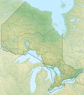 Sullivan Lake Location in Ontario | |
| Location | Cochrane District and Timiskaming District, Ontario |
| Coordinates | 48°16′39″N 79°42′22″W / 48.27750°N 79.70611°WCoordinates: 48°16′39″N 79°42′22″W / 48.27750°N 79.70611°W[1] |
| Part of | Saint Lawrence River drainage basin |
| Primary outflows | Misema River |
| Basin countries | Canada |
| Max. length | 1,008 metres (3,310 ft) |
| Max. width | 230 metres (750 ft) |
| Surface elevation | 375 metres (1,230 ft) |
For other places with the same name, see Sullivan Lake.
Sullivan Lake is a lake in geographic Ben Nevis Township,[2] Cochrane District, with a small tip in geographic Katrine Township,[3] Timiskaming District, in Northeastern Ontario, Canada.[1] It is in the Saint Lawrence River drainage basin and is the source of the Misema River. The lake is also located in the Pushkin Hills, part of the Blake River Megacaldera Complex.[4]
See also
References
- 1 2 "Sullivan Lake". Geographical Names Data Base. Natural Resources Canada. Retrieved 2014-05-16.
- ↑ "Ben Nevis" (PDF). Geology Ontario - Historic Claim Maps. Ontario Ministry of Northern Development, Mines and Forestry. Retrieved 2014-05-16.
- ↑ "Katrine" (PDF). Geology Ontario - Historic Claim Maps. Ontario Ministry of Northern Development, Mines and Forestry. Retrieved 2014-05-16.
- ↑ "Pushkin Hills". Ontario Parks. Retrieved 2014-05-16.
Other map sources:
- Map 15 (PDF) (Map). 1 : 1,600,000. Official road map of Ontario. Ministry of Transportation of Ontario. 2014. Retrieved 2014-05-16.
- Restructured municipalities - Ontario map #3 (Map). Restructuring Maps of Ontario. Ontario Ministry of Municipal Affairs and Housing. 2006. Retrieved 2014-05-16.
This article is issued from Wikipedia - version of the 5/20/2016. The text is available under the Creative Commons Attribution/Share Alike but additional terms may apply for the media files.