Sulphide Creek
| Sulphide Creek | |
| Name origin: Sulphide is the British English spelling for sulphur. | |
| Country | United States |
|---|---|
| State | Washington |
| County | Skagit, Whatcom |
| Source | North Cascades |
| - elevation | 5,803 ft (1,769 m) [1] |
| - coordinates | 48°48′13″N 121°34′52″W / 48.80361°N 121.58111°W [2] |
| Mouth | Skagit River |
| - elevation | 1,210 ft (369 m) [1] |
| - coordinates | 48°46′36″N 121°31′59″W / 48.77667°N 121.53306°WCoordinates: 48°46′36″N 121°31′59″W / 48.77667°N 121.53306°W [2] |
| Length | 2.5 mi (4 km) |
| Discharge | for Baker River |
| - average | 540 cu ft/s (15.3 m3/s) |
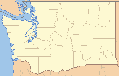 Location of the mouth of Sulphide Creek in Washington | |
Sulphide Creek is a 2.5-mile (4.0 km) glacial tributary of the Baker River in Whatcom County in the U.S. state of Washington, located within a steep and narrow canyon on the southeast flank of Mount Shuksan, inside North Cascades National Park.[2] Although called a creek, it is river-like due to its high volume. Its source is found in the "massive"[3] Sulphide and Crystal glaciers at roughly elevation 5,803 feet (1,769 m), and it runs east collecting several small tributaries before flowing into the Baker River at elevation 1,210 feet (370 m). The creek is known to have a series of very tall waterfalls occurring both on its mainstem and on its tributaries.
Name
"Sulphide" is the British English spelling of sulphur, although the origin of the name is unknown.
Course
After exiting the glaciers, Sulphide Creek skips several hundred feet down a series of Shuksan greenschist cliffs into a small tarn, Sulphide Lake, then as it flows out of the lake, drops down Sulphide Creek Falls, one of the tallest waterfalls in North America at 2,182 feet (665 m).[4] From the falls, it enters a steep and narrow glacial valley, often called a canyon, that has been said to have "no record of descent or exploration".[5]
Directly at the base of the falls, a tributary stream enters Sulphide Creek. on the right bank. The creek then turns slightly to the northeast, and receives a large tributary on the left bank. This tributary heads in several small snowfields on an east flank of Mount Shuksan, and several streams cascade down into a basin where they join together and flow into Sulphide Creek. Four notable waterfalls are found in the basin of this stream; these are Seahpo Peak Falls (2,200 ft or 670 m), Cloudcap Falls (2,400 ft or 730 m), Jagged Ridge Falls (1,500 ft or 460 m) and Rockflow Canyon Falls (200 ft or 61 m).[6]
The creek then continues generally southeast through forest until it joins the Baker River on its right bank, two drainages upstream from Blum Creek and several miles upstream from Baker Lake, a reservoir on the Baker River, and Shannon Creek. At this point, the distance from the confluence to Sulphide Creek Falls is roughly 2 miles (3.2 km).[4]
Volume
The volume of Sulphide Creek at its mouth is roughly 540 cubic feet (15 m3) per second on average, taking into account the flow of the mainstem at Sulphide Creek Falls and adding the flow of the tributary that harbors Rockflow Canyon Falls.[4][6]
See also
References
- 1 2 Elevation derived from Google Earth
- 1 2 3 "Sulphide Creek". Geographic Names Information System. United States Geological Survey. Retrieved 2009-05-16.
- ↑ "Top 10: North America Waterfall Destinations". AskMen.com. Retrieved 2009-05-17.
- 1 2 3 "Sulphide Creek Falls". Bryan Swan and Dean Goss. World Waterfall Database. Retrieved 2009-05-16.
- ↑ "Canyon Prospects in the North Cascades". Canyoneering Northwest. Retrieved 2009-05-16.
- 1 2
- Swan, Bryan. "Seahpo Peak Falls". Waterfalls of the Pacific Northwest. Retrieved 2009-05-17.
- Swan, Bryan. "Cloudcap Falls". Waterfalls of the Pacific Northwest. Retrieved 2009-05-17.
- Swan, Bryan. "Jagged Ridge Falls". Waterfalls of the Pacific Northwest. Retrieved 2009-05-17.
- Swan, Bryan. "Rockflow Canyon Falls". Waterfalls of the Pacific Northwest. Retrieved 2009-05-17.