Sympoliteia (municipality)
For the treaty used in ancient Greece, see Sympoliteia (treaty).
| Sympoliteia Συμπολιτεία | |
|---|---|
 Sympoliteia | |
|
Location within the regional unit 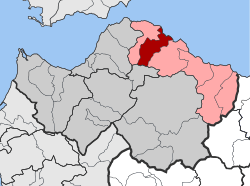 | |
| Coordinates: 38°16′N 22°03′E / 38.267°N 22.050°ECoordinates: 38°16′N 22°03′E / 38.267°N 22.050°E | |
| Country | Greece |
| Administrative region | West Greece |
| Regional unit | Achaea |
| Municipality | Aigialeia |
| • Municipal unit | 85.505 km2 (33.014 sq mi) |
| Elevation | 174 m (571 ft) |
| Population (2011)[1] | |
| • Municipal unit | 6,311 |
| • Municipal unit density | 74/km2 (190/sq mi) |
| Time zone | EET (UTC+2) |
| • Summer (DST) | EEST (UTC+3) |
| Postal code | 251 00 |
| Area code(s) | 2691 |
| Vehicle registration | ΑΧ |
Sympoliteia (Greek: Συμπολιτεία) is a former municipality in Achaea, West Greece, Greece. Since the 2011 local government reform it is part of the municipality Aigialeia, of which it is a municipal unit.[2] The municipal unit has an area of 85.505 km2.[3] Population 6,311 (2011).[1] The seat of the municipality was in Rododafni.
References
- 1 2 "Απογραφή Πληθυσμού - Κατοικιών 2011. ΜΟΝΙΜΟΣ Πληθυσμός" (in Greek). Hellenic Statistical Authority.
- ↑ Kallikratis law Greece Ministry of Interior (Greek)
- ↑ "Population & housing census 2001 (incl. area and average elevation)" (PDF) (in Greek). National Statistical Service of Greece.
External links
- Municipality of Sympoliteia (Greek)
This article is issued from Wikipedia - version of the 12/2/2016. The text is available under the Creative Commons Attribution/Share Alike but additional terms may apply for the media files.