Syracuse Northern Electric Railway
| Locale | Syracuse, New York to Oswego, New York |
|---|---|
| Dates of operation | 1917–1931 |
| Track gauge | 4 ft 8 1⁄2 in (1,435 mm) standard gauge |
The Syracuse Northern Electric Railway, also known as the Syracuse and Northern Electric Railway, was an interurban rail that ran from Syracuse, New York to Oswego, New York, a distance of 35.5 miles (57.1 km). The line also proceeded to South Bay, New York on Oneida Lake.[1]
The rail was formerly the Syracuse and South Bay Railway Company and the name was changed[2] in 1917.[3]
History
The first mortgage was issued on May 1, 1917, to the Trust and Deposit Company of Onondaga, New York, in the form of 5 percent mortgage bonds due on May 1, 1946.[3]
In 1917, the directors authorized the sale of four miles of track from Watertown Junction to South Bay, New York. The double-track lines were torn up and replaced with a single-track line. The section of rail was sold for $30,000.[4]
Syracuse and South Bay railway
The rail was formerly the Syracuse and South Bay Railway Company and the name was changed to Syracuse Northern Electric Railway Company.[2]
Financial
In June 1920, the total value of the Syracuse Northern Electric Railway franchise in Syracuse as determined by the New York State Tax Commission was $4,000, down from $4,150 in 1919.[5]
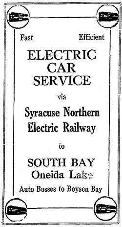
Vacation excursions
By May 1923, a round trip to South Bay from Syracuse cost 82 cents. The company advertised that "Good fishing awaits you at Oneida Lake. Rowboats and motor launches are available for pleasant rides to Frenchmen's Island. Auto buses meet the Electric Cars."[6]
Tickets were sold at the "Electric Terminal" at 112 West Genesee Street where other rails such as Rochester and Syracuse Railroad and Empire State Railway also sold vacation excursions.[6]
Trolleys replaced by buses
In August 1932, the Public Service Commission authorized the railway to substitute buses for trolleys on routes from Brewerton in the town of Cicero in Onondaga County to Syracuse. Additionally, from town of Cicero to South Bay and in the village of North Syracuse.[7]
This action was taken after a rehearing of the petition of the New York Central Railroad Company which claimed that no determination was made in regard to the removal of a bridge just east of the Syracuse-Cicero highway. A previous report of the commission stated that this was a matter between the two companies and any agreement for the removal of the bridge would have to be enforced by a court order. The rehearing counsel for the railway stated that an agreement had been accepted for the removal of the bridge and the hearing was adjourned until request and further hearing was received, if ever.[7]
Outstanding bonds redeemed
During September 1933, Syracuse Northern Electric Railway, Inc. issued a public notice that the company had elected to redeem all of its bonds outstanding on November 1, 1933, which would be deposited with the First Trust and Deposit Company of Syracuse as successor in trust to the original mortgage holder, Trust and Deposit Company of Onondaga a sum sufficient to redeem all bonds plus a premium of 10 percent and accrued interest to that date. All bonds held after that date were declared "null and void" and holders of such bonds were only entitled to look for payment "out of said funds deposited for such purpose."[3]
Land use
The Syracuse Northern Electric Railway ran from Downtown Syracuse north to the Northern Lights Traffic Circle via U.S. Route 11. This was by franchise. The line then proceeded to South Bay, New York, on Oneida Lake over a 100 feet (30 m) right-of-way which is now an Onondaga County roadway known as South Bay Road.[1]
There was a branch line from Watertown Junction (South Bay Road and Pine Grove Road) which went 6.2 miles (10.0 km) miles north to Brewerton. This line is adjacent to the east side of Interstate 81. It is a 100 feet (30 m) wide right-of-way which was occupied by a Niagara Mohawk Electrical Transmission Line by 1974. Some evidence of the railroad bed is visible between Cicero and Brewerton.[1]
References
- 1 2 3 "Inventory of Abandoned Railroad Rights of Way". New York State Department of Transportation, 1974. Retrieved February 18, 2011.
- 1 2 "152 Miles of Deserted Rights of Way Radiate from Syracuse". The Syracuse Herald. Syracuse, New York. November 5, 1933.
- 1 2 3 "Public Notice". Syracuse Herald. Syracuse, New York. September 20, 1933.
- ↑ Electric railway journal, Volume 50. McGraw-Hill Publishing Company, Inc., December 1917, pg. 1100. Retrieved February 4, 2011.
- ↑ "Few Changes Noted in Values of Franchises". Syracuse Herald. Syracuse, New York. June 18, 1920.
- 1 2 "Where to Go Memorial Day". Syracuse Herald. Syracuse, New York. May 29, 1923.
- 1 2 "Skaneateles Power Line Approved". Syracuse Herald. Syracuse, New York. August 10, 1932.