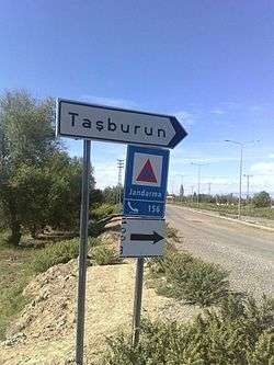
Taşburun
| Taşburun | |
|---|---|
| Town | |
 | |
 Taşburun Location in Turkey | |
| Coordinates: 39°59′N 44°15′E / 39.983°N 44.250°ECoordinates: 39°59′N 44°15′E / 39.983°N 44.250°E | |
| Country |
|
| Province | Iğdır Province |
| District | Karakoyunlu |
| Government | |
| • Mayor | Nesip Aksu (MHP) |
| Elevation | 840 m (2,750 ft) |
| Population (2011) | |
| • Total | 1,908 |
| Time zone | EET (UTC+2) |
| • Summer (DST) | EEST (UTC+3) |
| Postal code | 76800 |
| Area code(s) | 0476 |
| Vehicle registration | 76 |
| Website |
www |
Taşburun is a belde (town) in Iğdır Province, Turkey.
Geography
Taşburun is in Karakoyunlu district of Iğdır Province. It is situated at 39°59′N 44°15′E / 39.983°N 44.250°E on Turkish state highway ![]() which connects Turkey to Nakhchevan (a part of Azerbaijan). Mount Ağrı is to the south and Armenian border is to the east. The distance to Karakoyunlu is 8 kilometres (5.0 mi) and to Iğdır is 22 kilometres (14 mi). The population of Taşburun is 1908[1] as of 2011.
which connects Turkey to Nakhchevan (a part of Azerbaijan). Mount Ağrı is to the south and Armenian border is to the east. The distance to Karakoyunlu is 8 kilometres (5.0 mi) and to Iğdır is 22 kilometres (14 mi). The population of Taşburun is 1908[1] as of 2011.
History
According to mayor's page Taşburun was founded by Turkmen tribe named Taşburun after Seljuks annexed the area to their realm in 1064. In 1239 it was captured by the Mongols and in 1514 by the Ottoman Empire. It was ceded to Safavid Persia by the Treaty of Istanbul (1736) . In 1746 it was returned to Ottoman Empire by the Treaty of Kerden but lost to Russian Empire by the Treaty of San Stefano signed after the Russo-Turkish War (1877–1878). At the end of the First World War it was returmed to Turkey. In 1993 it was declared a seat of township.[2]
Population
| Taşburun's population | |||
|---|---|---|---|
| 2009 | 2,005 | ||
| 2007 | 2,186 | ||
| 2000 | 2,818 | ||
| 1997 | 1,782 | ||
| 1990 | 2,572 | ||
Economy
Main economic sectors are agriculture and animal breeding. There is also a small flour factory.[2]
References
External links
- (Turkish) Official website of the Taşburun Municipality
- (Turkish) Official website of the Karakoyunlu District