Taburete
| Taburete | |
|---|---|
 Taburete volcano seen from the southwest | |
| Highest point | |
| Elevation | 1,172 m (3,845 ft) |
| Coordinates | 13°26′06″N 88°31′55″W / 13.435°N 88.532°WCoordinates: 13°26′06″N 88°31′55″W / 13.435°N 88.532°W |
| Geography | |
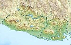 Taburete Location in El Salvador | |
| Location | Usulután Department, El Salvador |
| Geology | |
| Mountain type | Stratovolcano |
| Last eruption | Unknown |
Taburete is a stratovolcano in central El Salvador, rising above the coastal plain between the San Vicente and San Miguel volcanoes, and just west of Usulután volcano. It is topped by a well-preserved, 150–300 m (490–980 ft) deep summit crater, with the true summit on the south side of the crater rim.
See also
References
This article is issued from Wikipedia - version of the 8/13/2015. The text is available under the Creative Commons Attribution/Share Alike but additional terms may apply for the media files.