Talata Mafara
| Talata Mafara | |
|---|---|
| LGA and town | |
 Talata Mafara Location in Nigeria | |
| Coordinates: 12°21′N 6°04′E / 12.350°N 6.067°ECoordinates: 12°21′N 6°04′E / 12.350°N 6.067°E | |
| Country |
|
| State | Zamfara State |
| Area | |
| • Total | 1,430 km2 (550 sq mi) |
| Population (2006 census) | |
| • Total | 215,178 |
| Time zone | WAT (UTC+1) |
| 3-digit postal code prefix | 892 |
| ISO 3166 code | NG.ZA.TM |
Talata Mafara is a Local Government Area in Zamfara State, Nigeria. Its headquarters are in the town of Talata Mafara, about 15 km from the Bakolori Dam on the Sokoto River12°34′00″N 6°04′00″E / 12.56667°N 6.06667°E. The town lies on the southern edge of the major irrigation project fed by the dam.[1] The town is the birthplace of Yahaya Abdulkarim, governor of Sokoto State from January 1992 to November 1993.[2]
It has an area of 1,430 km² and a population of 215,178 at the 2006 census.
The postal code of the area is 892.[3]
References
- ↑ Akané Hartenbach and Jürgen Schuol (October 2005). "Bakolori Dam and Bakolori Irrigation Project – Sokoto River, Nigeria" (PDF). Eawag aquatic research institute. Retrieved 2010-01-10.
- ↑ Golu Timothy (18 June 2009). "I Am Not A Yoruba Man – Former Sokoto Gov". Leadership Nigeria. Retrieved 2010-01-10.
- ↑ "Post Offices- with map of LGA". NIPOST. Retrieved 2009-10-20.
State capital: Gusau | ||
| LGAs | 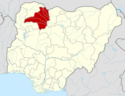 | |
This article is issued from Wikipedia - version of the 5/8/2013. The text is available under the Creative Commons Attribution/Share Alike but additional terms may apply for the media files.