Tarago Parish
| Tarago Parish New South Wales | |||||||||||||
|---|---|---|---|---|---|---|---|---|---|---|---|---|---|
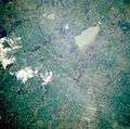 Tarago Parish from space shuttle 2005. | |||||||||||||
| LGA(s) | Goulburn Mulwaree | ||||||||||||
| County | Argyle | ||||||||||||
| Division | Eastern | ||||||||||||
| |||||||||||||
The Parish of Tarago is a parish of Argyle County. It does not actually contain the town of Tarago, which is located further to the south-east in the Parish of Mulwaree.[1]
The Federal Highway passes through the Parish of Tarago to the north of Rowes Lagoon. Currawang Road is another major road in the area.
The Tarago area was first inhabited by the Gundungurra people, [2]\[3][4] who were apparently badly affected by influenza in 1846/47. In the mid 1840s the NSW colonial government granted numerous land grants in area, beginning white settlement.
References
- New South Wales Parish maps preservation project
- "Tarago (Parish)". Geographical Names Register (GNR) of NSW. Geographical Names Board of New South Wales. Retrieved 4 August 2013.
- ↑ "Tarago (Locality)". Geographical Names Register (GNR) of NSW. Geographical Names Board of New South Wales. Retrieved 4 August 2013.
- ↑ Dharag Neighbours.
- ↑ Encyclopaedia of Aboriginal Australia, cited in "Goulburn:Aborigines". Archive associated with Australia Street project. University of Technology, Sydney. Retrieved 2006-07-11. External link in
|work=(help) - ↑ Norman Tindall, http://www.samuseum.sa.gov.au/archives/hdms/aa338/tindaletribes/gandangara.htm |title=Gandangara (NSW) Aboriginal Tribes of Australia (South Australian Museum, 2006).
Coordinates: 34°54′S 149°32′E / 34.900°S 149.533°E
This article is issued from Wikipedia - version of the 11/4/2016. The text is available under the Creative Commons Attribution/Share Alike but additional terms may apply for the media files.