Tell Dahab
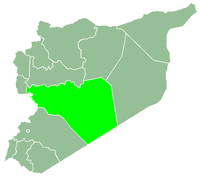
Tell Dahab (Arabic: تل ذهب, also spelled Tal Dhahab) is a village in central Syria, administratively part of the Homs Governorate, located northwest of Homs. Nearby localities include Taldou and Kafr Laha, Maryamin and al-Taybah al-Gharbiyah to the southwest, Awj to the west, Aqrab to the northwest, Bisin to the north and Talaf to the east. According to the Syria Central Bureau of Statistics (CBS), Tell Dahab had a population of 12,055 in the 2004 census.[1] Its inhabitants are predominantly Sunni Muslims.[2][3]
An ancient church dedicated to Saints Sergius and Bacchus, built during the Byzantine era, is located in Tell Dahab.[4] During the late Ottoman era, in 1829, Tell Dahab consisted of 65 feddans and paid annual taxes of 6,930 qirsh.[5] It was a well-established village by the 19th-century and during the brief Egyptian, the local agha ("military commander") Abdullah Agha Tayfur invested in Tell Dahab.[6]
References
Bibliography
|
|---|
|
| |
|---|
| Homs
Subdistrict | |
|---|
| Ayn al-Niser
Subdistrict | |
|---|
| Furqlus
Subdistrict | |
|---|
| Hisyah
Subdistrict | |
|---|
| Khirbet Tin Nur
Subdistrict | |
|---|
| Mahin
Subdistrict | |
|---|
| Qabu
Subdistrict | |
|---|
| Qaryatayn
Subdistrict | |
|---|
| Riqama
Subdistrict | |
|---|
| Sadad
Subdistrict | |
|---|
| Shin
Subdistrict | |
|---|
| Taldou
Subdistrict | |
|---|
|
| |
|
| |
|---|
| Mukharram
Subdistrict | |
|---|
| Jubb al-Jarrah
Subdistrict |
- Jubb al-Jarrah
- Abu Qatur
- Aliyat al-Alyan
- Duwayr al-Gharbiyah
- Duwayr al-Sharqiyah
- Ghuzayliyah
- Maksar al-Hisan
- Masaadah
- Masudiyah
- Mughayzil
- Muntar al-Abal
- Mushayrifah al-Qibliyah
- Rasm Humaydah
- Shiha
- Taladi
- Talaqtah
- Tarfawi
- Tawil
- Umm al-Rif (al-Rish)
- Umm Tuwaynah al-Shamali
- Usmud
|
|---|
|
|
|
|
|
| |
|---|
| Rastan
Subdistrict | |
|---|
| Talbiseh
Subdistrict | |
|---|
|
|
|
| |
|---|
| Tadmur
Subdistrict | |
|---|
| Sukhnah
Subdistrict | |
|---|
|
|
|
| |
|---|
| Talkalakh
Subdistrict | |
|---|
| Hadidah
Subdistrict | |
|---|
| Hawash
Subdistrict | |
|---|
| Nasirah
Subdistrict | |
|---|
|
|