Terevaka
| Mauga Terevaka | |
|---|---|
 | |
| Highest point | |
| Elevation | 507.41 m (1,664.7 ft) |
| Prominence | 506 metres (1,660 ft) |
| Isolation | 2,836 kilometres (1,762 mi) |
| Coordinates | 27°5′4″S 109°22′46″W / 27.08444°S 109.37944°WCoordinates: 27°5′4″S 109°22′46″W / 27.08444°S 109.37944°W |
| Geography | |
| Location | Easter Island |
| Geology | |
| Mountain type | Shield volcano |
| Last eruption | Pleistocene |
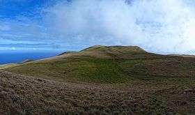
Ma′unga Terevaka is the largest, tallest (507.41 m (1,664.73 ft)) and youngest of three main extinct volcanoes that form Rapa Nui (Easter Island, a Chilean island in the Pacific Ocean). Several smaller volcanic cones and craters dot its slopes, including a crater hosting one of the island's three lakes, Rano Aroi.
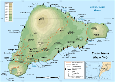
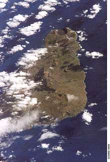
While Terevaka forms the bulk of Easter Island, the island has two older volcanic peaks; Poike which forms the eastern headland and Rano Kau the southern. Terevaka last erupted in the Pleistocene and is less than 400,000 years old. Its lava field at Roiho has been dated at between 110,000 and 150,000 years old. Terevaka is an easy walk up on a trail that starts next to the moai at Ahu Akivi, by foot or horse. It is often very windy at the top.
See also
References
- Haase, Karsten M.; Peter Stoffers; C. Dieter Garbe-Schönberg (October 1997). "The Petrogenetic Evolution of Lavas from Easter Island and Neighbouring Seamounts, Near-ridge Hotspot Volcanoes in the SE Pacific". Journal of Petrology. 38 (06): 785–813. doi:10.1093/petrology/38.6.785. Retrieved 2010-03-16.
- Kaneoka I, Katsui Y, 1985. K-Ar ages of volcanic rocks from Easter Island. Bull Volc Soc Japan, 30: 33-36.
- Vezzoli L, Acocella V, 2009. Easter Island, SE Pacific: an end-member type of hotspot volcanism. Geol Soc Amer Bull, 121: 869-886.
External links
- Education-Conservation-Research Terevaka Archaeological Outreach (non-profit)
- Guide to Easter Island from the Easter Island Foundation
- Old photos of Rano Aroi (upper right)