Tharbogang
| Tharbogang New South Wales | |
|---|---|
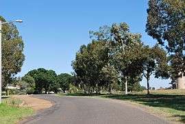 Dunn St in Tharbogang | |
|
Tharbogang | |
| Coordinates | 34°15′0″S 145°59′0″E / 34.25000°S 145.98333°ECoordinates: 34°15′0″S 145°59′0″E / 34.25000°S 145.98333°E |
| Population | 676 (2011 census)[1] |
| Postcode(s) | 2680 |
| Location | |
| LGA(s) | City of Griffith |
| State electorate(s) | Murray |
| Federal Division(s) | Riverina |
Tharbogang is a village and rural locality in the Riverina region of southwest New South Wales, Australia. The village is in the City of Griffith local government area and on the Kidman Way, 8 kilometres (5.0 mi) north west of the centre of Griffith and 580 kilometres (360 mi) west of the state capital, Sydney.
At the 2011 census, Tharbogang and the surrounding rural area had a population of 676.[1]
Tharbogang is a former station on the Temora–Roto railway line.
References
- 1 2 Australian Bureau of Statistics (31 October 2012). "Tharbogang (State Suburb)". 2011 Census QuickStats. Retrieved 30 March 2015.
External links
![]() Media related to Tharbogang at Wikimedia Commons
Media related to Tharbogang at Wikimedia Commons
| Preceding station | NSW Branch lines | Following station | ||
|---|---|---|---|---|
Lakeview towards Roto | Temora-Roto Line | towards Temora |
This article is issued from Wikipedia - version of the 3/30/2015. The text is available under the Creative Commons Attribution/Share Alike but additional terms may apply for the media files.