Thingdawl Te Tlang
| Thingdawlte Tlang | |
|---|---|
 Thingdawlte Tlang | |
| Highest point | |
| Elevation | 959.8 m (3,149 ft) |
| Listing | List of mountains of Bangladesh |
| Coordinates | 21°54′37″N 92°35′22″E / 21.91028°N 92.58944°ECoordinates: 21°54′37″N 92°35′22″E / 21.91028°N 92.58944°E |
| Geography | |
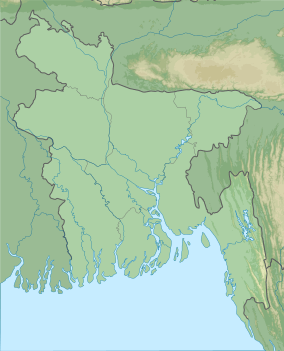 Thingdawlte Tlang Geo position of Thingdawlte Tlang | |
| Location | Ruma Bandarban |
| Parent range | Lowmbok Row |
| Geology | |
| Mountain type | Mountain |
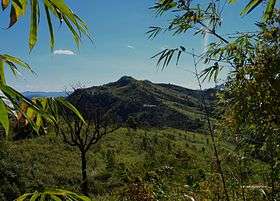
Thingdawlte Tlang[1] is a significant peak of Bangladesh.This peak is the Highest point of 'lawmbok Row' range and possible 7th highest of the country.In December,2012 a local explorer Fahim Hasan of "BD Explorer"[2] summited the peak of Thingdawlte Tlang and measured the height for the first time.Which is 3149 feet(959.8 m).[3] Gps accuracy was 3m(+/-).The name of the peak was collected by BD Explorer and confirmed by the local tribal people of Thingdawl Te village. Few days later Zaqiul Deep of "Travelers Of Bangladesh" measured the peak as 3,133 feet(955m). The most easiest route to summit this peak is to start from Ruma of Bandarban district.[4] Nearest sattlement is known as Thingdawlte(Bawm)village.This peak is named after this village.
See also
References
- ↑ "Photo of View of "Thingdawl Te Tlang" (থিংদৌল তে ত্ল্যাং) from "Kreikung Taung"". Panoramio. Retrieved 30 September 2015.
- ↑ "Photos by BD Explorer > best". Panoramio. Retrieved 30 September 2015.
- ↑ "Wikiloc - Photo of Expedition:Scaling unknown Heights By-BD Explorer". Wikiloc - GPS trails and waypoints of the World. Retrieved 30 September 2015.
- ↑ "Wikiloc - Expedition:Scaling unknown Heights By-BD Explorer trail - Ruma Bāzār (Bangladesh)- GPS track". Wikiloc - GPS trails and waypoints of the World. Retrieved 30 September 2015.