Thornleigh, New South Wales
| Thornleigh Sydney, New South Wales | |||||||||||||
|---|---|---|---|---|---|---|---|---|---|---|---|---|---|
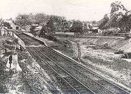 Thornleigh Railway Station in 1904 | |||||||||||||
| Population | 8,115 (2011 census)[1] | ||||||||||||
| Postcode(s) | 2120 | ||||||||||||
| Location | 25 km (16 mi) north-west of Sydney CBD | ||||||||||||
| LGA(s) | Hornsby Shire | ||||||||||||
| Region | Northern Suburbs | ||||||||||||
| State electorate(s) | Hornsby, Ku-ring-gai | ||||||||||||
| Federal Division(s) | Berowra, Bradfield | ||||||||||||
| |||||||||||||

Seventh_Day_Adventist_Church(Thornleigh).jpg)
Thornleigh is a suburb of Sydney, in the state of New South Wales, Australia 25 kilometres (16 mi) north-west of the Sydney central business district in the local government area of Hornsby Shire. Thornleigh is bounded to the north by Waitara Creek. Thornleigh borders the suburbs of Normanhurst, Westleigh, Hornsby, Wahroonga and Pennant Hills. It is considered part of the Northern Suburbs of Sydney.
Thornleigh offers great district views and the topography varies greatly with many properties built around bushland settings and into the hills to afford the great views. Top streets are considered the top of Tillock Street and Wanawong Drive for some of the suburbs best views and proximity to the train station.
History
The first non indigenous people to explore the area of Thornleigh were a party led by Governor Arthur Phillip in 1788. Settlers moved into the area in the 1830s and among them were James Milson, Patrick Duffy, John Thorn and Samuel Horne.[2]
Thornleigh is named after Constable John Thorn, who, along with Constable Horne, captured bushrangers Dalton and John MacNamara, leader of the North Rocks gang, on 22 June 1830, and were granted land as a reward in 1838. Horne's land became Hornsby, and Thorn's land became Thornleigh. The railway line was built in the 1880s and development followed.[3]
Thornleigh Post Office opened on 12 March 1888.[4]
As part of the construction of the railway from Strathfield to Hornsby, a 1.2km branch was constructed in 1884 by the contractors to a quarry in a gully west of Thornleigh. The tracks included a zig zag section.[5]
In 1901, the National Brickworks started operations at Thornleigh. In 1913, the largest malt works in the southern hemisphere was established by WG Chilvers.[2]
During the Great Depression of the 1930s, unemployment was a problem in the area, so a local woman named Lorna Brand raised money for the construction of a walking track near the Lane Cove River as a way of providing relief work. The track begins at Thornleigh Oval, at the bottom of Handley Avenue, and goes through the bush towards the Lane Cove River. It then goes parallel to the river for a short distance before looping back to arrive at Comenarra Parkway. An extension goes down to the river, through a spot called Conscript Pass. At this spot, there are rock carvings done by the men who worked on the track. One of the carvings is a caricature of Bertram Stevens, Premier of New South Wales from 1932 to 1939.[6] The track is known as Lorna Pass in memory of Lorna Brand, and is now part of the Great North Walk, a long-distance walking trail between Sydney and Newcastle.[7]
Transport
Thornleigh railway station is on the North Shore, Northern & Western Line of the Sydney Trains network. Pennant Hills Road is part of the National Highway, and is one of Sydney's major thoroughfares. The Esplanade from Pennant Hills is a main road accessing Thornleigh to Normanhurst.
Commercial areas
Thornleigh contains industrial and commercial areas. Thornleigh Marketplace containing a supermarket and speciality stores was constructed in 2005. Shops and restaurants are located around Thornleigh railway station and nearby Pennant Hills Road. American multinational fast food restaurant chain McDonald's have their Australian headquarters in Thornleigh.[8]
Schools
- Thornleigh West Public School is a primary school (K-6).
- Thornleigh Public School (K-6) closed at the end of 1989 with the widening of Pennant Hills Road to six lanes.
- Normanhurst West Public School (K-6) at the corner of Sefton and Dartford Roads.
Population and demographics
At the 2011 census, the population of Thornleigh in 2011 was 8,115 people. Of these:[1]
- Age distribution
- The distribution of ages in Thornleigh was very similar to the country as a whole. Thornleigh residents' median age was 38 years, compared to the national median of 37. Children aged under 15 years made up 22% of the population (national average was 19%) and people aged 65 years and over made up 14% of the population (national average was 14%).
- Ethnic diversity
- Just over two-thirds (67%) of Thornleigh residents were born in Australia, compared to the national average of 70%; another 4.4% came from England, 3.1% from China and 2.9% from India. However, only 26% identify their ancestry as Australian, which is the largest group; the next most common self-identified ancestries were English 24.1%, Irish 7.6%, Chinese 6.4% and Scottish 6.3%. Nearly three-quarters (74%) of people only spoke English at home; other languages spoken at home included Arabic 3.8%, Mandarin 3.4%, Cantonese 2.7%, Korean 1.3% and Hindi 1.3%.
- Employment
- There were 4,208 people who reported being in the labour force in the week before Census night in Thornleigh. Of these, 61% were employed full-time, 29% were employed part-time and 4.1% were unemployed. The most common occupations included Professionals 36%, Clerical and Administrative Workers 16%, and Managers 15%. 23% of employed people travelled to work on public transport and 55% by car (either as driver or as passenger).
- Finances
- The median weekly household income was $1,964, compared to the national median of $1,234. Real estate values were correspondingly high: the median monthly mortgage repayments were $2,600 compared to the national median of $1,800.
- Housing
- The great majority (83%) of private dwellings were family households, 16% were single person households and 1.8% were group households. Stand-alone houses accounted for 90% of dwellings, while 2.5% were flats, units or apartments and 7.1% were semi-detached. The average people per household was 2.9.
Sport
The local sports clubs include the Thornleigh Sport and Recreation Club with baseball, basketball, cricket, netball, soccer and softball divisions.[9] The soccer club known as Thunder FC consists of teams ranging from Under 6s through to All Age divisions playing in the Gladesville Hornsby Football Association. Home grounds are Oakleigh Oval and Ruddock Park.[10] The Brickpit Park is used for Basketball, Golf driving range, skateboarding and other passive recreational activities.[11] Thornleigh Squash Centre has 9 glass backed courts.[12]
References
- 1 2 Australian Bureau of Statistics (31 October 2012). "Thornleigh (State Suburb)". 2011 Census QuickStats. Retrieved 7 November 2012.
- 1 2 Joan Rowland (2008). "Thornleigh". Dictionary of Sydney. Dictionary of Sydney Trust. Retrieved 7 March 2013.
- ↑ The Book of Sydney Suburbs, Compiled by Frances Pollen, Angus & Robertson Publishers, 1990, Published in Australia ISBN 0-207-14495-8, page 255
- ↑ Premier Postal History. "Post Office List". Retrieved 1 June 2012.
- ↑ Oakes, John. Sydney's Forgotten Quarry Railways. pp. 65–71. ISBN 0975787039.
- ↑ The Great North Walk, McDougall, Shearer-Heriot (Kangaroo Press) 1988, p.49
- ↑ Sydney and Blue Mountains Bushwalks, Neil Paton (Kangaroo Press) 2004, pp.19-20
- ↑ "Organisation". Head Office 21-29 Central Ave THORNLEIGH NSW 2120. McDonalds. Retrieved 1 August 2013.
- ↑ "Thornleigh Sports Club". The Club is an integrated not-for-profit community sports and recreation organisation in Sydney’s Northern suburbs.It offers all residents, but particularly residents in the Thornleigh / Westleigh / Normanhurst / Pennant Hills / Hornsby area, access to a variety of sports and activities to enhance the health and well being of the community at large. Retrieved 14 March 2013.
- ↑ "Thornleigh Thunder FC". Retrieved 14 March 2013.
- ↑ "Brickpit Park". Facilities: Playground Flying fox and large climbing net Picnic tables Skate park Thornleigh Indoor Sports Stadium. Hornsby Council. Retrieved 14 March 2013.
- ↑ "Thornleigh Squash Centre". Sports Courts. Retrieved 14 March 2013.
External links
| Wikimedia Commons has media related to Thornleigh, New South Wales. |
Coordinates: 33°44′00″S 151°04′32″E / 33.73340°S 151.07553°E