Tiarno di Sopra
| Tiarno di Sopra | |
|---|---|
| Frazione | |
 Tiarno di Sopra Location of Tiarno di Sopra in Italy | |
| Coordinates: 45°53′N 10°40′E / 45.883°N 10.667°ECoordinates: 45°53′N 10°40′E / 45.883°N 10.667°E | |
| Country |
|
| Region | Trentino-Alto Adige/Südtirol |
| Province | Trentino (TN) |
| Comune | Ledro |
| Area(referred to the former municipality) | |
| • Total | 38.7 km2 (14.9 sq mi) |
| Population (Dec. 2004) | |
| • Total | 1,019 |
| • Density | 26/km2 (68/sq mi) |
| Demonym(s) | |
| Time zone | CET (UTC+1) |
| • Summer (DST) | CEST (UTC+2) |
| Postal code | 38060 |
| Dialing code | 0464 |
Tiarno di Sopra was a comune (municipality) in Trentino in the Italian region Trentino-Alto Adige/Südtirol. On January 1, 2010 it merged (with Pieve di Ledro, Bezzecca, Concei, Molina di Ledro and Tiarno di Sotto) in the new municipality of Ledro.[1][2]
Geography
Tiarno di Sopra, located about 40 km southwest of Trento, bordered with the following municipalities: Condino, Bezzecca, Cimego, Tiarno di Sotto, Storo, Molina di Ledro, Tremosine, Bondone and Magasa.
Demographic evolution
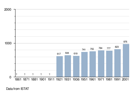
As of December 31, 2004, it had a population of 1,019 and an area of 38.7 km².[3]
References
External links
This article is issued from Wikipedia - version of the 4/10/2014. The text is available under the Creative Commons Attribution/Share Alike but additional terms may apply for the media files.