Tornado watch
- See Severe weather terminology (United States) for a comprehensive article on related weather terms.
A tornado watch (SAME code: TOA) is issued when weather conditions are favorable for the development of severe thunderstorms called a Supercell that are capable of producing tornadoes.[1] A tornado watch therefore implies that it is also a severe thunderstorm watch. A tornado watch must not be confused with a tornado warning. In most cases, the potential exists for large hail and/or damaging winds in addition to tornadoes.
A watch does not mean that the severe weather is actually occurring, only that atmospheric conditions have created a significant risk for it. If severe weather actually does occur, a tornado warning or severe thunderstorm warning would then be issued. Note that a watch is not required for a warning to be issued; tornado warnings are occasionally issued when a tornado watch is not active (i.e. when a severe thunderstorm watch is active, or when no watches are in effect), if a severe thunderstorm develops and has a confirmed tornado or strong rotation.
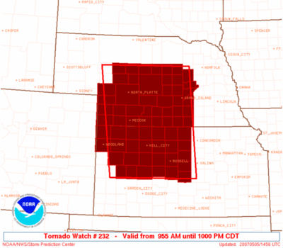
In the United States, the Storm Prediction Center (a national guidance center of the National Weather Service) issues watches for areas likely to produce tornadoes and severe thunderstorms. The watch boxes (or weather watches, WWs) are usually issued in the format of x miles north and south, or east and west, or either side of a line from y miles direction of city, state, to z miles another direction of another city, state. For example: "50 miles either side of a line from 10 miles northeast of Columbia, South Carolina to 15 miles south-southwest of Montgomery, Alabama" ("Either side" means perpendicular to the center line). In addition, a list of all counties included in its area of responsibility is now issued by each NWS forecast office for each watch.
In the event that a tornado watch is likely to lead to a major tornado outbreak along with possible destructive winds and hail, enhanced wording with the words Particularly Dangerous Situation (PDS) can be added to the watch; this is occasionally issued. Occasionally, a tornado watch may replace a severe thunderstorm watch (or a portion of one) should conditions that were originally forecast to be conducive for non-tornadic severe thunderstorms change to allow possible tornado formation.
In Canada, the criteria used to issue a tornado watch are the same and watches are issued by regional offices of the Meteorological Service of Canada of Environment Canada in Vancouver, Edmonton, Toronto, Montreal and Halifax, on a county or regional basis.
The term "red box" refers to the assigned coloring used for watch box outlines used in Storm Prediction Center and National Weather Service products; television stations typically assign other colors (colors used may vary, but very seldom if ever red, which is usually used for tornado warnings) to highlight tornado watches in severe weather advisory displays.
Watch Outline Updates and Status Messages
Watch Outline Updates are relayed (and at the initial watch issuance, issued) by the Storm Prediction Center, however it is the local National Weather Service Weather Forecast Offices that decide what counties (in their warning area) are included or excluded in the watch, via a conference call with the SPC. As a result, watch products will sometimes display counties inside the watch outline that are not included in the counties listed, and vice versa; however the local Weather Forecast Office will need to expand to add these counties into the watch. A Watch Status Message works in a similar fashion; the SPC designates which areas it thinks where a threat still exists (the most common designation for this is on the basis of the location of surface features such as cold fronts and drylines that would delineate where the threat of severe thunderstorms has ended and where it will remain a possibility), and the NWS offices decide what counties to remove from the watch (the local offices will almost always follow the SPC recommendation on the status messages).[2]
If conditions are no longer favorable for tornadoes in the watch area (either because atmospheric conditions that earlier supported tornadic development have become less conducive for them or were not present compared to predictions in earlier forecasts to form tornadoes), the tornado watch may either be replaced by a severe thunderstorm watch or cancelled outright; if no thunderstorm activity occurs, this leads to a tornado watch "bust", which may also factor into the Storm Prediction Center's decision as to whether to cancel the watch.
Example of a tornado watch
  SEL8

  URGENT - IMMEDIATE BROADCAST REQUESTED
  TORNADO WATCH NUMBER 68
  NWS STORM PREDICTION CENTER NORMAN OK
  825 AM EDT THU MAR 26 2009

  THE NWS STORM PREDICTION CENTER HAS ISSUED A
  TORNADO WATCH FOR PORTIONS OF

         SOUTHEAST ALABAMA
         WESTERN FLORIDA PANHANDLE
         SOUTHWEST GEORGIA
         COASTAL WATERS

  EFFECTIVE THIS THURSDAY MORNING AND AFTERNOON FROM 825 AM UNTIL
  200 PM EDT.

  TORNADOES...HAIL TO 1 INCH IN DIAMETER...THUNDERSTORM WIND GUSTS
  TO 70 MPH...AND DANGEROUS LIGHTNING ARE POSSIBLE IN THESE AREAS.

  THE TORNADO WATCH AREA IS APPROXIMATELY ALONG AND 55 STATUTE
  MILES EAST AND WEST OF A LINE FROM 15 MILES EAST OF ATLANTA
  GEORGIA TO 30 MILES SOUTH SOUTHEAST OF CRESTVIEW FLORIDA.  FOR A
  COMPLETE DEPICTION OF THE WATCH SEE THE ASSOCIATED WATCH OUTLINE
  UPDATE (WOUS64 KWNS WOU8).

  REMEMBER...A TORNADO WATCH MEANS CONDITIONS ARE FAVORABLE FOR
  TORNADOES AND SEVERE THUNDERSTORMS IN AND CLOSE TO THE WATCH
  AREA. PERSONS IN THESE AREAS SHOULD BE ON THE LOOKOUT FOR
  THREATENING WEATHER CONDITIONS AND LISTEN FOR LATER STATEMENTS
  AND POSSIBLE WARNINGS.

  OTHER WATCH INFORMATION...CONTINUE...WW 67...

  DISCUSSION...SQUALL LINE WITH EMBEDDED BOW ECHOES AND SUPERCELLS
  WILL CONTINUE EAST THROUGH SE AL...WRN AND CNTRL GA...AND THE FL
  PANHANDLE NEXT FEW HOURS. INSTABILITY IS MARGINAL AHEAD OF THE
  LINE...BUT MAY BE SUFFICIENT FOR A THREAT OF ISOLATED DAMAGING WIND
  AND PERHAPS ISOLATED TORNADOES GIVEN THE FAVORABLY SHEARED
  ENVIRONMENT.

  AVIATION...TORNADOES AND A FEW SEVERE THUNDERSTORMS WITH HAIL
  SURFACE AND ALOFT TO 1 INCH. EXTREME TURBULENCE AND SURFACE WIND
  GUSTS TO 60 KNOTS. A FEW CUMULONIMBI WITH MAXIMUM TOPS TO 500.
  MEAN STORM MOTION VECTOR 25035.


  ...DIAL/HALES
Example of a Watch Outline Update
  BULLETIN - IMMEDIATE BROADCAST REQUESTED
  TORNADO WATCH OUTLINE UPDATE FOR WT 68
  NWS STORM PREDICTION CENTER NORMAN OK
  825 AM EDT THU MAR 26 2009

  TORNADO WATCH 68 IS IN EFFECT UNTIL 200 PM EDT FOR THE
   FOLLOWING LOCATIONS

  ALC031-045-061-067-069-261800-
  /O.NEW.KWNS.TO.A.0068.090326T1225Z-090326T1800Z/

  AL
  .    ALABAMA COUNTIES INCLUDED ARE

  COFFEE               DALE                GENEVA
  HENRY                HOUSTON


  FLC005-013-045-059-063-131-133-261800-
  /O.NEW.KWNS.TO.A.0068.090326T1225Z-090326T1800Z/

  FL
  .    FLORIDA COUNTIES INCLUDED ARE

  BAY                  CALHOUN             GULF
  HOLMES               JACKSON             WALTON
  WASHINGTON


  GAC035-037-053-061-063-077-079-099-113-145-149-151-171-197-199-
  201-207-215-231-239-243-249-253-255-259-261-263-269-273-285-293-
  307-261800-
  /O.NEW.KWNS.TO.A.0068.090326T1225Z-090326T1800Z/

  GA
  .    GEORGIA COUNTIES INCLUDED ARE

  BUTTS                CALHOUN             CHATTAHOOCHEE
  CLAY                 CLAYTON             COWETA
  CRAWFORD             EARLY               FAYETTE
  HARRIS               HEARD               HENRY
  LAMAR                MARION              MERIWETHER
  MILLER               MONROE              MUSCOGEE
  PIKE                 QUITMAN             RANDOLPH
  SCHLEY               SEMINOLE            SPALDING
  STEWART              SUMTER              TALBOT
  TAYLOR               TERRELL             TROUP
  UPSON                WEBSTER


  GMZ750-261800-
  /O.NEW.KWNS.TO.A.0068.090326T1225Z-090326T1800Z/

  CW

  .    ADJACENT COASTAL WATERS INCLUDED ARE

  COASTAL WATERS FROM APALACHICOLA TO DESTIN FL OUT 20 NM

  ATTN...WFO...TAE...FFC...
Example of a Watch Status Message
STATUS REPORT #1 ON WW 68

VALID 261425Z - 261540Z

SEVERE WEATHER THREAT CONTINUES RIGHT OF A LINE FROM 20 ESE PNS
TO 30 N DHN TO 15 E ATL.

..SPC..03/26/09

ATTN...WFO...TAE...FFC...
References
- ↑ Tornado Safety Facts - Tornado Safety 101
- ↑ http://www.crh.noaa.gov/product_sites.php?site=ICT&product=WCN|Watch County Notification Messages