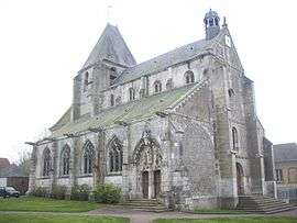
Tourny
| Tourny | ||
|---|---|---|
 | ||
| ||
 Tourny | ||
|
Location within Normandy region  Tourny | ||
| Coordinates: 49°11′06″N 1°32′48″E / 49.185°N 1.5467°ECoordinates: 49°11′06″N 1°32′48″E / 49.185°N 1.5467°E | ||
| Country | France | |
| Region | Normandy | |
| Department | Eure | |
| Arrondissement | Les Andelys | |
| Canton | Les Andelys | |
| Intercommunality | Epte-Vexin-Seine | |
| Government | ||
| • Mayor (2008–2014) | Daniel Foucher | |
| Area1 | 11.95 km2 (4.61 sq mi) | |
| Population (2008)2 | 909 | |
| • Density | 76/km2 (200/sq mi) | |
| Time zone | CET (UTC+1) | |
| • Summer (DST) | CEST (UTC+2) | |
| INSEE/Postal code | 27653 / 27510 | |
| Elevation | 106–159 m (348–522 ft) | |
|
1 French Land Register data, which excludes lakes, ponds, glaciers > 1 km² (0.386 sq mi or 247 acres) and river estuaries. 2 Population without double counting: residents of multiple communes (e.g., students and military personnel) only counted once. | ||

Tourny is a former commune in the Eure department in Normandy in northern France. On 1 January 2016, it was merged into the new commune of Vexin-sur-Epte.[1]
Population
| Historical population | ||
|---|---|---|
| Year | Pop. | ±% |
| 1793 | 1,079 | — |
| 1800 | 902 | −16.4% |
| 1806 | 1,062 | +17.7% |
| 1821 | 1,002 | −5.6% |
| 1831 | 1,001 | −0.1% |
| 1836 | 994 | −0.7% |
| 1841 | 955 | −3.9% |
| 1846 | 940 | −1.6% |
| 1851 | 900 | −4.3% |
| 1856 | 817 | −9.2% |
| 1861 | 803 | −1.7% |
| 1866 | 866 | +7.8% |
| 1872 | 835 | −3.6% |
| 1876 | 835 | +0.0% |
| 1881 | 765 | −8.4% |
| 1886 | 781 | +2.1% |
| 1891 | 796 | +1.9% |
| 1896 | 774 | −2.8% |
| 1901 | 721 | −6.8% |
| 1906 | 692 | −4.0% |
| 1911 | 694 | +0.3% |
| 1921 | 604 | −13.0% |
| 1926 | 590 | −2.3% |
| 1931 | 607 | +2.9% |
| 1936 | 562 | −7.4% |
| 1946 | 639 | +13.7% |
| 1954 | 636 | −0.5% |
| 1962 | 678 | +6.6% |
| 1968 | 677 | −0.1% |
| 1975 | 677 | +0.0% |
| 1982 | 695 | +2.7% |
| 1990 | 739 | +6.3% |
| 1999 | 900 | +21.8% |
| 2008 | 909 | +1.0% |
See also
References
- ↑ Arrêté préfectoral 4 December 2015 (French)
| Wikimedia Commons has media related to Tourny. |
This article is issued from Wikipedia - version of the 3/24/2016. The text is available under the Creative Commons Attribution/Share Alike but additional terms may apply for the media files.