Trairi
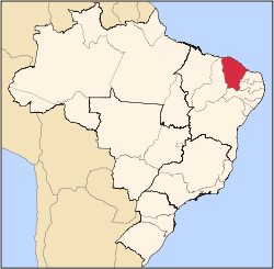
Trairi is a municipality in the state of Ceará in the Northeast region of Brazil.[1][2][3][4]
Trairi has a population of approximately 51000 inhabitants (2012) and is famous for its shorline stretching from Guajiru[5] to Mundaú.[6]
In 2013 the construction of a huge controversial windmill park began in the dunes from Barra Grande[7] to the Mundaú River.
See also
References
- ↑ "Divisão Territorial do Brasil" (in Portuguese). Divisão Territorial do Brasil e Limites Territoriais, Instituto Brasileiro de Geografia e Estatística (IBGE). July 1, 2008. Retrieved December 17, 2009.
- ↑ "Estimativas da população para 1º de julho de 2009" (PDF) (in Portuguese). Estimativas de População, Instituto Brasileiro de Geografia e Estatística (IBGE). August 14, 2009. Retrieved December 17, 2009.
- ↑ "Ranking decrescente do IDH-M dos municípios do Brasil" (in Portuguese). Atlas do Desenvolvimento Humano, Programa das Nações Unidas para o Desenvolvimento (PNUD). 2000. Retrieved December 17, 2009.
- ↑ "Produto Interno Bruto dos Municípios 2002-2005" (PDF) (in Portuguese). Instituto Brasileiro de Geografia e Estatística (IBGE). December 19, 2007. Retrieved December 17, 2009.
- ↑ Guajiru
- ↑ Mundaú
- ↑ Barra Grande
|
|---|
|
|
|
| Centro-Sul Cearense |
|---|
| Iguatu | |
|---|
| Lavras da Mangabeira | |
|---|
| Varzea Alegre | |
|---|
|
| |
|
| Jaguaribe |
|---|
| Baixo Jaguaribe | |
|---|
| Litoral de Aracati | |
|---|
| Medio Jaguaribe | |
|---|
| Serra do Pereiro | |
|---|
|
|
|
| Metropolitana de Fortaleza |
|---|
| |
|
|
| Noroeste Cearense |
|---|
| Coreau | |
|---|
| Ibiapaba | |
|---|
| Ipu | |
|---|
| Litoral de Camocim e Acarau | |
|---|
| Meruoca | |
|---|
| Santa Quiteria | |
|---|
| Sobral | |
|---|
|
|
|
| Norte Cearense |
|---|
| Baixo Curu | |
|---|
| Baturite | |
|---|
| Caninde | |
|---|
| Cascavel | |
|---|
| Chorozinho | |
|---|
| Itapipoca | |
|---|
| Medio Curu | |
|---|
| Uruburetama | |
|---|
|
|
|
| Sertoes Cearenses |
|---|
| Sertao de Crateus | |
|---|
| Sertao de Inhamuns | |
|---|
| Sertao de Quixeramobim | |
|---|
| Sertao de Senador Pompeu | |
|---|
|
|
|
| Sul Cearense |
|---|
| Barro | |
|---|
| Brejo Santo | |
|---|
| Cariri | |
|---|
| Caririacu | |
|---|
| Chapada do Araripe | |
|---|
|
|
Coordinates: 3°16′40″S 39°16′08″W / 3.27778°S 39.2689°W / -3.27778; -39.2689