Trenton–Robbinsville Airport
| Trenton–Robbinsville Airport | |||||||||||
|---|---|---|---|---|---|---|---|---|---|---|---|
 | |||||||||||
| IATA: none – ICAO: none – FAA LID: N87 | |||||||||||
| Summary | |||||||||||
| Airport type | Public use | ||||||||||
| Owner | TRA Inc. | ||||||||||
| Serves | Robbinsville, New Jersey | ||||||||||
| Location | Mercer County, New Jersey | ||||||||||
| Elevation AMSL | 118 ft / 36 m | ||||||||||
| Coordinates | 40°12′50″N 074°36′06″W / 40.21389°N 74.60167°WCoordinates: 40°12′50″N 074°36′06″W / 40.21389°N 74.60167°W | ||||||||||
| Website |
RobbinsvilleAirport | ||||||||||
| Map | |||||||||||
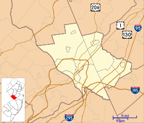 N87 Location in Mercer County, New Jersey | |||||||||||
| Runways | |||||||||||
| |||||||||||
| Statistics (2009) | |||||||||||
| |||||||||||
Trenton–Robbinsville Airport (FAA LID: N87) is a privately owned, public use airport located one nautical mile (2 km) east of the central business district of Robbinsville, in Mercer County, New Jersey, United States.[1] It is included in the National Plan of Integrated Airport Systems for 2011–2015, which categorized it as a general aviation reliever airport.[2]
The airport is located next to Miry Run Golf Course on Sharon Road just off Route 130. Small private planes fly into Trenton–Robbinsville Airport. It offers gas, lessons, rental planes, and hangars for privately owned planes. Cutting Edge Aviation and Aviation Charters is located at the west end of the field and offer full service aircraft maintenance.
The airport is improving safety issues. Work geared towards that goal started in October 2011 and were expected to finish in June 2012.
Facilities and aircraft
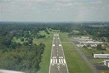
Trenton–Robbinsville Airport covers an area of 139 acres (56 ha) at an elevation of 118 feet (36 m) above mean sea level. It has one runway designated 11/29 with an asphalt surface measuring 4,275 by 75 feet (1,303 x 23 m).[1]
For the 12-month period ending January 2, 2009, the airport had 19,615 general aviation aircraft operations, an average of 53 per day. At that time there were 58 aircraft based at this airport: 93% single-engine, 5% multi-engine, and 2% helicopter.[1]
See also
References
- 1 2 3 4 FAA Airport Master Record for N87 (Form 5010 PDF). Federal Aviation Administration. Effective November 15, 2012.
- ↑ "2011–2015 NPIAS Report, Appendix A" (PDF, 2.03 MB). National Plan of Integrated Airport Systems. Federal Aviation Administration. October 4, 2010. External link in
|work=(help)
External links
- Trenton–Robbinsville Airport
- Trenton–Robbinsville Airport (N87) from New Jersey DOT Airport Directory
- Aerial image as of April 1995 from USGS The National Map
- FAA Terminal Procedures for N87, effective December 8, 2016
- Resources for this airport:
- FAA airport information for N87
- AirNav airport information for N87
- FlightAware airport information and live flight tracker
- SkyVector aeronautical chart for N87