Triveniganj
| Triveniganj Tribeniganj | |
|---|---|
| Town | |
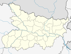 Triveniganj Location in Bihar | |
| Coordinates: IN 26°07′41″N 86°53′20″E / 26.128°N 86.889°ECoordinates: IN 26°07′41″N 86°53′20″E / 26.128°N 86.889°E | |
| Country |
|
| District | Supaul |
| Elevation | 59 m (194 ft) |
| Languages | |
| • Official | Hindi, Maithli,[1] English |
| Time zone | IST (UTC+5:30) |
| PIN | 852139 |
| Telephone code | +91-6477 |
| Vehicle registration | BR 50 |
| Lok Sabha constituency | Supaul |
| Vidhan Sabha constituency | Triveniganj |
| Distance from Patna | 271 km (168 mi)[2] NE (land) |
Triveniganj is a town and a notified area in Supaul district in the state of Bihar, India. It has 27 Panchayats and 64 Revenue Villages.[3] Triveniganj is counted as a major agriculture market of kosi zone.
Triveniganj is also among only four subdivisions in Supaul and it is also a block of Supaul. Triveniganj, a small beautiful town is surrounded by lush green fields. Triveniganj's education system is the best one around this area.
Geography
Triveniganj has an average elevation of 59 metres (193 feet). It has an area of 5.3 square kilometres (2.0 sq mi).[4]
Demographics
As of 2011 Triveniganj had a population of 322,734.[5] Males constitute 52%(168014) of the population and females 48%(154720). Triveniganj has an average literacy rate of 49.3%, lower than the national average of 74.04%: male literacy was 58.1%, and female literacy was 39.7%. In Triveniganj, 18.4% of the population was under 6 years of age.