Typhoon Sanba (2012)
| Typhoon (JMA scale) | |
|---|---|
| Category 5 (Saffir–Simpson scale) | |
 Typhoon Sanba rapidly strengthening on September 13, 2012 | |
| Formed | September 10, 2012 |
| Dissipated | September 19, 2012 |
| (Extratropical after September 18, 2012) | |
| Highest winds |
10-minute sustained: 205 km/h (125 mph) 1-minute sustained: 285 km/h (180 mph) |
| Lowest pressure | 900 hPa (mbar); 26.58 inHg |
| Fatalities | 6 total |
| Damage | $378.8 million (2012 USD) |
| Areas affected | Palau, Japan, South Korea, North Korea, China, Russia |
| Part of the 2012 Pacific typhoon season | |
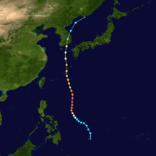
Typhoon Sanba, known in the Philippines as Typhoon Karen, was the strongest tropical cyclone worldwide in 2012. The sixteenth named storm and tenth typhoon of the annual typhoon season, Sanba formed as a tropical depression east of The Philippines on September 10. The storm gradually intensified as it moved generally northward in an area favorable for tropical development. The system was soon upgraded to a tropical storm less than a day after formation and subsequently further to a typhoon on September 12. Later that day, Sanba entered a phase of explosive intensification, quickly strengthening and gaining annular characteristics. On September 13, the system attained its peak intensity with maximum sustained winds of 125 mph (205 km/h),[nb 1] and a barometric pressure of 900 mbar (hPa; 26.58 inHg), becoming the strongest typhoon in the Western Pacific Ocean since Megi in 2010. Accelerating towards more northerly latitudes, a period of gradual weakening ensued afterwards as its eye expanded. It made landfall on South Korea late on September 17 as a typhoon before transitioning into an extratropical cyclone the following day. Sanba's remnants tracked into the Primorsky Krai region of eastern Russia before they were last noted on September 19.
Passing just to the west of Japan, Sanba caused extensive losses to agriculture, forestry, and fishing industries on the islands of Okinawa Prefecture. Further inland on Kōchi and Gifu Prefectures, heavy rains damaged agricultural regions and washed out numerous roads. Losses on both prefectures totalled to ¥1.55 billion (US$1.98 million).[nb 2] Upon its landfall on the Korean Peninsula on September 17, it became the first time in 50 years that the peninsula had been struck by at least four typhoons in a single year.[1] In South Korea, torrential rainfall also washed out road systems and inundated crop land, as well as damaged infrastructure. Losses there associated with Sanba totaled to ₩389 billion (US$347.5 million). In North Korea, the heavy precipitation worsened preexisting flood conditions initially started by Tropical Storm Khanun two months prior. Overall, throughout the typhoon's nine-day trek, Sanba caused US$378.8 million in losses and killed six people.
Meteorological history
A low-pressure area formed east of Palau on September 9 and gradually drifted westward.[2] Early on September 10, the Japan Meteorological Agency (JMA) upgraded it to a tropical depression, before the Joint Typhoon Warning Center (JTWC) issued a Tropical Cyclone Formation Alert on the system later that day and also upgraded it to a tropical depression late on the same day, as Sanba started to become more organized, with the banding of thunderstorms strengthened, and wrapped more tightly into the low level circulation center .[3][4][5]
As the system entered the Philippine Area of Responsibility early on September 11, the Philippine Atmospheric, Geophysical and Astronomical Services Administration (PAGASA) started to advisories on the system and named it Karen.[6] At the same time, the JMA upgraded the system to a tropical storm and named it Sanba, and the JTWC also upgraded it to a tropical storm later.[7]

On September 12, the JTWC reported that Sanba had strengthened into a category 1 typhoon. Late on the same day, Sanba began explosive intensification, prompting the JMA upgrading it to a severe tropical storm and even a typhoon later. On September 13, the JTWC reported that Sanba had rapidly strengthened into category 2 typhoon to category 4 typhoon, as it became an Annular Typhoon, with a 37 kilometer wide eye. The system's central dense overcast also became more compacted, at around the same time. Late on September 13, the JTWC reported that Sanba strengthened into a category 5 super typhoon, and had intensified into the strongest typhoon in the western north pacific since Megi in 2010. On September 15, as the system started to weaken into a category 3 typhoon, the well defined eye wall dissipated, and started to undergo an eyewall replacement cycle, and soon ended up with a 70 kilometer wide eye.
On September 17, at 01:00 (UTC) Sanba made landfall over Korea.
Impact
Japan
In Kōchi Prefecture, 222 hectares (548 acres) of agricultural land was damaged by the storm, with losses reaching ¥50 million (US$640,000).[8] Throughout Okinawa, damage to agriculture, forestry, and fisheries amounted to ¥900 million (US$11.5 million).[9] Heavy rains from the storm in Gifu Prefecture triggered numerous landslides and caused significant flooding that washed out hundreds of roads. Losses in the prefecture reached ¥1.5 billion (US$19.2 million).[10]
South Korea
Across South Korea, heavy rains from the storm washed out numerous roads and flooded cropland. Numerous structures along rivers were damaged or destroyed by flooding. Losses from the typhoon reached ₩389 billion (US$347.5 million).[11]
See also
Notes
- ↑ All winds are in ten-minute sustained standards, as per the Japan Meteorological Agency, unless otherwise stated.
- ↑ All monetary values are based on the value of its respective currency during 2012.
References
- ↑ http://english.yonhapnews.co.kr/national/2012/09/17/73/0302000000AEN20120917002153315F.HTML
- ↑ "Tropical Cyclone Alert 091900". Joint Typhoon Warning Center. Archived from the original on September 10, 2012. Retrieved 11 September 2012.
- ↑ "Tropical Cyclone Advisory 100000". Japan Meteorological Agency. Archived from the original on September 10, 2012. Retrieved 11 September 2012.
- ↑ "Tropical Cyclone Formation Alert 101400". Joint Typhoon Warning Center. Archived from the original on September 11, 2012. Retrieved 11 September 2012.
- ↑ "Tropical Cyclone Warning 001 - Tropical Storm Sanba". Joint Typhoon Warning Center. Archived from the original on September 11, 2012. Retrieved 11 September 2012.
- ↑ "Weather Bulletin Number ONE". Philippine Atmospheric, Geophysical and Astronomical Services Administration. Archived from the original on September 11, 2012. Retrieved 11 September 2012.
- ↑ "Tropical Cyclone Advisory 110000". Japan Meteorological Agency. Archived from the original on September 11, 2012. Retrieved 11 September 2012.
- ↑ 行政ファイル:台風16号の県内被害は5000万円 /高知. 毎日新聞 (in Japanese). Yahoo! News. September 20, 2012. Retrieved September 20, 2012.
- ↑ 台風16号被害 9億円超 県内引き続き調査. 琉球新報 (in Japanese). Yahoo! News. September 20, 2012. Retrieved September 20, 2012.
- ↑ 多園尚樹 (September 25, 2012). 台風16号被害、西濃中心に15億円 (in Japanese). Chunichi Shimbun. Archived from the original on September 25, 2012. Retrieved September 25, 2012.
- ↑ 태풍 산바 피해액 389억 원 (in Korean). 경남도민일보. September 25, 2012. Archived from the original on September 25, 2012. Retrieved September 25, 2012.
External links
| Wikimedia Commons has media related to Typhoon Sanba (2012). |
- JMA General Information of Typhoon Sanba (1216) from Digital Typhoon
- JMA Best Track Data of Typhoon Sanba (1216) (Japanese)
- JTWC Best Track Data of Super Typhoon 17W (Sanba)
- 17W.SANBA from the U.S. Naval Research Laboratory
- Radar animations of Sanba (courtesy Brian McNoldy, RSMAS/Univ of Miami)
Tropical cyclones of the 2012 Pacific typhoon season | ||
|---|---|---|
 | ||
| ||