Uddel
| Uddel | |
|---|---|
| Village | |
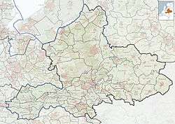
 Location of Uddel in the municipality of Apeldoorn (the urban area of Beekbergen is red and the rural area is pink) | |
 Uddel Location of Uddel in Gelderland | |
| Coordinates: 52°15′27″N 5°46′57″E / 52.25750°N 5.78250°E | |
| Country | Netherlands |
| Province | Gelderland |
| Municipality | Apeldoorn |
| Area[1] | |
| • Village | 57.9 km2 (22.4 sq mi) |
| • Urban | 0.9 km2 (0.3 sq mi) |
| Elevation[2] | 35 m (115 ft) |
| Population (January 1, 2015)[1] | |
| • Village | 2,927 |
| • Density | 51/km2 (130/sq mi) |
| • Urban | 1,867 |
| Time zone | CET (UTC+1) |
| • Summer (DST) | CEST (UTC+2) |
| Postcodes | 3888 |
| Area code | 0577 |

Uddel, church

Reformed Congregation in the Netherlands De Beek-Uddel
Uddel is a village in the Netherlands, on the Veluwe, in the municipality of Apeldoorn, Gelderland, Netherlands. Uddel is located on the N310 from Elburg to Arnhem. The oldest mention of Uddel dates back to the year 792, as the settlement Uttiloch. The village had 2,927 inhabitants in 2016.
Uddel is a conservative Protestant village, located on the Dutch Bible Belt. In the 2006 municipal elections, 65 percent of the local population voted for the Reformed Political Party. The three Christian parties in the elections (the Reformed Political Party, the ChristianUnion and the Christian Democratic Appeal) had a combined total of almost 87 percent of the votes.
Notable inhabitants
- Gerrit Holdijk (1944-2015), jurist and politician (SGP)
Coordinates: 52°16′N 5°47′E / 52.267°N 5.783°E
References
- 1 2 "Apeldoorn in Cijfers" (in Dutch). Retrieved 20 October 2015.
- ↑ "Actueel Hoogtebestand Nederland: Viewer" (in Dutch). Retrieved 20 October 2015.
This article is issued from Wikipedia - version of the 10/27/2016. The text is available under the Creative Commons Attribution/Share Alike but additional terms may apply for the media files.