Ulong Island

Ulong is a major island and channel of western Palau.[1] It is sometimes called Aulong and originally written Oroolong in English. Ulong is regarded by many as one of the best drift dives in the world.[2]
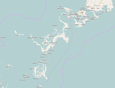
Geography
Ngerumekaol Channel partially cuts through the reef near the Island.[3] The channel stretches about 500 metres (1,600 ft), with an average width of 33 metres (108 ft) and leads into a coral reef lagoon.[2] There are sharks within the currents of the channel and Ulong Corner.[4] Uruktapel is the largest island southward of Koror; at about 2 miles (3.2 km) off its western point is Ulong. Denges and Eil Malk Passages are passable, but navigation may be difficult in the lagoon between them and Ulong Island. From Ulong to Malakal Harbor, the lagoon is navigable.[5]
History
Henry Wilson (1740–1810), an English naval captain of the BritishEast India Company was aboard his packet ship Antelope, when it shipwrecked off Ulong Island,[6] In the late 1700s, the island's inhabitants attempted to defend Ulong from attack along Ikesakes Reef but, having been defeated, were forced to leave.[7] There are Palau Cave Paintings on the island.[8]
References
- ↑ Google Earth
- 1 2 "Ulong Channel". Asia Dive Site. Retrieved 20 October 2011.
- ↑ Johannes, Robert Earle (1981). Words of the lagoon: fishing and marine lore in the Palau District of Micronesia. University of California Press. pp. 33–. ISBN 978-0-520-03929-2. Retrieved 21 October 2011.
- ↑ Tierney, Beth; Tierney, Shaun (1 May 2006). Diving the world: a guide to the world's coral seas. Footprint Travel Guides. pp. 327–. ISBN 978-1-904777-59-5. Retrieved 21 October 2011.
- ↑ Great Britain. Hydrographic Dept (1900). Pacific islands ... (Public Domain ed.). The Hydrographic office, Admiralty. pp. 437–. Retrieved 21 October 2011.
- ↑ "Palau: Airai -- Visitors: Explorers". Retrieved 20 October 2011.
- ↑ D'Arcy, Paul (2006). The people of the sea: environment, identity and history in Oceania. University of Hawaii Press. pp. 107–. ISBN 978-0-8248-2959-9. Retrieved 21 October 2011.
- ↑ Parmentier, Richard J. (1987). The sacred remains: myth, history, and polity in Belau. University of Chicago Press. pp. 332–. ISBN 978-0-226-64695-4. Retrieved 21 October 2011.
Coordinates: 7°11′14″N 134°22′05″E / 7.187304°N 134.368009°E