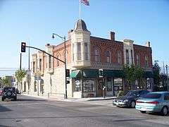
Union Oil Company Building
|
Santa Paula Hardware Company Block--Union Oil Company | |
 | |
  | |
| Location |
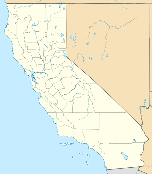
1003 E. Main St. Santa Paula, California |
|---|---|
| Coordinates | 34°21′15″N 119°3′32″W / 34.35417°N 119.05889°WCoordinates: 34°21′15″N 119°3′32″W / 34.35417°N 119.05889°W |
| Area | 0.2 acres (0.081 ha) |
| Built | 1889 |
| Architect | Burrows, C.W. |
| Architectural style | Queen Anne style with Italianate influences |
| NRHP Reference # | 86002619[1] |
| CHISL # | 996 |
| Significant dates | |
| Added to NRHP | August 14, 1986 |
| Designated CHISL | 1991[2] |
The Santa Paula Hardware Company Building, located in Santa Paula, California, and more commonly referred to as the Union Oil Company Building, is significant for its historical importance as the birthplace of the Union Oil Company on October 17, 1890. Originally the Santa Paula Hardware and Post Office were downstairs, and the Union Oil Company offices were upstairs. The building continued to serve as a field division office after the main headquarters moved to Los Angeles in 1900.
The Ventura County Cultural Heritage Board designated the building County Landmark #36 in December 1977. The building is a California Historical Landmark (#996) and is listed on the National Register of Historic Places (NPS-86002619).[3]
California Oil Museum
In 1950, the Union Oil Museum was established, and in 1990, for its Centennial Celebration, the building was restored to its original appearance and reopened as a new state-of-the-art oil museum known as the California Oil Museum. The exhibits include oil and gas industry equipment such as an 1890s iron and timber operating drilling rig, historic gas pumps and product containers, a recreated 1890s period Union Oil Company corporate headquarters office, and a 1930s period apartment.
See also
References
- ↑ National Park Service (2009-03-13). "National Register Information System". National Register of Historic Places. National Park Service.
- ↑ "Union Oil Company Building". Office of Historic Preservation, California State Parks. Retrieved 2012-10-15.
- ↑ Cultural Heritage Board. "Ventura County Landmark Map" County of Ventura Planning Division Accessed 1 January 2014
External links
| Topics | |
|---|---|
| Lists by states |
|
| Lists by insular areas | |
| Lists by associated states | |
| Other areas | |
| |