Upper Longdon
| Upper Longdon | |
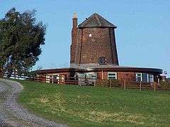 Windmill Cottage |
|
 Upper Longdon |
|
| OS grid reference | SK060145 |
|---|---|
| Civil parish | Longdon |
| District | Lichfield |
| Shire county | Staffordshire |
| Region | West Midlands |
| Country | England |
| Sovereign state | United Kingdom |
| Post town | RUGELEY |
| Postcode district | WS15 |
| Dialling code | 01543 |
| Police | Staffordshire |
| Fire | Staffordshire |
| Ambulance | West Midlands |
| EU Parliament | West Midlands |
| UK Parliament | Lichfield |
|
|
Coordinates: 52°43′45″N 1°54′40″W / 52.729167°N 1.911111°W
Upper Longdon is a village within the civil parish of Longdon and is in the District of Lichfield of the English county of Staffordshire.[1][2]
Location
The village is 2.1 miles (3.4 km) west of the village of Longdon. The town of Rugeley, and the border of Cannock Chase is 3.4 miles (5.5 km) to the north of the village.
Facilities
The village has one public house called the Chetwynd Arms located in the centre of the village on Upper Way.
Notable Features
There is one listed building within the village called the Gables.[3] The building is a pair of cottages thought to have been built around 1840. One of the outstanding features of the cottages are the ornamental fretted gable end barge boards.
External links
References
- ↑ OS Explorer Map 244: Cannock Chase & Chasewater: (1:25 000) :ISBN 0 319 46269 2
- ↑ Map Details retrieved 11 April 2013
- ↑ Listed building status – The Gables retrieved 14 April 2013
This article is issued from Wikipedia - version of the 12/3/2016. The text is available under the Creative Commons Attribution/Share Alike but additional terms may apply for the media files.