Upper West Side
| Upper West Side | |
|---|---|
| Neighborhoods of Manhattan | |
|
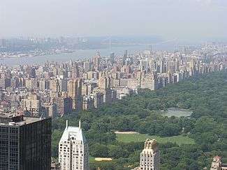
The Upper West Side and Central Park as seen from the Rockefeller Center Observatory. In the distance is the Hudson River and George Washington Bridge. | |
| Nickname(s): UWS | |
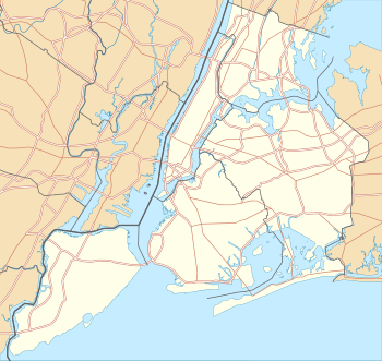 Upper West Side Location in New York City | |
| Coordinates: 40°47′13″N 73°58′31″W / 40.78694°N 73.97528°WCoordinates: 40°47′13″N 73°58′31″W / 40.78694°N 73.97528°W | |
| Country | United States |
| State | New York |
| City | New York City |
| Borough | Manhattan |
| Area | |
| • Total | 1,222.7 acres (494.8 ha) |
| • Land | 1,222.7 acres (494.8 ha) |
| • Water | 0 acres (0 ha) 0% |
| Population | |
| • Total | 209,084 |
| • Density | 110,000/sq mi (42,000/km2) |
| 2010 figures for Manhattan CB 7 | |
| Ethnicity[1] | |
| • White | 67.4% |
| • Hispanic | 15.0% |
| • Black | 7.6% |
| • Asian | 7.6% |
| • Other | 2.4% |
| ZIP code | 10023, 10024, 10025, 10069 |
| Area code(s) | 212, 917, 646 |
The Upper West Side, sometimes abbreviated UWS,[2] is a neighborhood in the borough of Manhattan, New York City, that lies between Central Park and the Hudson River and between West 59th Street and West 110th Street. The Upper West Side is sometimes also considered by the real estate industry to include the neighborhood of Morningside Heights.[3]
Like the Upper East Side, the Upper West Side is an affluent, primarily residential area with many of its residents working in commercial areas of Midtown and Lower Manhattan. It has the reputation of being New York City's cultural and intellectual hub, with Columbia University located at the north end of the neighborhood, and artistic workers, with Lincoln Center located at the south end. Conversely, the Upper East Side is traditionally perceived to be home to commercial and business types.[4]
Geography
Upper West Side is bounded on the south by 59th Street, Central Park to the east, and the Hudson River to the west. Its northern boundary is somewhat less obvious. Although it has historically been cited as 110th Street,[5] which fixes the neighborhood alongside Central Park, it is now sometimes (primarily by the real estate industry) considered to be 125th Street, encompassing Morningside Heights.[6] The area north of West 96th Street and east of Broadway is also identified as Manhattan Valley. The overlapping area west of Amsterdam Avenue to Riverside Park was once known as the Bloomingdale District.
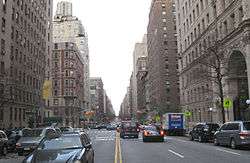
From west to east, the avenues of the Upper West Side are Riverside Drive, West End Avenue (11th Avenue), Broadway, Amsterdam Avenue (10th Avenue), Columbus Avenue (9th Avenue), and Central Park West (8th Avenue). The 66-block stretch of Broadway forms the spine of the neighborhood and runs diagonally north/south across the other avenues at the south end of the neighborhood; above 78th Street Broadway runs north parallel to the other avenues. Broadway enters the neighborhood at its juncture with Central Park West at Columbus Circle (59th Street), crosses Columbus Avenue at Lincoln Square (65th Street), Amsterdam Avenue at Verdi Square (71st Street), and then merges with West End Avenue at Straus Park (aka Bloomingdale Square, at 107th Street).
Morningside Heights, just west of Harlem, is the site of the Cathedral of Saint John the Divine, Columbia University, Barnard College, Bank Street College of Education, the National Council of Churches, Union Theological Seminary, Manhattan School of Music, Teachers College and Jewish Theological Seminary of America, as well as Grant's Tomb and Riverside Church.
Traditionally the neighborhood ranged from the former village of Harsenville, centered on the old Bloomingdale Road (now Broadway) and 65th Street, west to the railroad yards along the Hudson, then north to 110th Street, where the ground rises to Morningside Heights. With the building of Lincoln Center, its name, though perhaps not the reality, was stretched south to 58th Street. With the arrival of the corporate headquarters and expensive condos of the Time Warner Center at Columbus Circle, and the Riverside South apartment complex built by Donald Trump, the area from 58th Street to 65th Street is increasingly referred to as Lincoln Square by realtors who acknowledge a different tone and ambiance than that typically associated with the Upper West Side. This is a reversion to the neighborhood's historical name.
History
Native American and colonial use
The long high bluff above useful sandy coves along the North River was little used or traversed by the Lenape people.[7] A combination of the stream valleys, such as that in which 96th Street runs, and wetlands to the northeast and east, may have protected a portion of the Upper West Side from the Lenape's controlled burns;[8] lack of periodic ground fires results in a denser understory and more fire-intolerant trees, such as American Beech.
In the eighteenth and early nineteenth century, the Upper West Side-to-be contained some of colonial New York's most ambitious houses, spaced along Bloomingdale Road.[9] It became increasingly infilled with smaller, more suburban villas in the first half of the nineteenth century, and in the middle of the century, parts had become decidedly lower class.
Bloomingdale District
The name "Bloomingdale District" was used to refer to a part of the Upper West Side – the present-day Manhattan Valley neighborhood – located between 96th and 110th Streets and bounded on the east by Amsterdam Avenue and on the west by Riverside Drive, Riverside Park, and the Hudson River.
Its name was a derivation of the description given to the area by Dutch settlers to New Netherland, likely from Bloemendaal, a town in the tulip region.[10] The Dutch Anglicized the name to "Bloomingdale" or "the Bloomingdale District", to the west side of Manhattan from about 23rd Street up to the Hollow Way (modern 125th Street). It consisted of farms and villages along a road (regularized in 1703) known as the Bloomingdale Road. Bloomingdale Road was renamed The Boulevard in 1868, as the farms and villages were divided into building lots and absorbed into the city.[11][12] By the 18th century it contained numerous farms and country residences of many of the city's well-off, a major parcel of which was the Apthorp Farm. The main artery of this area was the Bloomingdale Road, which began north of where Broadway and the Bowery Lane (now Fourth Avenue) join (at modern Union Square) and wended its way northward up to about modern 116th Street in Morningside Heights, where the road further north was known as the Kingsbridge Road. Within the confines of the modern-day Upper West Side, the road passed through areas known as Harsenville,[13] Strycker's Bay, and Bloomingdale Village.
With the building of the Croton Aqueduct passing down the area between present day Amsterdam Avenue and Columbus Avenue in 1838–42, the northern reaches of the district became divided into Manhattan Valley to the east of the aqueduct and Bloomingdale to the west. Bloomingdale, in the latter half of the 19th century, was the name of a village that occupied the area just south of 110th street.[14]
Late 19th century development
Much of the riverfront of the Upper West Side was a shipping, transportation, and manufacturing corridor. The Hudson River Railroad line right-of-way was granted in the late 1830s to connect New York City to Albany, and soon ran along the riverbank. One major non-industrial development, the creation of Central Park in the 1850s and '60s, caused many squatters to move their shacks into the Upper West Side. Parts of the neighborhood became a ragtag collection of squatters' housing, boarding houses, and rowdy taverns.
As this development occurred, the old name of Bloomingdale Road was being chopped away and the name Broadway was progressively applied further northward to include what had been lower Bloomingdale Road. In 1868, the city began straightening and grading the section of the Bloomingdale Road from Harsenville north, and it became known as "Western Boulevard" or "The Boulevard". It retained that name until the end of the century, when the name Broadway finally supplanted it.
Development of the neighborhood lagged even while Central Park was being laid out in the 1860s and '70s, then was stymied by the Panic of 1873. Things turned around with the introduction of the Ninth Avenue elevated in the 1870s along Ninth Avenue (renamed Columbus Avenue in 1890), and with Columbia University's relocation to Morningside Heights in the 1890s, using lands once held by the Bloomingdale Insane Asylum.[15]
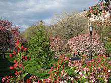
Riverside Park was conceived in 1866 and formally approved by the state legislature through the efforts of city parks commissioner Andrew Haswell Green. The first segment of park was acquired through condemnation in 1872, and construction soon began following a design created by the firm of Frederick Law Olmsted, who also designed the adjacent, gracefully curving Riverside Drive. In 1937, under the administration of commissioner Robert Moses, 132 acres (0.53 km2) of land were added to the park, primarily by creating a promenade that covered the tracks of the Hudson River Railroad. Moses, working with landscape architect Gilmore D. Clarke also added playgrounds, and distinctive stonework and the 79th Street Boat Basin, but also cut pedestrians off from direct access to most of the riverfront by building the Henry Hudson Parkway by the river's edge. According to Robert Caro's book on Moses, The Power Broker, Riverside Park was designed with most of the amenities located in predominantly white neighborhoods, with the neighborhoods closer to Harlem getting shorter shrift. Riverside Park, like Central Park, has undergone a revival late in the 20th century, largely through the efforts of The Riverside Park Fund, a citizen's group. Largely through their efforts and the support of the city, much of the park has been improved. The Hudson River Greenway along the river-edge of the park is a popular route for pedestrians and bicycle commuters, and offers spectacular vistas. A dramatic improvement is the $15.7 million "Riverwalk" extension to the park's greenway constructed between 83rd and 91st Streets on a promenade in the river itself, completed in May 2010.[16]
Early 20th century
Subway expansion
The Upper West Side experienced a building boom from 1885 to 1910, thanks in large part to the 1904 opening of the city's first subway line, which comprised, in part, what is now a portion of the IRT Broadway – Seventh Avenue Line, with subway stations at 59th, 66th, 72nd, 79th, 86th, 91st, 96th, 103rd, 110th, 116th, and 125th Streets. This followed upon the opening of the now demolished IRT Ninth Avenue Line – the city's first elevated railway – which opened in the decade following the American Civil War.
This further stimulated residential development of the area. The stately tall apartment blocks on West End Avenue and the townhouses on the streets between Amsterdam Avenue and Riverside Drive, which contribute to the character of the area, were all constructed during the pre-depression years of the twentieth century. A revolution in building techniques, the low cost of land relative to lower Manhattan, the arrival of the subway, and the democratization of the formerly expensive elevator made it possible to construct large apartment buildings for the middle classes. The large scale and style of these buildings is one reason why the neighborhood has remained largely unchanged into the twenty-first century.[14]
The neighborhood changed from the 1930s to the 1950s. In 1932, the IND Eighth Avenue Line opened under Central Park West.[17] In 1940, the elevated IRT Ninth Avenue Line over Columbus Avenue closed.[18] Immigrants from Eastern Europe and the Caribbean moved in during the '50s and the '60s.[19] The Lincoln Center for the Performing Arts opened in the 1960s.[20]
Enclaves
In the 1900s, the area south of 67th Street was heavily populated by African-Americans and supposedly gained its nickname of "San Juan Hill" in commemoration of African-American soldiers who were a major part of the assault on Cuba's San Juan Hill in the Spanish–American War. By 1960, it was a rough neighborhood of tenement housing, the demolition of which was delayed to allow for exterior shots in the movie musical West Side Story. Thereafter, urban renewal brought the construction of the Lincoln Center for the Performing Arts and Lincoln Towers apartments during 1962–1968.
The Upper West Side is a significant Jewish neighborhood, populated with both German Jews who moved in at the turn of last century, and Jewish refugees escaping Hitler's Europe in the 1930s. Today the area between 85th Street and 100th Street is home to the largest community of young Modern Orthodox singles outside of Israel.[21] However, the Upper West Side also features a substantial number of non-Orthodox Jews. A number of major synagogues are located in the neighborhood, including the oldest Jewish congregation in the United States, Shearith Israel; New York's second-oldest and the third-oldest Ashkenazi synagogue, B'nai Jeshurun; Rodeph Sholom; the Stephen Wise Free Synagogue; and numerous others.
Late 20th century urban renewal
From the post-WWII years until the AIDS epidemic, the neighborhood, especially below 86th Street, had a substantial gay population. As the neighborhood had deteriorated, it was affordable to working class gay men, and those just arriving in the city and looking for their first white collar jobs. Its ethnically mixed gay population, mostly Hispanic and white, with a mixture of income levels and occupations patronized the same gay bars in the neighborhood, making it markedly different from most gay enclaves elsewhere in the city. The influx of white gay men in the Fifties and Sixties is often credited with accelerating the gentrification of the Upper West Side,[22] and by the mid and late '70s, the gay male population had become predominantly white. Another component that brought about the eventual gentrification of the neighborhood were the recent college graduates in the late '70s and early '80s who moved in, drawn to the neighborhood's relatively large apartments and cheap housing.
In a subsequent phase of urban renewal, the rail yards which had formed the Upper West Side's southwest corner were replaced by the Riverside South residential project, which included a southward extension of Riverside Park. The evolution of Riverside South had a 40-year history, often extremely bitter, beginning in 1962 when the New York Central Railroad, in partnership with the Amalgamated Lithographers Union, proposed a mixed-use development with 12,000 apartments, Litho City, to be built on platforms over the tracks. The subsequent bankruptcy of the enlarged, but short-lived Penn Central Railroad brought other proposals and prospective developers. The one generating the most opposition was Donald Trump's "Television City" concept of 1985, which would have included a 152-story office tower and six 75-story residential buildings. In 1991, a coalition of prominent civic organizations proposed a purely residential development of about half that size, and then reached a deal with Trump. As of 2008, construction is well underway, but still to be resolved is the future of the West Side Highway viaduct over the park area.
The community's links to the events of September 11, 2001 were evinced in Upper West Side resident and Pulitzer Prize winner David Halberstam's paean to the men of Ladder Co 40/Engine Co 35, just a few blocks from his home, in Firehouse.
Today, this area is the site for several long-established charitable institutions; their unbroken parcels of land have provided suitably scaled sites for Columbia University and the Cathedral of Saint John the Divine, as well as for some vanished landmarks, such as the Schwab Mansion on Riverside Drive, the most ambitious free-standing private house ever built in Manhattan.
The name Bloomingdale is still used in reference to a part of the Upper West Side, essentially the location of old Bloomingdale Village, the area from about 96th Street up to 110th Street and from Riverside Park east to Amsterdam Avenue. The triangular block bound by Broadway, West End Avenue, 106th Street and 107th Street, although generally known as Straus Park (named for Isidor Straus and his wife Ida), was officially designated Bloomingdale Square in 1907. The neighborhood also includes the Bloomingdale School of Music and Bloomingdale neighborhood branch of the New York Public Library. Adjacent to the Bloomingdale neighborhood is a more diverse and less affluent subsection of the Upper West Side called Manhattan Valley, focused on the downslope of Columbus Avenue and Manhattan Avenue from about 102nd Street up to 110th Street.
Demographics
As of 2010, Manhattan Community Board 7 has a population of 209,084, which is down from 210,993 in 1990. Of the population, 140,850 (67.4%) are White non Hispanic, 31,347 (15%) of Hispanic origin, 15,834 (7.6%) are African American, 15,988 (7.6%) Asian or Pacific Islander, 221 (0.1%) American Indian or Native Alaskan, 671 (0.3%) of some other race, 4,173 (2%) of two or more race.[1]
Approximately 12.2% of the population benefits from public assistance as of 2012.[23]
The land area is 1.9 square miles (4.9 km2).[23]
Transportation
Two subway lines serve the Upper West Side. The IRT Broadway – Seventh Avenue Line (1 2 3 trains) runs along Broadway. The IND Eighth Avenue Line (A B C D trains) runs along Central Park West.[24]
There are five different bus routes — M5, M7, M10, M11, M104 buses — that go up and down the Upper West Side, and the M57 goes up West End Avenue for 15 blocks in the neighborhood. Additionally, crosstown routes include the M66, M72, M79, M86 SBS, M96, M106. The M20 terminates at Lincoln Center.[25]
Government
Community Board 7
Community Board 7 (CB7) deals with land use and zoning matters, the City budget, municipal service delivery, and multiple community concerns of the Upper West Side.[26] CB7 covers the Upper West Side from 59th/60th Streets to 110th Street. NYPD Precincts 20 and 24 are in CB7's area.
New York City's Community Boards review data collected by the 311 Customer Service Center. 3-1-1 (3-1-1) is a non-emergency telephone number, and New York City releases monthly reports on the number of requests for services to 311.[27]
In CB7, 80% of the calls to 311 are either building complaints, noise complaints, city property damage/complaints, and lost and found property. The composition of the calls to 311 vary on a monthly basis due to weather. For instance, there were 79 total calls to 311 in October 2012 regarding damaged or dead trees in the wake of Hurricane Sandy, which reached New York City at the end of that month. In the next month, daily calls regarding trees dropped 25%, while daily calls regarding heating increased 58%. The largest number of calls to 311 in the most recent reporting month of November 2012 were referenced to the Department of Housing Preservation and Development regarding heating. The next highest was for residential noise complaints.[27][28]
| Category[27] | Nov. '11 | Oct. '12 | Nov. '12 | Sequential % chg. | Year-over-Year % chg. |
|---|---|---|---|---|---|
| Building complaints | 1,003 | 1,081 | 1,148 | 6% | 14% |
| Heating (w/in building complaints) | 381 | 438 | 669 | 53% | 76% |
| Noise complaints | 578 | 552 | 480 | −13% | −17% |
| City property damage/complaints | 454 | 416 | 262 | −37% | −42% |
| Damaged/Dead Tree (w/in city complaints) | 29 | 76 | 57 | −28% | 97% |
| Lost Property | 327 | 221 | 216 | −2% | −34% |
| All other calls | 779 | 632 | 527 | −17% | −32% |
| Total Calls | 3,141 | 2,902 | 2,633 | −9% | −16% |
| Per Day | 105 | 97 | 88 | −9% | −16% |
Police
Precinct 20[29] covers the Upper West Side from 59th Street to 86th Street. This precinct area also includes Neighborhood Tabulation Areas (NTAs) for the Upper West Side (mn12) and Lincoln Square (mn14).[30]
Recent data indicates that crime, after declining steadily for many years, bottomed in 2011. Information from the NYPD indicates total crime complaints have increased approximately 15% in the last year.[31] Citywide crime complaints have increased 4%. This tabulation includes all types of crime complaints, from murders to petit larceny. Crime complaints increased this year in Precinct 20 for almost all of the CompStat categories, except for misdemeanor assaults. There were 2,058 crime complaints year-to-date as of November 25, 2012, up from 1,789 crime complaints in the same time period a year ago.
From 2000 to 2010 the population in precinct 20 increased by 1,674 people, up 1% annually.[30] In comparison, but not in exactly the same time period, crime complaints decreased by 2% annually from 2001 to 2011.
Buildings and structures
Institutions
Organization headquarters
- American Bible Society
- American Broadcasting Company – KPF-designed headquarters located at 77 West 66th Street at Columbus Avenue.
- Time Warner – Skidmore, Owings & Merrill-designed headquarters located on Columbus Circle, at the site of the old New York Coliseum.
- Two primary music licensing organizations are located in the neighborhood, ASCAP and BMI.
- The College Board, a national non-profit examination body launched in 1900, has its headquarters on Columbus Avenue, across from Fordham University.[32]
- The Jewish Guild for the Blind – This non-sectarian, non-profit organization serving the visually impaired, blind and those with multiple disabilities, has its national headquarters on West 65th Street just off Central Park West.
Cultural
- American Folk Art Museum
- Eva and Morris Feld Gallery
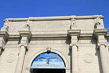
- American Museum of Natural History
- Ballet Hispanico Tina Ramirez
- Bach Vespers at Holy Trinity
- Bard Graduate Center Gallery
- Beacon Theater
- Children's Museum of Manhattan
- Lincoln Center – A total of 12 performing arts companies hosted in a variety of theater and recital spaces
- Metropolitan Opera
- David Geffen Hall (formerly Avery Fisher Hall), home of the New York Philharmonic
- New York State Theater, home of the New York City Ballet
- Juilliard School of Music
- Jazz at Lincoln Center
- Alice Tully Hall
- Film Society of Lincoln Center
- School of American Ballet
- Vivian Beaumont Theater
- Damrosch Park[33]
- New York Public Library for the Performing Arts
- Bruno Walter Auditorium
- Museum of Biblical Art
- Merkin Concert Hall
- New-York Historical Society
- Nicholas Roerich Museum
- Symphony Space
- Thalia Theater
- El Taller Latinoamericano
Educational
Preschool to 12th grade
All public noncharter schools are operated by the New York City Department of Education.
- Abraham Joshua Heschel School
- Lower and Middle Schools – West End Avenue at West 61st Street
- High School – West End Avenue at West 60th Street
- Alexander Robertson School – West 95th Street off Central Park West
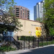
- The Anderson School PS 334 – (K-5 & 6–8), 77th & Columbus
- Ascension School – (Pre-K3–8), 220 West 108th Street (between Broadway and Amsterdam)
- The Beacon School – an alternative, non testing public high school on west 61st.
- Beit Rabban Day School – an innovative, non-denominational day school combining intellectual rigor, serious Jewish learning, and a progressive educational approach
- Bloomingdale School of Music
- MS 54 Booker T. Washington Middle School – 103 West 107th Street, between Amsterdam and Columbus Avenues
- Calhoun School
- Main Building – 433 West End Avenue at 81st Street.
- Robert L. Beir Lower School – 160 West 74th Street, between Amsterdam & Columbus avenues.
- The Cathedral School of the Cathedral of St. John the Divine – in Morningside Heights
- The Center School – 84th street, between Columbus & Amsterdam Avenues
- The Collegiate School
- Columbia Grammar and Preparatory School
- Columbus Academy
- MS 44
- The Computer School (MS 245)
- Corpus Christi School – next to Columbia University and Teachers College
- Dwight School
- Ethical Culture Fieldston School – Central Park West and 63rd Street
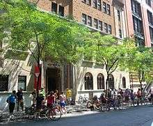
- Fiorello H. LaGuardia High School of Music & Art and Performing Arts – behind Lincoln Center
- La Salle Academy
- Lucy Moses School
- The Mandell School
- Manhattan Day School
- Martin Luther King, Jr Campus Schools
- PS 75 Emily Dickinson School
- PS 199 on 70th Street between West End Avenue and Amsterdam Avenue.
- PS 87 on 78th Street between Amsterdam Avenue and Columbus Avenue.
- PS 9 – 84th and Columbus
- PS 163 (aka the Alfred E. Smith School) – West 97th Street, between Amsterdam and Columbus Avenues
- PS 166
- PS/IS 187
- Rodeph Sholom School
- School of the Blessed Sacrament – 140 West 70th Street
- Solomon Schechter School of Manhattan (2–8 West 89th)
- Special Music School
- St. Agnes Boys High School
- St. Hilda's and St. Hugh's School – in Morningside Heights
- The Studio School
- Success Academy Upper West
- Trevor Day School
- Trinity School
- Twin Parks Montessori Schools
- Central Park Montessori – 1 West 91st Street
- Park West Montessori – 435 Central Park West
- Riverside Montessori – 202 Riverside Drive
- Edward A. Reynolds West Side High School – 140 West 102nd Street
- Yeshiva Ketana of Manhattan occupies Herts & Tallent's 1903 beaux arts Rice Mansion at 346 West 89th Street and Riverside Drive.
- York Preparatory School – 40 W 68th St
Higher education
- The Richard Gilder Graduate School at American Museum of Natural History – Central Park West & West 79th Street
- The American Musical and Dramatic Academy – 211 W 61st Street, between Amsterdam & West End Avenues.
- Columbia University – in Morningside Heights
- Bank Street College of Education and School for Children – in Morningside Heights
- Bard Graduate Center at 86th and Columbus.
- Barnard College – one of the Seven Sisters in Morningside Heights
- Fordham University Lincoln Center campus – Schools of Law, Business, Social Service and Education
- Jewish Theological Seminary of America – in Morningside Heights
- The Juilliard School
- Lander College for Women, a division of Touro College, West 60th Street between Amsterdam and West End Avenues.
- New York Institute of Technology – in the Columbus Circle proximity
- New York Theological Seminary – in Morningside Heights
- William E. Macaulay Honors College – this collaborative endeavor of CUNY's senior colleges occupies the 92nd St Y's former Makor/Steinhardt Building on West 67th Street, east of Columbus Avenue, the latter having relocated to Tribeca.
- Manhattan School of Music – in Morningside Heights
- Mannes College The New School for Music, a division of The New School, on 85th Street between Amsterdam and Columbus
- Teachers College of Columbia University, in Morningside Heights
- Union Theological Seminary – in Morningside Heights
Religious
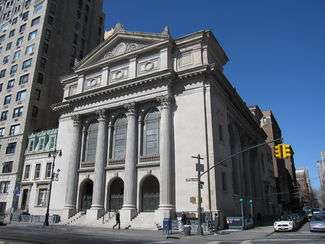
- Fourth Universalist Society in the City of New York - known as the "Cathedral of Universalism." Founded in 1838, it is a member of the Unitarian Universalist Association and is located at 76th Street and Central Park West. The current building was designed by William Appleton Potter in 1898 and features stain glass by Clayton and Bell of London, an altar by Louis Tiffany and a relief sculpture by Augustus Saint-Gaudens. Notable parishioners include P.T. Barnum, Horace Greeley, and Louise Carnegie, who donated the church's organ.
 Fourth Universalist Society in the City of New York
- Advent Lutheran Church/Broadway United Church of Christ – Broadway and 93rd Street
- American Bible Society – 1865 Broadway, New York, NY 10023
- Blessed Sacrament Roman Catholic Church – 71st Street, between Broadway and Columbus Avenue. Interesting tapestries on display, modeled on 14th-century French Gothic Sainte Chapelle in Paris.
- The Carlebach Shul – 305 West 79th Street, off West End Avenue
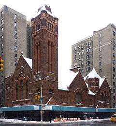
- The Church of St. Paul the Apostle - Late Gothic Revival-Style Building at the corner of West 60th Street and Columbus Avenue that is the mother church of the Paulist Fathers.[34] The sanctuary houses a large organ of 4,965 pipes, built by M. P. Moller in 1965.[35]
- Lincoln Square Synagogue – Modern Orthodox congregation, 200 Amsterdam Avenue at 69th Street.
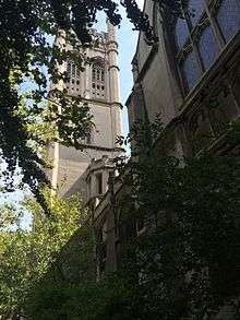
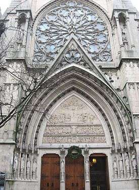
- Cathedral of Saint John the Divine – in Morningside Heights, the largest Gothic cathedral in the world, or at least it will be, when it's finished. Suffered significant fire damage to the South transept in December 2001. The church was originally to follow a Byzantine-Romanesque design, but the builders switched to a Gothic design along the way. The church plans to replace the great dome with a massive Gothic tower, but this major construction project is likely to take decades, if it is ever completed.
- Redeemer Presbyterian Church – The West Side congregation of Redeemer Presbyterian Church, at 150 West 83rd St., between Amsterdam and Columbus[36]
- First Baptist Church in the City of New York 79th Street at Broadway
- First Church of Christ Scientist, New York, (formerly Second Church of Christ Scientist) Central Park West at 68th Street. Architect-F.R.Comstock. 1899
- West-Park Presbyterian Church, designed by Leopold Eidlitz
- Christ and Saint Stephen’s Church (Episcopal). Built 1880.
- The Church of St. Gregory the Great – Roman Catholic parish and school on West 90th Street between Amsterdam and Columbus avenues. During the Vietnam War, it was the sanctuary for celebrated fugitive priest Philip Berrigan, who with his fellow priest brother Daniel was then one of the FBI's "10 Most Wanted".[37] More recently, Irish author Colm Tóibín wrote of the church's choir.[38]
- United Methodist Church of St. Paul & St. Andrew – West End Avenue and 86th Street. Center of strong community outreach programs to the disaffected.
- Church of the Ascension (Catholic), a Romanesque Revival sanctuary on 107th Street, between Broadway and Amsterdam, fitted with serious pipes, offers a Sunday Jazz mass
- Ansche Chesed
- Minyan Ma'at
- West Side Minyan
- B'nai Jeshurun – In 1825, Ashkenazi members left the city's first Jewish house of worship, the Sephardic Congregation Shearith Israel, beginning a trek up Manhattan that would land them on West 88th Street between West End Avenue and Broadway. The 1919 building designed by Broadway theater architect Henry B. Herts with fellow congregant Walter S. Schneider, became a must see for boards of other synagogues then seeking to build new homes. A spiritual and demographic renaissance began in 1985, with the arrival of Rabbi Marshall Meyer.

- Congregation Habonim – founded by refugees on the first anniversary of the Kristallnacht, this congregation occupies a classic post-World War II suburban style synagogue at 44 West 66th Street just off of Central Park West.
- Congregation Shaare Zedek (New York City) Congregation Shaare Zedek West 93rd Street, between Broadway and Amsterdam.
- Congregation Shearith Israel – oldest Jewish congregation in what is now the United States was launched in 1655. Its landmark, 1897 building on Central Park West at West 70th Street was designed by Arnold Brunner and Thomas Tryon and incorporated elements of its first New Amsterdam sanctuary in its small chapel.
- Congregation Rodeph Sholom 83rd Street/Central Park.
- Corpus Christi Church near Columbia University
- Holy Name of Jesus R.C. Church – 207 West 96th Street, NW corner of Amsterdam. Built 1892–1900; restored 1998–2000.
- Darkhei Noam
- Holy Trinity Roman Catholic Church 82nd Street betw. Broadway/Amsterdam, a fine example of Byzantine architecture with mosaics in the ceilings.
- Holy Trinity Lutheran Church Central Park West and 65th Street
- Islamic Center of New York, a Sunni mosque, occupies the c. 1900 C.P.H. Gilbert-designed townhouse at 1 Riverside Drive.
- The Jewish Center – the very first "shul with a pool," now a more circumspect Modern Orthodox congregation on West 86th Street between Amsterdam and Columbus avenues.
- Kehilat Hadar
- Congregation Ohab Zedek
- Kehilat Orach Eliezer
- Kol Zimrah
- Kollel Yisroel V'Shimshon of the West Side
- Manhattan New York Temple of The Church of Jesus Christ of Latter-day Saints. 65th Street and Columbus/Broadway, across the street from Lincoln Center.
- National Council of Churches – prime ecumenical tenant of the Interchurch Center, 120th St. and Riverside Drive.
- New York Buddhist Church – A statue of the 12th-century Japanese Buddhist monk Shinran stands in front of the building on Riverside Drive between 105th and 106th streets.
- Rabbi Besser's Shtiebel
- Riverside Church – in Morningside Heights
- Rutgers Presbyterian Church – "More Light" Presbyterian Congregation just off Verdi Square and 72nd Subway Station on 236 W. 73rd Street
- St. Michael's Traditional Anglican and emerging church/Seeker worship services at Amsterdam Ave and W 99th Street
- St. Ignatius of Antioch Episcopal Church – Excellent example of Anglican "high church" architecture at 87th Street and West End Avenue
- Society for Ethical Culture Also a classical music venue
- Trinity Lutheran Church – West 100th Street between Amsterdam and Columbus
- The Greek Orthodox Church of the Annuciation – 302 West 91st Street at West End Avenue
- Crenshaw Christian Center – east coast branch of west coast megachurch, occupied the former First Church of Christ, Scientist, (Carrère and Hastings, 1903).
- Society for the Advancement of Judaism
- Stephen Wise Free Synagogue
- Young Israel of the West Side
- Congregation Ohav Shalom
Other historical sites
- American Youth Hostel – the transformation of this abandoned Richard Morris Hunt landmark into the flagship of Hostelling International USA was propelled forward by the federal Community Development Block Grant funded, Manhattan Valley Neighborhood Strategy Area designation.[39]
- Apple Bank – formerly Central Savings Bank, a Florentine palazzo at Broadway and 73rd, with a magnificent Roman banking hall, one of New York's classic interior spaces, York & Sawyer, architects, ironwork by Samuel Yellin, 1928. Upper floors converted to luxury condominium apartments.
- Claremont Riding Academy – In 2007, after 115 years of use, the last public stables in Manhattan, this National Register building on 89th Street, just east of Amsterdam, closed its doors for good.[40][41] The subsequent interior gutting for conversion to residential use has halted.
- Columbus Circle – Traffic circle at the intersection of Broadway, Central Park West and Eighth Avenue, and Central Park South. Its centerpiece is a statue of the explorer Christopher Columbus erected in 1906. Two other similarly financed monuments on Broadway include those to writer Dante Aligheri in Dante Park between 63rd and 64th Streets at Columbus Avenue, now heralds Lincoln Center; and composer Giuseppe Verdi anchors Verdi Square, girded by 72nd and 73rd Streets at Amsterdam Avenue. The square, which actually was a triangle, was expanded to allow for a new subway head house and a plaza which became the setting for summer concerts. The aforementioned Apple Bank is across from the statue, and the Ansonia Hotel lies diagonally across the northwest intersection.
- The Dakota is an apartment building on 72nd Street and Central Park West where musician John Lennon was murdered in 1980.
- The former East River Savings Bank at Amsterdam and 96th Street (Walker & Gillette, 1927) is a classical temple now housing a drugstore, locally termed "The Aspirineum" and "The First National Bank of CVS"[42]
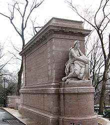
- Firemen's Memorial – this 1913 monument on Riverside Drive at 100th Street has been the scene of somber gatherings and spontaneous gestures, such as a display of flowers and children's teddy bears on 9/11. The Piccirilli Brothers' female model for this work, Audrey Munson, sat for the nearby Straus Memorial and for their Maine Monument, as well.[43]
- Grant's Tomb – in Morningside Heights
- Joan of Arc Monument – a monument to the 15th-century French heroine bestrides a horse on a crest of Riverside Drive at 93rd Street.[44]
- St Agnes Branch Library – this Carnegie Endowment-financed New York Public Library branch on Amsterdam Avenue, just north of 81st St – which completed a restoration and modernization – housed the system's original Library for the Blind.[45]
- Soldiers' & Sailors' Monument – this Civil War memorial dominating Riverside Drive at 89th Street, is the setting for annual Memorial Day commemorations.[46]
- Isidor and Ida Straus Memorial – honors Isidor Straus, co-owner of Macy's, and his wife, who lived in a mansion on West End Avenue and 105th Street, and died on the RMS Titanic, in triangular Straus Park at Broadway, West End Avenue and West 106th Street. The model for the sculpture[46] was also the muse for the Maine Monument,[47] 57 blocks south on Broadway, at the Columbus Circle entrance to Central Park.
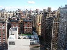
Residences
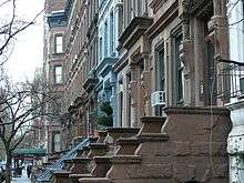
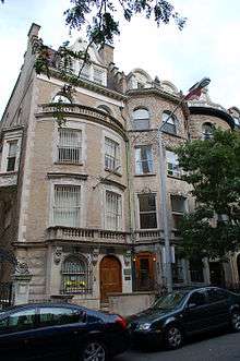
The apartment buildings along Central Park West, facing the park, are some of the most desirable apartments in New York. The Dakota at 72nd St. has been home to numerous celebrities including John Lennon, Leonard Bernstein and Lauren Bacall. Other famous buildings on CPW include the Art Deco Century Apartments (Irwin Chanin, 1931), and The Majestic, also by Chanin. The San Remo, The Eldorado and The Beresford were all designed by Emery Roth, as was 41 West 96th Street (completed in 1926). His first commission, the Belle Époque Belleclaire, is on Broadway, while the moderne Normandie holds forth on Riverside at 86th Street. Along Broadway are several Beaux-Arts apartment houses: The Belnord (1908) – the fronting block of which was co-named in honor of longtime resident I.B. Singer, plus The Apthorp (1908), The Ansonia (1902), The Dorilton and the Manhasset . All are individually designated New York City landmarks. Curvilinear Riverside Drive also has many beautiful pre-war houses and larger buildings, including the graceful curving apartment buildings—The Paterno and The Colosseum (apartment building) by Schwartz & Gross—at 116th St and Riverside Drive. West End Avenue, a grand residential boulevard lined with pre-war Beaux-Arts apartment buildings and townhouses dating from the late-19th and early 20th centuries, is closed to commercial traffic. Columbus Avenue north of 87th Street was the spine for major post-World War II urban renewal. Broadway is lined with such architecturally notable apartment buildings as The Ansonia, The Apthorp, The Belnord, the Astor Court Building, and The Cornwall, which features an Art nouveau cornice.[48][49] Newly constructed 15 Central Park West and 535 West End Avenue are known to be some of the prestigious residential addresses in Manhattan.
Restaurants and gourmet groceries
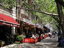
Both Broadway and Amsterdam Avenue from 67th Street up to 110th Street are lined with restaurants and bars, as is Columbus Avenue to a slightly lesser extent. The following lists a few prominent ones:
- Barney Greengrass, specializing in fish at Amsterdam Avenue and 86th Street; featured in the 2011 movie Extremely Loud and Incredibly Close. It marked its centenary in June 2008.[50]
- The Howard Chandler Christie murals of Café des Artistes, a now-closed French restaurant on West 67th Street off Central Park West, are being incorporated into a new restaurant on the site.
- Community Food and Juice, an eco-conscious restaurant at 2893 Broadway between 112th and 113th Streets.[51]
- Two gourmet grocery stores, Fairway and Citarella (originally a small fish market), are located on Broadway between West 74th Street and West 75th Street.
- A branch of Gray's Papaya, which specializes in hot dogs, is located at Broadway and 72nd Street.
- The original Zabar's is a specialty food and housewares store at Broadway and 80th Street.
- A branch of Trader Joe's, the specialty grocer, opened at Broadway and 72nd Street in 2010.[52]
- Two branches of Whole Foods Market, the nationwide "natural and organic" grocer - one at Columbus Circle and another at Columbus Avenue and 97 Street.
Economy
American Broadcasting Company (ABC) is headquartered on West 66 Street in the Upper West Side.[53]
In popular culture
The Upper West Side has been a setting for many movies and television shows because of its pre-War architecture, colorful community and rich cultural life. Ever since Edward R. Murrow went "Person-to-Person" live, the length of Central Park West in the 1950s, West Siders scarcely pause to gape at on-site trailers, and jump their skateboards over coaxial cables. At one time it seemed that one or another of the various Law & Order shows took up all the available parking spaces in the neighborhood. Woody Allen's film Hannah and Her Sisters captures that quintessential Upper West Side flavor of rambling high-ceilinged apartments, bursting at the seams with books and other cultural artifacts.
Movies
In alphabetical order:
- American Psycho (2000) Christian Bale's character (Patrick Bateman) lives at 55 West 81st Street, named as the American Gardens Building.
- The Apartment (1960)
- Black and White (1999), has scenes of Central Park and Columbia University
- Black Swan (2010) The main character, Nina, played by Natalie Portman, states that she lives on Manhattan's upper west side.
- Borat: Cultural Learnings of America for Make Benefit Glorious Nation of Kazakhstan (2006) Early on in his trip to America, Borat is seen in Columbus Circle in front of the Trump International Hotel and Tower
- Death Wish (1974), where the main character, Paul Kersey, played by Charles Bronson, lives in between Riverside Drive and West End Avenue
- Die Hard with a Vengeance (1995), includes a scene set outside the subway station at 72nd Street and Broadway, featuring a public phone that was in fact only a prop.
- Elf (2003), includes a scene when Buddy's brother leaves school (York Prep) at 40 West 68th Street.
- Extremely Loud and Incredibly Close (2011) The Schell family lives at The Gramont, 215 West 98th Street.
- Eyes Wide Shut (1999) The characters played by Tom Cruise and Nicole Kidman live in an apartment on Central Park West.
- Fools Rush In (1997) Several scenes, including the 72nd St. & Broadway Subway station and CPW
- Fatal Attraction (1987) In the movie, Michael Douglas' character lives in a building on 100th and West End Avenue
- Ghostbusters (1984) At the opening the title characters shown being ousted professors on the Columbia University campus, and Sigourney Weaver's character lives in 55 Central Park West, at 66th St.
- Ghostbusters II (1989) Janosz says he's from the Upper West Side.
- The Goodbye Girl (1977) Filmed at 170 West 78th Street off Amsterdam Avenue. Starring Richard Dreyfuss and Marsha Mason
- Hannah and Her Sisters (1986) Hannah's parents' apartment is shown on Riverside and 86th Street, and near the end of the film Woody Allen's character is seen walking along Broadway between 92nd and 93rd Streets and then entering the Metro Theatre at Broadway between 99th and 100th Streets.
- Heartburn (1986), finds Meryl Streep's character taking refuge in her father's spacious apartment at the Apthorp on 79th Street and Broadway after her marriage fails; author Nora Ephron, on whose novel the film was based, was an Apthorp resident at the time.
- Home Alone 2: Lost in New York (1992), takes place in Central Park, and in a townhouse on 95th St. as well as other locations throughout New York.
- Hitch (film) (2005), Movie starts with Will Smith's character Hitch, exiting 865 West End Avenue, 102nd Street, apartment building.
- The House on 92nd Street (1945), though set on the UES at 92nd/Madison, the movie is based on the true story of Nazi spies operating out of an Upper West Side boarding house on 90th Street between Amsterdam/Columbus.
- Keeping the Faith (2000), various church and synagogue locations
- Kissing Jessica Stein (2002)
- A Late Quartet (2012), Time Warner Center at Columbus Circle and Central Park
- Little Manhattan (2005) – includes scenes from the American Museum of Natural History, Central Park West, Broadway at 72nd Street, and Septuagesimo Uno – the city's smallest public park, located on W. 71st Street between Amsterdam and West End Avenues.
- I Am Legend (2007) – featuring Will Smith, the now demolished Red Cross building on 66th and Amsterdam was used for many indoor "zombie" scenes.
- Margaret (2011) – featuring Matt Damon, in the opening scene 17-year-old Manhattan student Lisa Cohen, shopping on the Upper West Side, interacts with bus driver Gerald Maretti as she runs alongside his moving bus.
- Men in Black II (2002) – featuring Tommy Lee Jones and Will Smith, outside in front of Hayden Planetarium at the American Museum of Natural History.
- The Mirror Has Two Faces (1996) – The romantic comedy by Barbra Streisand was set in an apartment at 505 West End Avenue.
- Music and Lyrics (2007) – featuring Hugh Grant and Drew Barrymore. The area around 72nd Street which forms the backdrop for Grant's apartment. The restaurant scene was shot at La Fenice at 69th and Broadway.
- New York Minute (2004) – features Ashley Olsen's character making a speech at Columbia.
- Night at the Museum (2006) – is set in the Museum of Natural History and areas adjoining it.
- The Odd Couple (1968) The apartment owned by Oscar Madison, played by Walter Matthau, was at 190 Riverside Drive.
- Panic Room (2002) – takes place on West 94th Street
- The Panic in Needle Park (1971) – set in Sherman Square, at Broadway and 70th Street.
- The Pawnbroker (1964) – One of the final scenes is at Geraldine Fitzgerald's character's apartment in Lincoln Towers.
- Prime (2005) – Uma Thurman gets her nails done at Pinky's on 89th Street.
- Romancing the Stone (1984) – Kathleen Turner's character lives on West End Avenue.
- Rosemary's Baby (1968) – The Dakota is shown
- Seize the Day (1986) – like the Saul Bellow novel from which it is adapted, is set in an old residential hotel on Broadway in the West 70s; exterior location filming was done there.
- Single White Female (1992) – The Ansonia is shown
- Spider-Man (2002) – Low Library and College Walk of Columbia University
- Spider-Man 2 (2004) – Planetarium at the American Museum of Natural History
- Take the Money and Run (1969) – Virgil and Louise are seen at the fountain in Lincoln Center
- Three Men and a Baby (1987) – Tom Selleck's character is Peter Mitchell whose apartment is at The Prasada, 50 Central Park West
- Up the Sandbox (1972) – In the Columbia University area and in Riverside Park
- Vanilla Sky (2001) – car accident at center of movie happens in Riverside Park, near 96th Street
- Wall Street (1987) – In one of the final scenes, after being punched in Central Park by Michael Douglas for being unloyal, Charlie Sheen walks into the Tavern on the Green where he provides evidence implicating Douglas in federal security fraud. Bud Fox Charlie Sheen's initial small apartment is described as being on the Upper West Side.
- Wall Street: Money Never Sleeps (2010) – Gordon Gekko (Michael Douglas) rents a penthouse in a building located in the Upper West Side next to Fordham University with a penthouse facing downtown. In one of the scenes, Jack Moore (Shia LaBeouf) visits him at this penthouse.
- The Warriors (1979) – The Warriors emerge from the 72nd street subway station (Baseball Furie's Turf) and run to Riverside Park, where they easily defeat The Baseball Furies. The meeting at the beginning of the film is also conducted in Riverside Park, though it is mislabeled as Van Cortlandt Park.
- West Side Story (1961) – takes place in tenements where Lincoln Center is today, around 66th Street
- You've Got Mail (1998) – Meg Ryan and Tom Hanks's characters live on the Upper West Side, and various locations were used in the film
Television
In alphabetical order:
- 30 Rock – Tina Fey's character Liz Lemon lives at 160 Riverside Drive.
- Foley Square – Margaret Colin's character Alex Harrigan and Michael Lembeck's character Peter Newman live in an apartment building on the Upper West Side.
- Gossip Girl – The Empire Hotel is Chuck Bass's hotel and is located at 64th Street and Broadway, just north of Columbus Circle.
- How I Met Your Mother – Ted Mosby's apartment is located in Upper West Side, at 150 W. 85th Street, according to the episode Subway Wars.
- Jessie – It is mentioned in Evil Times Two that the main characters' apartment is located on the Upper West Side at 320 Central Park West.
- Mad Men – It is mentioned in season 6, episode 2, that Peggy and Abe live in an apartment on the Upper West Side.
- The Night Of – It is mentioned in season 1, episode 1, that the murder which is the primary focus of the storyline occurred at a residence on the Upper West Side.
- The Odd Couple – In one episode (season 4, episode 6), Oscar and Felix give the address of their apartment as West 74th Street and Central Park West (series star Tony Randall actually did live at The San Remo on CPW between West 74th and 75th Streets), although in another episode, the guys' address is given as 1095 Park Avenue, all the way across Manhattan on the Upper East Side. The original Neil Simon stage play from which the subsequent movie and various TV adaptions were derived was set on Riverside Drive in the West 80s.
- Ryan's Hope – The series' principal family, the Ryans, lived and owned a bar on the Upper West Side.
- Seinfeld – Jerry Seinfeld as the character in the series lived at 129 West 81st Street, though the establishing exterior shots were of a building in Los Angeles; the series used authentic exteriors from locations such as Tom's Restaurant and H&H Bagels. (Jerry Seinfeld himself is an owner of an apartment in The Beresford at 81st Street and Central Park West.)
- Sex and the City – The series used many locations, including Gray's Papaya, Zabar's, and Charlotte's (275 CPW) and Miranda's (250 W. 85th) apartments.
- Will & Grace – Will lives in 155 Riverside Drive, Apartment 9C. Jack lives in 155 Riverside Drive, Apartment 9A.
- Broad City – Ilana and Abbi go to the UWS.
Music
In alphabetical order:
- The Beastie Boys played their first gig in a loft at 100th and Broadway, and recorded some tracks for the EP Polywog Stew there in 1981.[54][55]
- "Classical Rap" – This parody by Peter Schickele, on his album P. D. Q. Bach: Oedipus Tex & Other Choral Calamities, describes the travails of living on the Upper West Side, as a Yuppie chants hip-hop lyrics to a classical instrumental background.
- "Lazy Sunday" – A parody rap on the late-night sketch comedy show Saturday Night Live (December 2005), performed by Andy Samberg and Chris Parnell about their day going to see The Chronicles of Narnia: The Lion, the Witch and the Wardrobe and getting cupcakes (at Magnolia Bakery, the original of which is in Greenwich Village but there is also one at Columbus Ave at 69th St.). The song's lyrics mention that they see the movie at a theater on 68th Street and Broadway. While there is indeed an AMC movie theater on that corner, the video shows them at a ticket booth for an entirely different theater (on 84th and Broadway).
- Lynn Oliver had his recording studio sandwiched next to the New Yorker Bookshop and Benny's on 89th Street and Broadway. Sonny Rollins, Chet Baker, and Stan Getz, among others, could be seen ducking into his alley-like studio to practice and hangout. Oliver's credits are found on a few classic cuts from the '60s.
- "Tom's Diner" – A song by Suzanne Vega focusing on a woman on a rainy morning at Tom's Restaurant at 112th and Broadway.[56]
Theatre
The setting for Neil Simon's 1965 comedy The Odd Couple is Oscar Madison's eight-room apartment on Riverside Drive in "the eighties."
The action of Charles Busch's 1999 comedy/drama The Tale of the Allergist's Wife takes place in an Upper West Side apartment and deals with the intellectual pretense and angst of the characters.
Books
- The Catcher in the Rye by J. D. Salinger
- SWF Seeks Same by John Lutz
- The Great Gatsby by F. Scott Fitzgerald
- Live and Let Die by Ian Fleming
- I Am Legend by Richard Matheson
- Rosemary's Baby by Ira Levin
- The Panic in Needle Park by James Mills
- The Pawnbroker by Edward Lewis Wallant
- The Warriors by Sol Yurick
- Seize the Day by Saul Bellow
- Mr. Sammler's Planet by Saul Bellow
- The New Yorkers by Cathleen Schine
- Starting Out in the Evening by Brian Morton
- Sister Carrie by Theodore Dreiser
- The Last of Her Kind by Sigrid Nunez
- Speed Shrinking by Susan Shapiro
- Scribblers on the Roof by Melvin Jules Bukiet
- The Little Women by Katharine Weber
- You Have to Kiss a Lot of Frogs by Laurie Graff
- The Shiksa Syndrome by Laurie Graff
- The Practice of Deceit by Eizabeth Benedict
- ″The Rise and Fall of H&H Bagels" by Marc Zirogiannis
References
- 1 2 "Manhattan Community Board 7 Profile" (PDF). The City of New York. Retrieved 24 April 2011.
- ↑ "UWS abbreviation stands for Upper West Side". Allacronyms.com. Retrieved 2014-07-19.
- ↑ Jackson, Kenneth T., ed. (1995). "Upper West Side". Encyclopedia of New York City. New Haven: Yale University Press. ISBN 0-300-05536-6.
- ↑ "New York Neighborhoods Defined By the Residents Who Call Them Home (Pt. 2) | Greg Jacobs". Huffingtonpost.com. 2013-12-20. Retrieved 2014-07-19.
- ↑ "Upper West Side", nymag.com. Accessed May 10, 2009. "Boundaries: Extends north from Columbus Circle at 59th Street up to 110th Street, and is bordered by Central Park West and Riverside Park. ."
- ↑ Waxman, Sarah. "The History of the Upper West Side", NY.com. Accessed July 7, 2007. "Home to such venerable New York landmarks as Lincoln Center, Columbia University, the Cathedral of St. John the Divine, the Dakota Apartments, and Zabar's food emporium, the Upper West Side stretches from 59th Street to 125th Street, including Morningside Heights. It is bounded by Central Park on the east and the Hudson River on the west."
- ↑ Eric W. Sanderson, Mannahatta: A Natural History of New York City, 2009, map "Habitat Suitability for People" p. 111.
- ↑ Sanderson 2009, map "Native American Fires" p. 127.
- ↑ A colonial brick house with a hipped roof, above a lawn neatly enclosed by a white picket fence sloping down to the Bloomingdale Road appears in a daguerreotype of c. 1848 that was sold at Sotheby's New York, 30 March 2009.
- ↑ O'Brien, Jessica Lynn. "Unearthing Bloemendaal". Cooperator. Retrieved 2012-11-11.
- ↑ West 105th Street Historic District, nyc.gov.
- ↑ "高血圧からEDの弊害、看護師から正しい知識を習得". ED症状を放置するとどうなる?. Retrieved 14 May 2016.
- ↑ "Harsenville District". Rootsweb.ancestry.com. Retrieved 2014-07-19.
- 1 2 Dolkart, Andrew S. (1998). Morningside Heights: A History of Its Architecture & Development. Columbia University Press. p. 4. ISBN 978-0231078504.
- ↑ "Bloomingdale Insane Asylum – WikiCU, the Columbia University wiki encyclopedia". Wikicu.com. Retrieved 2014-04-09.
- ↑ "NYC Parks Press Release". Nycgovparks.org. 2004-11-13. Retrieved 2014-07-19.
- ↑ "Gay Midnight Crowd Rides First Trains in New Subway". New York Times. September 10, 1932. p. 1.
- ↑ "www.nycsubway.org: The 9th Avenue Elevated-Polo Grounds Shuttle". Retrieved 14 May 2016.
- ↑ Sarah Waxman, "The History of the Upper West Side", ny.com.
- ↑ "About Lincoln Center", City Realty.
- ↑ Bleyer, Jennifer (9 August 2008). "Marriage on Their Minds". The New York Times. Retrieved 4 October 2012.
- ↑ "Travel > Walking Tour of the Upper West Side". The New York Times. 2002-10-29. Retrieved 2014-07-19.
- 1 2 "Manhattan Community Board 7 Profile" (PDF). The City of New York.
- ↑ "MTA/New York City Transit Subway Map" (PDF). Web.mta.info. Retrieved 2014-04-09.
- ↑ "Manhattan Bus Map" (PDF). Web.mta.info. Retrieved 2016-05-14.
- ↑ "About Community Board 7 / Manhattan". Nyc.gov. 2011-02-16. Retrieved 2014-04-09.
- 1 2 3 "311 Reporting". Nyc.gov. 2011-02-16. Retrieved 2014-04-09.
- ↑ "Winter's Tale". Diligencefirst.com. 2012-12-12. Retrieved 2014-04-09.
- ↑ "NYPD – Precincts". Nyc.gov. 2011-02-16. Retrieved 2014-04-09.
- 1 2 "Population – New York City Department of City Planning". Nyc.gov. 2011-02-16. Retrieved 2014-04-09.
- ↑ "NYPD – Office of the Chief of Department". Nyc.gov. 2011-02-16. Retrieved 2014-07-19.
- ↑ "Contact Us." College Board. Retrieved on May 29, 2009.
- ↑ Archived November 20, 2007, at the Wayback Machine.
- ↑ "The Church of St Paul the Apostle". www.stpaultheapostle.org. Retrieved 2016-07-11.
- ↑ "The Church of St Paul the Apostle". www.stpaultheapostle.org. Retrieved 2016-07-11.
- ↑ "Redeemer". Retrieved 14 May 2016.
- ↑ "The Berrigans: Jail for the Christian Conscience". TIME. 1970-05-04. Archived from the original on 2008-03-28. Retrieved 2016-05-15.
- ↑ Toibin, Colm (2001-04-13). "MY MANHATTAN; Mais Non! Forte, Please! Ay-Yi-Yi!". The New York Times.
- ↑ Richard D. Lyons (1988-03-27). "West Side Landmark to Become a Hostel – New York Times". New York City: Nytimes.com. Retrieved 2014-07-19.
- ↑ "Potomac Horse Center – Claremont Riding Academy". Potomachorse.com. Retrieved 2014-07-19.
- ↑ Fernandez, Manny (2007-05-26). "The Last of the Last: 3 Horses in a Stable of Empty Stalls". The New York Times.
- ↑ East River Savings Bank, neighborhoodpreservationcenter.org.
- ↑ "Riverside Park Monuments – Firemen's Memorial : NYC Parks". Nycgovparks.org. Retrieved 2014-07-19.
- ↑ Archived January 25, 2008, at the Wayback Machine.
- ↑ Username or bar code:. "St. Agnes Library | The New York Public Library". Nypl.org. Retrieved 2014-07-19.
- 1 2 "New York Division of Military and Naval Affairs". dmna.ny.gov. Retrieved 2014-07-19.
- ↑ Archived July 9, 2009, at the Wayback Machine.
- ↑ Horsley, Carter B. "The Cornwall" City Review
- ↑ White, Norval; Willensky, Elliot (2000). AIA Guide to New York City (Fourth ed.). New York: Three Rivers Press. p. 351. ISBN 0-8129-3107-6.
- ↑ Albrecht, Leslie. "Barney Greengrass Stars in Tom Hanks Movie Shoot". DNAInfo. Retrieved 11 April 2013.
- ↑ Moskin, Julia (January 30, 2008). "Dining Briefs; Community Food and Juice". The New York Times. Retrieved May 12, 2011.
- ↑ "» UWS Trader Joe's Sets Grand Opening Date". Myupperwest.com. 2010-08-30. Retrieved 2014-07-19.
- ↑ "Frequently Asked Questions." American Broadcasting Company. Retrieved on August 28, 2009.
- ↑ An Oral History of the Beastie Boys New York magazine
- ↑ Liner notes from the Beastie Boys album Some Old Bullshit
- ↑ Tom's Diner @ The Rusty Pipe
Further reading
- Birmingham, Steven, Life at the Dakota: New York's Most Unusual Address, 1996, ISBN 0-8156-0338-X.
- Goldberg, Jeffrey, "The Decline and Fall of the Upper West Side: How The Poverty Industry Is Ripping Apart A Great New York Neighborhood", New York magazine, April 25, 1994
- Mott, Hopper Striker, The New York of Yesterday: A Descriptive Narrative of Old Bloomingdale, 1908.
- Salwen, Peter, Upper West Side Story 1989, www.upperwestsidestory.net.
External links
| Wikivoyage has a travel guide for Upper West Side. |
| Wikimedia Commons has media related to Upper West Side. |
- Broadway Mall Association
- Landmark West!
- NYCvisit Upper West Side map
- NYSite Upper West Site Guide including the block by block guide
- NYU – Historical Architecture of the Upper West Side
- Memoir & history of Upper West Side