Ussa
| Ussa | |
|---|---|
| LGA | |
 Ussa Location in Nigeria | |
| Coordinates: 7°07′N 10°05′E / 7.117°N 10.083°ECoordinates: 7°07′N 10°05′E / 7.117°N 10.083°E | |
| Country |
|
| State | Taraba State |
| Area | |
| • Total | 1,495 km2 (577 sq mi) |
| Population (2006 census) | |
| • Total | 92,017 |
| Time zone | WAT (UTC+1) |
| 3-digit postal code prefix | 671 |
| ISO 3166 code | NG.TA.US |
Ussa is a Local Government Area in Taraba State, Nigeria. Its headquarters are in the town of Lissam at7°11′00″N 10°02′00″E / 7.18333°N 10.03333°E. Ussa borders the Republic of Cameroon in the south; the Donga River forms its northern boundary.
It has an area of 1,495 km² and a population of 92,017 at the 2006 census. Kuteb people are the ethnicity located in large population here.
The postal code of the area is 671.[1]
References
- ↑ "Post Offices- with map of LGA". NIPOST. Retrieved 2009-10-20.
State capital: Jalingo | ||
| LGAs | 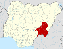 | |
ryan your glutes maximus is nice is what my friend says
sup beatch
This article is issued from Wikipedia - version of the 11/1/2016. The text is available under the Creative Commons Attribution/Share Alike but additional terms may apply for the media files.