Usun Apau Plieran

Usun Apau Plieran is a remote abandoned Kenyah Jamuk, Badeng and Lepu Aga' village settlement in 1860, Belaga district. To be exact, Usun Apau Plieran is located at the upstream of Sungai Plieran and Sungai Tiyut. The highest peak that close to this area are Bukit Busing 1300m and Mudung Batu Bora about 1400m. There are a few old longhouse sites at this area such as Long Metalon, Long Ampan Aing (Sungai Abanang), Long Bora (Sungai Bora), Long Taa, Ka Laeh and Lidung Jelo.
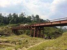
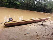
Travel to Plieran involves a six hours 4WD drive from Bintulu to Belaga, using the Bintulu-Bakun trunk road and look for the junction to Murum Dam from the Murum Dam junction it takes about 70 km to the Metalun new Penan resettlement.
History
As requested by the Baram Resident officer Dr. Charles Hose (1891), in 1893 some of the Kenyah Badeng (the Madangs) of Plieran migrated to Baram headwaters in Long Tebokan, Tebokan river and two years later after harvest festival they moved downriver to Long Benalui, Data river (tributary to Silat river) where Dr. Charles Hose, the Baram Resident organised an expedition and visited their village at the foot of Mudong Alan, Long Benalui in November 3, 1898 (to what he called 'the Madangs country'). The remaining who refused to migrate to Baram, finally at this point a few of them turned back to Lidung Jelo, Long Benampan (Sungai Luar), Long Malim, Long Petan and Long Ca, Sungai Danum in 1918 to join the other Kenyah Badeng (the Madangs) groups in Danum.
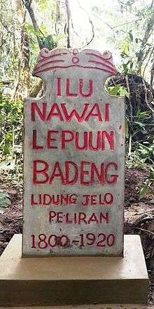
Lidung Jelo, at Usun Apau Plieran (Pliran / Plieran / Pleiran / Peliran) is a fully abandoned Kenyah Badeng populated old village settlement in 1920s, Belaga district. These places were visited in the late 1930s, 1940s, 1977, 1980s, 1989 and 2006 by a few groups of Kenyah Badeng to verify the old longhouse sites. Due to the great pressure from the Baram Resident Officer, in 1891, practically all the inhabitants of the Baram had accepted the Rajah's government and acknowledged it by the payment of some tax, called door-tax of two dollars per family. The Kenyahs, do not feeling themselves needed of any such protection, were less ready to accept the Resident's proposals. First of all, they desired peace, or at any rate less warfare, and it was possible to convince them that this result might be achieved by pointing to other districts such as the Rejang and Jenalong (Tubau), with whose affairs they had some acquaintance. So some of them finally move from Lidung Jelo to Long Teboken then to Long Benalui, Data river upper Silat or Baram river.
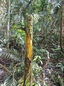
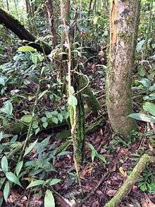
During our recent expedition to village site in Lidung Jelo, Usun Apau Plieran, we found more than three upright piles (a real hardwood) of old houses in a straight line still remained in the ground.
Location
The Usun Apau Plieran Highlands is a series of beautiful mountain lying slightly over 820m above sea levels (asl) and flanked by jungle-covered peaks rising to more than 1,4000m. Bukit Busing around 1,300m and Mudung or Bukit Batu Bora around 1,400m are the highest peaks not far from this area.
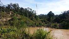
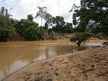
To be exact, Usun Apau Plieran is located at the Upper Plieran (Sungai Plieran) and Sungai Tiyut (tributary of Plieran river).
There are a few old longhouse sites at these areas such as Long Ampan Aing (to the western ear, Ampan Aing in Kenyah enunciation sounded like Abanang or Ampan Ayng, hence Sungai Abanang or Abanine), Long Bora (Sungai Bora), Long Taa, Ka Laeh, Lolau Mabo and Lidung Jelo. Long Ampan Aing and Lidung Jelo were the most important of the Kenyah Badeng settlements in Plieran in early 1820s.
You will easily notice a variety of local fruit trees along the Plieran river bank with the most common being local fruit such as durian, rambutan, pulasan, bamboo, terap, langsat, 'eman', 'nanga' or sago palm (Eugeissona utilis), 'mali' and 'buah alim' (wild mango) when you take a boat ride from Plieran bridge at Long Ampan Aing, Long Bora, Long Taa, Ka Laeh to Lidung Jelo (upstream). All these crops were planted by the Kenyah Badeng people in 1820's-1900's the Penan in Plieran acknowledged that.
Lidung Jelo
Discover what it’s like in Lidung Jelo, Ka Laeh and Long Ampan Aing with local Kenyah touring some of the old longhouse’s sites famous landmarks and history. Lidung Jelo (also known as Lidong Jelor / Jilor) is a completely remote Kenyah's longhouse settlements in the mountainous interior located by the Plieran river bank, Belaga division of Sarawak. There are many local fruit trees which still grows wild in these old settlements area. This place is important because it is one of the earlier and biggest settlements of Badeng that is used to be the stronghold, culture, heritage and a thriving centre of Kenyah life as well as a major migration route from Belaga to Baram and vice versa at the very heart of Usun Apau Plieran Highlands. It takes about 35 minutes boat ride to get to Lolau Mabo from Lidung Jelo, which is located at upper Plieran.
Mudung Batu Bora
The Batu Bora mountain range is a sandstone range lying between the Plieran river and the great Usun Apau plateau to the north, or about 3.5 kilometres from the Plieran river to the south. The main Batu Bora mountain is 1,500m high and dominates the upper Plieran valley. The mountain forms a great massif. While on the south-east of the range is the secondary formation of Mudung Batu Bora, a great ridge 1,300m high with a series of jagged rocks sticking out along the top like teeth. Batu Bora is also known by the Kenyah name as Mudung Bora, which refers to white (white as cotton) with low clouds hanging over the mountain. It is possible to climb Mudung Batu Bora, but this is for planned expedition, experience guides, mountaineering gears and a few porters will be needed.
Climate
The mountainous inland region extends from Sarawak's watershed boundary with East Kalimantan. This region is generally over 725 metres above sea levels with substantial areas exceeding 1,400 metres. The climate is quite pleasant in Plieran, it can become quite chilly in the morning and the evening. The most important feature of Usun Apau Plieran is the cooler climate. The area has an average temperature ranging from 19° to 28 °C. The mean minimum temperature is consistently below 26 °C.
How to get there
Usun Apau Plieran is accessible from Bintulu by 4WD along the logging road. Travel to Usun Apau Plieran involves a six (6) hours 4WD drive from Bintulu to Belaga, using the Bintulu-Bakun trunk road and the road to Bakun / Murum Dam. From the Murum's Dam junction passing along the logging road and palm oil plantation roads, it takes about 2–3 hours to reach the Usun Apau Plieran Highlands.
A variety of other treks included 4-5 days long trails leading to East Kalimantan (with overnight stops in the rainforest nearby Upper Hulu Plieran river and Upper Iwan river).
Neighbouring settlements & rivers include
- Lio Matoh 18 kilometres (11.2 mi) northeast
- Long Tungan 15 kilometres (9.3 mi) northeast
- Metalun resettlement 1.3 kilometres (0.8 mi) eastwest
- Sungai Sut 5.6 kilometres (3.5 mi) northwest
- Sungai Weng 6.3 kilometres (3.9 mi) north
- Sungai Data 9.7 kilometres (6.0 mi) northeast
- Sungai Tebokan 10 kilometres (6.2 mi) east
- Sungai Danum 8 kilometres (5.0 mi) south
References
- Sketch map of Baram District: Brunei and Sarawak in Northwestern Borneo. Map ref: SEAS3986 and SEAS4194, By Charles Hose. (1893/1900)
- http://www.themaphouse.com/search_getamap.aspx?id=109316&ref=SEAS3986
- http://www.themaphouse.com/search_getamap.aspx?id=113865&ref=SEAS4194
- Longhouse and jungle: an expedition to Sarawak Guy Arnold (1959)
- IN THE HEART OF BORNEO: Geographical Journal London By Charles Hose p. 40-p. 52 (1900)
- The Usun Apau Plateau Guy Arnold p. 167, p. 170, p. 172 (the map - figure 3), p. 173, p. 175 (a.excavations), p. 176
- Interior of Borneo: Oamaru Mail, Volume XXXVIII, Issue 10471, 2 June 1910, Page 1 Dr. Charles Hose
- NW. Borneo, Sarawak: near the Madang Country (Nov.), between the headwaters of the Batang Kayan, Rejang and Baram rivers; Silat River; Lata (Data) River; Long Purau (1898) Dr. Charles Hose
- The Sarawak Museum Journal, Volume 41 1990 p. 43, p. 44, p. 46
- The Pagan Tribes of Borneo (a Description of Their Physical Moral & Intellectual Condition with Some Discussion of Their Ethnic Relations) (Dr. Charles Hose with William McDougall) (1912)
- The Life of the Longhouse: An Archaeology of Ethnicity Peter Metcalf p. 263 & p. 264 (The Madang Country / The Madang People)
- Maps of Malaysia and Borneo: Discovery, Statehood and Progress: The maps of the interior 1892 p.179 By Fr Durand, Richard Curtis
- Innermost Borneo: Ten Years' Exploration & Research Author(s)": Tom Harrisson Source: The Geographical Journal, Vol. 125, No. 3/4 (Sep-Dec, 1959), pp. 299–311, p. 303, p. 306
- The Life of the Longhouse: An Archaeology of Ethnicity " By Peter Metcalf pp. 263–264