Utrera
| Utrera | |||
|---|---|---|---|
| Municipality | |||
|
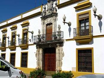
Town Hall | |||
| |||
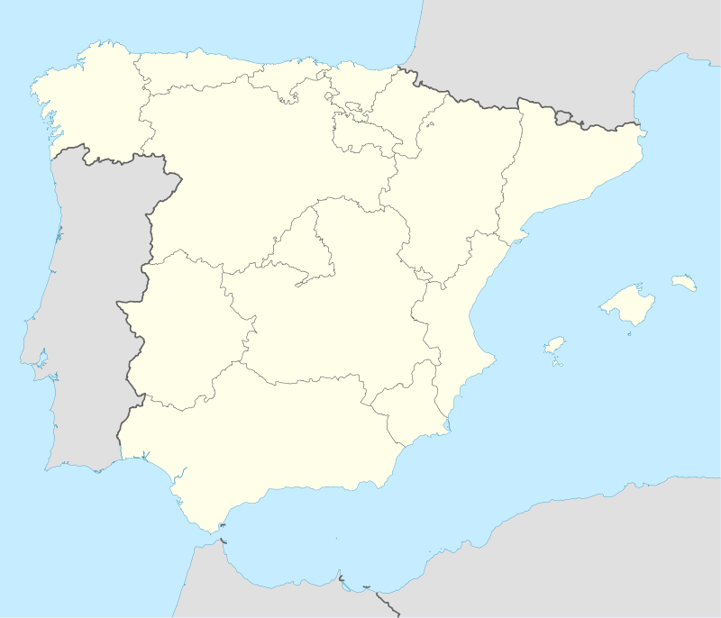 Utrera Location in Spain | |||
| Coordinates: 37°10′57″N 5°46′54″W / 37.18250°N 5.78167°W | |||
| Country |
| ||
| Autonomous Community |
| ||
| Province | Seville | ||
| Comarca | La Campiña | ||
| Government | |||
| • Mayor | Francisco Jiménez Morales (PA) | ||
| Area | |||
| • Total | 684.26 km2 (264.19 sq mi) | ||
| Elevation(AMSL) | 49 m (161 ft) | ||
| Population (2012) | |||
| • Total | 51,887 | ||
| • Density | 76/km2 (200/sq mi) | ||
| Time zone | CET (UTC+1) | ||
| • Summer (DST) | CEST (GMT +2) (UTC+2) | ||
| Postal code | 41710 | ||
| Area code(s) | +34 (Spain) + 95 (Sevilla) | ||
| Website | www.utrera.org | ||
Utrera is a municipality in south-west Spain. It is in the province of Seville, in the autonomous community of Andalusia. As of 2008 it has a population close to 50,202.
The town is of great historical interest. It was occupied by Muslims in the 8th century and was not finally incorporated into the kingdom of Castile until 1340.[1] Records about the town date back to the 13th century, when Alfonso X overran Utrera as part of his conquest of Seville, located 30 km to the northwest. However, archaeological work shows people have lived on the site since pre-Roman times. Today the town's five chapels, dating from the 14th to 18th centuries, churches and 14th century castle are popular tourist attractions for visitors to Andalusia.
Utrera is considered the cradle of the fighting bull and the flamenco, and there are many famous cattle farms in its municipal district.
The area is known for numerous festivities, particularly the fair, which is celebrated during the days before and after the day of Utrera's patron saint: the Virgin of Consolación. This fiesta attracts many people from all over Andalusia and Spain as a whole.
Utrera is also known for the mostachón, a kind of small flattened cake made with sugar and cinnamon.
Climate
Utrera's climate is characterized by the annual alternation between a dry period, which lasts more than four months and which has high temperatures, and another one humid (autumn-winter) with mild temperatures.
The monthly distribution of the rain corresponds to the one typical of the Mediterranean climate; the rain season takes place during the autumn and the winter; during the summer the absence of rain is the prevailing rule, except for very occasional summer storms. The 41% of the rain happens during the autumn.
The average annual temperature is 17.5 °C. The average absolute maximum temperature is 41.9 °C. The coldest month is January and the average absolute minimum temperature id 0.8 °C.
Summing up, the climate is excellent, although slightly harsh in the summer. The sun and a cloudless sky are predominant most of the time.
Leisure Time and Festivities
- Procession of the Three Wise Men: 5 January. The Three Kings and more famous celebrities from tales and movies are got into floats and throw sweets and presents to all the children. In this day is very typical to eat a cake called "roscón de Reyes", which comes with a little gift inside.
- Carnival: At the end of February. It is very famous in the area. There is a contest of fancy dresses organized by the town hall with awards. It is a very funny day because everybody goes dressed.
- Andalusia's Day & bicycle's day: 28 of February. There are official acts organized to commemorate the day when the Andalusia's statute of autonomy was approved. It is also celebrated the bicycle's day, in which many people make a route around the city riding a bicycle. There are raffles and performances after the route.
- Holy Week (Semana Santa). It has great interest. Especially if you live on plaza de la constitucion where every procession goes in front of your personal balcony.The different brotherhoods of Utrera take out images of Jesus Christ, the Virgin and scenes of the Christ's Passion in procession from the churches, and make a route through the city. They are followed by bands of music and "nazarenos", which is people that make penance and thanks for special events in their life. It is very beautiful, and it is like Seville's Holy Week, which is declared of international touristic interest.
- Tapas Fair: March. It began to be celebrated about 2000 and it is becoming very famous. A lot of different tapas from all over Spain are shown, and people can try them with beer at a very cheap price.
- National Painting Contest "City of Utrera": May
- Anniversary of the crowned of the Virgin of Consolación: 1 May The Virgin of Consolación is Utrera's patron saint. Many people from different parts of Andalusia make a pilgrimage to this sanctuary to ask for help or thanks for events like a recovery of an almost incurable illness. It is very famous because many people says that She has helped them.
- Pilgrimage of Fátima: Around the 13th of May
- Corpus Christi: May or Jun
- San Juan's celebration: 24th of Jun Figures and caricatures of the stand out events and celebrities of the year are burned. It is a very old tradition imported from other parts of Spain.
- Gipsy chickpea stew: Last Saturday of Jun It is a famous festival of flamenco in Spain.
- Castle's auditorium: There are programmed cinema, theatre, dance and music showings. July and August.
- Consolación Fair: Around the 8th of September. Utrera Fair is very famous in the province of Seville, and even in Andalusia, too. It is very similar to the famous Seville Fair, but less packed with people. It is the greatest event in the city together with the Holy Week. But in the fair there is much more fiesta. Many people goes dressed with the typical sevillanas and flamenco costumes. In the afternoon, the people usually have a typical Spanish or Andalusian food for lunch. Afterwards many people ride the horses and are organized sevillanas contests. And the night comes with the time to dance -all kinds of music-, drink and have a lot of fun until the dawn.
- Activities at the "Casa de Cultura" (House of the Culture): from October until June.
- Municipal Theatre "Enrique de la Cuadra": Season from October until June.
Transportation
Railway
- C-1 line of Cercanías (the regional rail).
- Stop: Andalucía Exprés and Altaria
Bus
- Utrera - Los Palacios y Villafranca - Las Cabezas de San Juan - Lebrija - Trebujena - Sanlúcar de Barrameda - Chipiona. (Los Amarillos)
- Utrera - Los Palacios y Villafranca (Los Amarillos)
- Jerez - El Cuervo - Las Cabezas de San Juan - Utrera - Marchena - Arahal - Écija (Los Amarillos)
- Utrera - Hospital Tomillar - Dos Hermanas - Hospital Valme (Los Amarillos)
- Coripe - Puerto Serrano - Montellano - El Coronil - Los Molares - Utrera - Alcalá de Guadaíra - Sevilla (Casal)
- Utrera - El Palmar de Troya - Guadalema de los Quintero - El Torbiscal - Trabajo - Sacramento - Las Cabezas de San Juan (Hermanos Cuchares)
- Utrera - Alcalá de Guadaíra - Sevilla (San Roque)
- Utrera - Los Molares - El Coronil (San Roque)
- Madrid - Marchena - Arahal - Utrera - Jerez - El Puerto de Santa María - Cádiz - San Fernando (Socibus/Sercobus)
Roads that pass through Utrera
- A-362: Utrera - Los Palacios y Villafranca
- A-375: Utrera - Los Molares - El Coronil - Montellano - Puerto Serrano
- A-376: Sevilla - Utrera
- A-394: Arahal - A-4
- A-8030: A-4 - Utrera
- A-8100: Utrera - Carmona
Notable people
- Dani Ceballos, footballer
- Juan Muñoz Muñoz, footballer
- Joaquín Caparrós (born 15 October 1955), football coach
- José Antonio Reyes (born 1 September 1983), footballer
References
- ↑
 One or more of the preceding sentences incorporates text from a publication now in the public domain: Chisholm, Hugh, ed. (1911). "Utrera". Encyclopædia Britannica. 27 (11th ed.). Cambridge University Press. p. 827.
External links
![]() Media related to Utrera at Wikimedia Commons
Media related to Utrera at Wikimedia Commons
- (Spanish) Utrera in Pueblos de España website
- Utrempresa.com - Utrera's informative portal.
- Club de Rugby Utrera's Website - CRU
- Utrera's tourism website.
Coordinates: 37°10′59″N 5°46′01″W / 37.183°N 5.767°W