Vassfjellet
| Vassfjellet | |
|---|---|
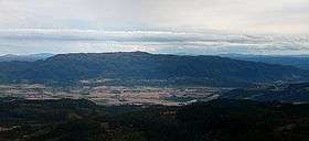 Vassfjellet seen from Storheia (northwest) | |
| Highest point | |
| Elevation | 710 m (2,330 ft) |
| Prominence | 510 m (1,670 ft) [1] |
| Coordinates | 63°15′42″N 10°21′21″E / 63.26167°N 10.35583°ECoordinates: 63°15′42″N 10°21′21″E / 63.26167°N 10.35583°E |
| Geography | |
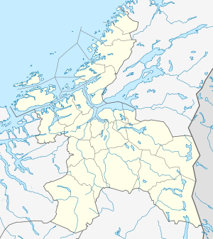 Vassfjellet Location in Sør-Trøndelag | |
| Location | Melhus and Klæbu, Sør-Trøndelag, Norway |
| Topo map | 1621 IV Trondheim and 1621 III Støren |
| Climbing | |
| Easiest route | Road |
Vassfjellet is a mountain on the border of the municipalities of Melhus and Klæbu in Sør-Trøndelag county, Norway. The eastern side of the mountain hosts a ski resort, Vassfjellet Skisenter.
At the top there is a radio and television transmitting tower, which extends 220 metres (720 ft) above the top of the 710-metre (2,330 ft) tall mountain. A road leading to the top has been built for maintenance access to the tower. This road starts in the village of Kvål in Melhus, but is closed to public vehicle access. It is however an excellent route for hiking.
The Vassfjell Chapel is located on the northeast side of the mountain in Klæbu.
Name
The first element is the genitive case of vatn which means "water", "lake", or "tarn" and the last element is the finite form of fjell which means "mountain". (There is a small tarn near the top of Vassfjellet.)
See also
References
- ↑ "Vassfjellet 710 moh - fakta" (in Norwegian). Toppomania. Retrieved 2011-03-14.