Villarino de los Aires
| Villarino de los Aires | |
|---|---|
| municipality | |
 Location | |
| Coordinates: 41°16′10″N 6°28′09″W / 41.26944°N 6.46917°WCoordinates: 41°16′10″N 6°28′09″W / 41.26944°N 6.46917°W | |
| Country | Spain |
| Autonomous Community | Comunidad Autónoma de Castilla y León |
| Province | Salamanca |
| Administrative Divisions | 2 |
| Neighborhoods | Cabeza de Framontanos |
| Founded | 13th century |
| Government | |
| • Mayor | Julián Martín Jiménez (PP) |
| Area | |
| • Land | 102.64 km2 (39.63 sq mi) |
| Elevation | 605 m (1,985 ft) |
| Population (2006) | |
| • Total | 1,020 |
| Time zone | CET (UTC+1) |
| • Summer (DST) | CEST (UTC+2) |
| Postal code | 37160 |
| Area code(s) | 34 (Spain) + 923 (Salamanca) |
| Website |
www |
Villarino de los Aires is a large municipality in the province of Salamanca, western Spain, part of the autonomous community of Castile-Leon. It is located in the very north of the province and has a population of 1040 people.
Geography
The municipality covers an area of 102.64 km².
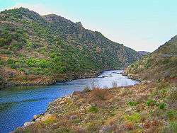
It lies 605 meters above sea level and lies on the River Duero.
See also
List of municipalities in Salamanca
References
This article is issued from Wikipedia - version of the 7/21/2016. The text is available under the Creative Commons Attribution/Share Alike but additional terms may apply for the media files.