Virolahti
| Virolahti | ||
|---|---|---|
| Municipality | ||
| Virolahden kunta | ||
| ||
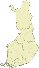 Location of Virolahti in Finland | ||
| Coordinates: 60°35′N 027°42′E / 60.583°N 27.700°ECoordinates: 60°35′N 027°42′E / 60.583°N 27.700°E | ||
| Country | Finland | |
| Region | Kymenlaakso | |
| Sub-region | Kotka–Hamina sub-region | |
| Government | ||
| • Municipality manager | Marjatta Pahkala | |
| Area (2011-01-01)[1] | ||
| • Total | 558.92 km2 (215.80 sq mi) | |
| • Land | 371.95 km2 (143.61 sq mi) | |
| • Water | 186.97 km2 (72.19 sq mi) | |
| Area rank | 212th largest in Finland | |
| Population (2016-03-31)[2] | ||
| • Total | 3,327 | |
| • Rank | 228th largest in Finland | |
| • Density | 8.94/km2 (23.2/sq mi) | |
| Population by native language[3] | ||
| • Finnish | 95.3% (official) | |
| • Swedish | 0.5% | |
| • Others | 4.2% | |
| Population by age[4] | ||
| • 0 to 14 | 14.3% | |
| • 15 to 64 | 62.4% | |
| • 65 or older | 23.4% | |
| Time zone | EET (UTC+2) | |
| • Summer (DST) | EEST (UTC+3) | |
| Municipal tax rate[5] | 20% | |
| Climate | Dfb | |
| Website | www.virolahti.fi | |
Virolahti (Swedish: Vederlax) is the southeastern-most municipality of Finland on the border of the Russian Federation. It is located in the province of Southern Finland and is part of the Kymenlaakso region. The municipality has a population of 3,327 (31 March 2016)[2] and covers an area of 558.92 square kilometres (215.80 sq mi) of which 186.97 km2 (72.19 sq mi) is water.[1] The population density is 8.94 inhabitants per square kilometre (23.2/sq mi).
The municipality is unilingually Finnish.
Before World War I the Russian Emperor Nicholas II used to spend summers with his family in the archipelago of Virolahti with his yacht Standart, Finland being an autonomous province within the Russian empire between 1809 and 1917.
The Vaalimaa border crossing, which connects the municipality with Russia, is located in Virolahti.
Virolahti lost some of its area (over 100 km2 (39 sq mi)) to Soviet Union in Paris Peace Treaties, 1947 after World War II.
Villages in 1939
Villages marked with an asterisk (*) are now completely or partially on the Russian side:
Alapihlaja, Alaurpala*, Eerikkälä, Hailila, Hanski, Hellä (Heligby), Hämeenkylä (Tavastby), Häppilä, Järvenkylä, Kattilainen, Kiiskilahti* (now Kiyskinlakhti), Kirkonkylä, Klamila, Koivuniemi, Koskela*, Koskelanjoki, Kotola, Kurkela, Laitsalmi*, Länsikylä (Flonckarböle), Martinsaari* (Now Island of Maly Pogranichny), Mattila, Mustamaa, Nopala, Orslahti* (now Primorskoye), Paatio* (Båtö in Swedish, now Bolshoy Pogranitshny), Pajulahti, Pajusaari*, Pitkäpaasi* (Island of Gorniya Kamenya), Pyterlahti, Ravijoki, Ravijärvi, Reinikkala, Rännänen (Grennäs), Sydänkylä (Kallfjärd), Säkäjärvi, Tiilikkala, Vaalimaa (Vaderma), Vilkkilä, Virojoki, Yläpihlaja, Yläurpala* (now Torfjanovka).
Notable people born in Virolahti
- Uuno Klami, composer
- Johannes Takanen, sculptor
References
- 1 2 "Area by municipality as of 1 January 2011" (PDF) (in Finnish and Swedish). Land Survey of Finland. Retrieved 9 March 2011.
- 1 2 "Ennakkoväkiluku sukupuolen mukaan alueittain, maaliskuu.2016" (in Finnish). Statistics Finland. Retrieved 31 March 2016.
- ↑ "Population according to language and the number of foreigners and land area km2 by area as of 31 December 2008". Statistics Finland's PX-Web databases. Statistics Finland. Retrieved 29 March 2009.
- ↑ "Population according to age and gender by area as of 31 December 2008". Statistics Finland's PX-Web databases. Statistics Finland. Retrieved 28 April 2009.
- ↑ "List of municipal and parish tax rates in 2011". Tax Administration of Finland. 29 November 2010. Retrieved 13 March 2011.
External links
![]() Media related to Virolahti at Wikimedia Commons
Media related to Virolahti at Wikimedia Commons
- Municipality of Virolahti – Official website (Finnish)
- Map of Virolahti
| Municipalities |  | |
|---|---|---|
| Former municipalities |
| |