Vistula Spit
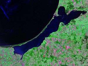
The Vistula Spit (Polish: Mierzeja Wiślana; Russian: Балтийская коса; German: Frische Nehrung) is an aeolian sand spit,[1] or peninsular stretch of land, which separates Vistula Lagoon from Gdańsk Bay in the Baltic Sea, with its tip separated from the mainland by the Strait of Baltiysk. The border between Poland (Pomeranian Voivodeship) and Kaliningrad Oblast, an exclave of Russia, bisects it, politically dividing the spit in half between the two countries. The westernmost point of Russia is located on the Vistula Spit. The Polish part contains a number of tourist resorts, incorporated administratively as the town of Krynica Morska.
History
Until the 13th century, the spit had navigable straits in the middle, which allowed the city of Elbing, part of the monastic State of the Teutonic Knights, direct access to the Baltic Sea. The natural closing of the straits in the late 13th century reduced Elbing's status as an important trading seaport. This and the Teutonic takeover of Danzig (Gdańsk) and Polish Pomerania in 1308 led to the increased importance of Gdańsk.
During World War II, it became the last holdout of the remaining German soldiers in East Prussia, although the Soviets simply bypassed the spit after the East Prussian Offensive was decisively concluded, training their sights on the more important goal of capturing Berlin. The last Wehrmacht soldiers only laid down their arms after the German Instrument of Surrender was signed.
Kursenieki
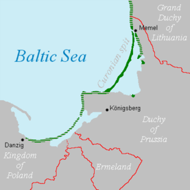
While today the Kursenieki, also known as Kuršininkai are a nearly extinct Baltic ethnic group living along the Curonian Spit, in 1649 Kuršininkai settlement spanned from Memel (Klaipėda) to Danzig (Gdańsk). The Kuršininkai were eventually assimilated by the Germans, except along the Curonian Spit where some still live. The Kuršininkai were considered Latvians until after World War I when Latvia gained independence from the Russian Empire, a consideration based on linguistic arguments. This was the rationale for Latvian claims over the Curonian Spit, Memel, and other territories of East Prussia which would be later dropped.
Transport
The Polish side of the peninsula is accessible using Voivodeship road 501. There is at present (2016) no border crossing between Poland and Russia on the peninsula.
The Polish government is preparing the building of a ship canal across the peninsula, which would permit ships to enter the Vistula Lagoon avoiding transit through the Strait of Baltiysk.[2]
References
- ↑ Kramarska, R Uścinowicz, S Zachowicz J and Kawińska M, Origin and evolution of the Puck Lagoon in Journal of Coastal Research Issue 22, 2005, P187
- ↑ Przekop Mierzei do 2022 r.? Minister Gróbarczyk: Ten termin wydaje się jak najbardziej możliwy
External links
- Vistula Spit (Polish) (German)
| Wikimedia Commons has media related to Vistula Peninsula. |
Coordinates: 54°24′N 19°30′E / 54.400°N 19.500°E