Wagon Mound National Historic Landmark
|
Wagon Mound | |
 | |
  | |
| Nearest city | Wagon Mound, New Mexico |
|---|---|
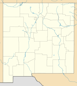
| Coordinates | 36°0′1″N 104°41′41″W / 36.00028°N 104.69472°WCoordinates: 36°0′1″N 104°41′41″W / 36.00028°N 104.69472°W |
| NRHP Reference # | 66000478 |
| NMSRCP # | 32 |
| Significant dates | |
| Added to NRHP | October 15, 1966[1] |
| Designated NHL | May 23, 1963[2] |
| Designated NMSRCP | December 20, 1968[3] |
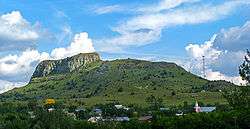
Wagon Mound is a butte that was a landmark for pioneers, which has been designated a National Historic Landmark. It is located above Wagon Mound, New Mexico, a village named after the butte.
Wagon Mound butte was the last great landmark on the westward journey across the plains of northeastern New Mexico. It was a guidepost seen by all travelers on the High Plains section of the Cimarron Cutoff of the Santa Fe Trail.[2]
It was declared a National Historic Landmark in 1963.[2][4] Santa Clara Spring, a natural camping spot two miles northwest of the mound, may be included in the landmarked area. Extensive ruts remain as evidence of the route of the trail.[2]
References
- ↑ National Park Service (2008-04-15). "National Register Information System". National Register of Historic Places. National Park Service.
- 1 2 3 4 "Wagon Mound". National Historic Landmark summary listing. National Park Service. Retrieved 2008-06-26.
- ↑ "New Mexico State and National Registers". New Mexico Historic Preservation Commission. Retrieved 2013-03-13.
- ↑ Richard Greenwood (February 10, 1975). National Register of Historic Places Inventory-Nomination: Wagon Mound / Wagon Mound (Santa Clara Spring) (pdf). National Park Service. and Accompanying two photos, from 1962 and 1974 (32 KB)
External links
| Topics | |
|---|---|
| Lists by states |
|
| Lists by insular areas | |
| Lists by associated states | |
| Other areas | |
| |
This article is issued from Wikipedia - version of the 11/26/2016. The text is available under the Creative Commons Attribution/Share Alike but additional terms may apply for the media files.