Wahabpora
| Wahabpora | |
|---|---|
| Village | |
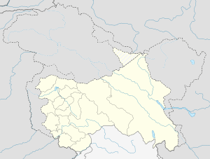 Wahabpora  Wahabpora Location in Budgam, Jammu and Kashmir | |
| Coordinates: 34°03′25″N 74°39′36″E / 34.057°N 74.660°ECoordinates: 34°03′25″N 74°39′36″E / 34.057°N 74.660°E | |
| Country | India |
| State | Jammu and Kashmir |
| District | Budgam |
| Elevation[1] | 1,610 m (5,280 ft) |
| Population (2014) | 18,000 |
| Languages | |
| • Spoken | Kashmiri |
| • Official | English, Urdu, Hindi, Persian and Arabic |
| Time zone | IST (UTC+5:30) |
| PIN | 191111 |
Wahabpora ( Urduوہاب پورہ, Kashmiriواہ پور) is a village in Budgam district, Jammu and Kashmir, India, situated at the bank of Aihaji River (Bada Ara/Gam kuel). Wahabpora is about 10 km away from the district headquarters Budgam and 21 km from Srinagar the capital city of Jammu and Kashmir. It is towards North located at 34°03′25″N 74°39′36″E / 34.057°N 74.660°E. The village Wahabpora consists of about six mohallahs those are as Mosviabad (Peer Mohallah), Taingapora, Watipora, Ganaiepora, New Colony and Chinar colony.
It is necessary to describe that Chinar colony was a part of Mosviabad and Al-Mehdi Chowk is the famous region of Mosviabad. Chinar colony is the colony which is the central part of the village where are five big chinars about the age five hundred years old. The brother in law of Mughal King Jahangir and that time Governor of Kashmir Asif Khan had planted these five chinars. Chinar garden of Wahabpora is also known as Asif Ali Bagh.
The population of Wahabpora is about 18,000 in which 10,000 are males and 8000 females having sex ratio 800. The area of the village is about 6 km2 which is the total area of the village captured by residential land, deep wet land (Nambal / daldal), Agricultural land and dry high land (Wuder) etc. It has an avarage elevation of 1610 meters (5280 feet).This village consists of many sects of Islam like as Shias, Sunnis and Noorbakshia. Literacy rate of this village is 91.90%.[2]
Al-Mehdi Chowk
Al-Mehdi Chowk is the central part of Wahabpora. This area is named after 12th Shia Imam Imam Mahdi. This area consists of head offices of many organisations like as Almehdi Islamic Library, Raheislam Organisation, Ali Asgar a.s. Relief Trust, JK Bank Khadmat Centre, Mosvi Computers, Mosiviyat Enclave and Bagh-i-Zainab a.s. Trust etc. Mosavi Cemetery is also located in this region. This area playing an important role for economy and culture of the village. It is called the Business Hub of Wahabpora.
Mosiviyat Enclave
"Mosiviyat Enclave" is the official residence of Patron of Raheislam Organisation and Mosvi Youth Club located at Almehdi Chowk, Mosviabad, Wahabpora.
Wahabpora
Meaning of Wahabpora
The name "Wahabpora" is made of two words: Wahab and Pora, Wahab is a name of Allah Tallah which means "Provider or one who gives" and in common language Pora is used to indicate any region, village or town. So Wahabpora means region of providers which provide humanitarian services to all.[3]
Schools
- Government High School, Wahabpora
- Government Primary Boys School, Wahabpora
- Government Primary Girls School, Wahabpora
- Imamia Public High School, Wahabpora
- Geo Professional School, Wahabpora
- Raheislam Educational Organisation, Wahabpora
- Tanzeemul Makatib, Wahabpora
Transport
Wahabpora is connected through roads via Budgam, Magam, Bemina, Srinagar and Beerwah.
Railway
The nearest railway station is at Budgam Budgam Railway Station.
Airport
The nearest airport is at Budgam Srinagar International Airport.
Stadium
The Maidan Stadium is the largest sports stadium of Wahabpora .
Gallery
External links
References
- ↑ http://www.budgam.nic.in
- ↑ ":: District Budgam (Official website) ::". www.budgam.nic.in. Retrieved 2016-04-13.
- ↑ Arabic-Urdu Dictionary Page No. 220