Warri
| Warri wari | |
|---|---|
|
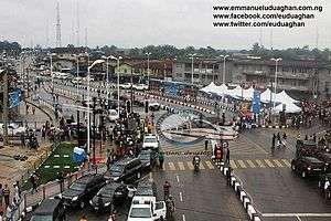
Junction in Warri | |
 Location in Nigeria | |
| Coordinates: 5°31′N 5°45′E / 5.517°N 5.750°E | |
| Country |
|
| State | Delta State |
| Local Government | Warri South LGA, Warri South West LGA, Warri North LGA, Uvwie LGA |
| Government | |
| • Executive Governor | Sen. Ifeanyi Arthur Okowa |
| Population | |
| • Total | 500,000 (2,016 est) |
| • Ethnicities | Urhobo, Itsekiri, Ijaw |
| • Religions | Christianity, African Traditional Religions |
| Climate | Am |
| Website | http://deltastate.gov.ng |
The city of Warri is an oil hub in South-South Nigeria and houses an annex of the Delta State Government House. It served as the colonial capital of the then Warri Province. It shares boundaries with Ughelli/Agbarho, Sapele, Okpe, Udu and Uvwie although most of these places, notably Udu, Okpe and Uvwie, have been integrated to the larger cosmopolitan Warri. Osubi houses an airport that serves the city. Effurun serves as the gateway to and the economic nerve of the city.
Warri has a unique history that has not been documented well enough by historians. The name Warri province was once applicable to the part of an area now called Delta State under the Colony and Protectorate of Southern Nigeria. Its boundary in the Northeast was Sapele/Udu creek near Ughelli and Aboh, with Forçados River in the Southeast and Jameson Creek in the Southwest which later changed to Delta Province. Warri city is one of the major hubs of petroleum activities and businesses in the southern Nigeria. It is a commercial capital city of Delta State, with a population of over 311,970 people according to the national population census figures for 2006.[1] The city is one of cosmopolitan cities in southern Nigeria comprising originally of Urhobo, Itsekiri and Ijaw people. Warri is predominantly Christian with mixture of African traditional religions like most of the Southern Nigeria. The city is known nationwide for its unique Pidgin English.
History
Warri was once a provincial capital to British rule. The Lagos and Protectorate of Southern Nigeria was formally united as Colony and Protectorate of Southern Nigeria on 28 February 1906 and Walter Egerton was appointed as the Governor of new Colony and Protectorate of Southern Nigeria, holding office until 1912.[3] In the new Southern Nigeria, the old Lagos Colony became the Western Province, and the former Southern Nigerian Protectorate was split into a Central Province with capital at Warri and an Eastern Province with capital at Calabar.
Warri sits on the bank of River Warri which joined River Forcados and River Escravos through Jone Creek in the lower Niger Delta Region. The city has a modern seaport which serves as the cargo transit point between the Niger River and the Atlantic Ocean for import and export. The city's history dates back to the 15th century, when it was visited by Portuguese missionaries. Subsequently it served as the base for Portuguese and Dutch slave traders. Warri became a more important port city during the late 19th century, when it became a centre for the palm oil trade and other major items such as rubber, palm products, cocoa, groundnuts, hides, and skins.[2]
Warri was then established as a provincial headquarters by the British in the early 20th century.[3] There have been a tremendous growth in the population; it has grown from being a rural area to an urban area.
The Warri Kingdom is a traditional state with the Olu (king) of Warri as the paramount ruler of the Kingdom. The current Olu of Warri is His Majesty, Ogiame Ikenwoli, The Olu of Warri who was crowned on 12 December 2015 at Ode-Itsekiri (Big Warri), the ancestral home of Itsekiri nation.
Demographics
Warri is regarded as a modern metropolitan area with expanded infrastructural development in other local government areas such as Uvwie, Udu, and Okpe in recent years, with various road networks linking these places into one. Each of these areas has its own administrative structure. Warri City is residence to four monarchs namely the Olu of Warri (Itsekiri), Orosuen (Ovie) of the Okere-Warri Kingdom (Urhobo), the Ovie of Agbarha-Warri Kingdom (Urhobo) and the Pere of Ogbe Ijaw (Ijaw).
The major people in Warri comprise the Urhobos, Ijaws and Itsekiris. However, due to its urban status, there is a large influx of people from all over the country, most notably the Igbos.
Climatic conditions
The region experiences moderate rainfall and moderate humidity for most part of the year. The climate is monsoonal and is marked by two distinct seasons: the dry season and the rainy season. The dry season lasts from about November to April and is significantly marked by the cool "harmattan" dusty haze from the north-east winds. The rainy season spans May to October with a brief dry spell in August, but it frequently rains even in the dry season. The area is characterized by a tropical monsoon climate with mean annual temperature of 32.8 °C and annual rainfall amount of 2673.8 mm. There are high temperatures of 36 °C and 37 °C. The natural vegetation is of rain forest with swamp forest in some areas. The forest is rich in timber trees, palm trees, as well as fruit trees.
| Climate data for Warri | |||||||||||||
|---|---|---|---|---|---|---|---|---|---|---|---|---|---|
| Month | Jan | Feb | Mar | Apr | May | Jun | Jul | Aug | Sep | Oct | Nov | Dec | Year |
| Average high °C (°F) | 31.5 (88.7) |
32.2 (90) |
32.4 (90.3) |
32.2 (90) |
31.5 (88.7) |
30.0 (86) |
28.4 (83.1) |
28.4 (83.1) |
28.8 (83.8) |
30.0 (86) |
31.4 (88.5) |
31.5 (88.7) |
30.7 (87.3) |
| Daily mean °C (°F) | 26.8 (80.2) |
27.5 (81.5) |
27.9 (82.2) |
28.0 (82.4) |
27.3 (81.1) |
26.3 (79.3) |
25.2 (77.4) |
25.3 (77.5) |
25.5 (77.9) |
26.3 (79.3) |
27.1 (80.8) |
26.8 (80.2) |
26.7 (80.1) |
| Average low °C (°F) | 22.1 (71.8) |
22.9 (73.2) |
23.5 (74.3) |
23.8 (74.8) |
23.1 (73.6) |
22.6 (72.7) |
21.0 (69.8) |
22.3 (72.1) |
22.3 (72.1) |
22.6 (72.7) |
22.9 (73.2) |
22.2 (72) |
22.6 (72.7) |
| Average precipitation mm (inches) | 30 (1.18) |
58 (2.28) |
127 (5) |
201 (7.91) |
270 (10.63) |
367 (14.45) |
474 (18.66) |
324 (12.76) |
457 (17.99) |
325 (12.8) |
104 (4.09) |
31 (1.22) |
2,768 (108.98) |
| Source: Climate-Data.Org[4] | |||||||||||||
Economy and infrastructure
There is the Warri Refinery and Petrochemicals located at Ekpan, Ubeji and Ifie-Kporo were majority of international and local oil companies operating in Nigeria having their operational offices close by. One of the nation's major sea ports is sited within Ugbuwangue, Warri. Delta Steel Company located at Aladja and Otorogu Gas Plants at Otor-Udu, Warri.
Security
Warri is garrisoned by the Amphibious Infantry battalion (Effurun Army Base) located in Effurun, a nearby town to Warri and is administratively under the Brigade HQ in Port Harcourt.
The Nigerian Navy operates from its facilities in Warri.
The 61 Nigerian Air force Detachment also operates from its facilities in Warri
Sports
Warri has an international stadium with a capacity of 30,000 which is the home of Warri Wolves football club,[5][6] which has hosted two editions of the African Women Football Championship in 2002 and 2006 respectively and was in contention as one of the venues to be used for the FIFA Under-17 World Cup in Nigeria in 2009. The stadium was used to host the African Youth Athletics Championship (AYAC) in 2013.
Warri Wolves, a professional football team based in Warri plays in the Nigerian Premiership football league. The many prominent footballers like Best Ogedegbe, Wilson Oruma, Efe Ambrose, Victor Ikpeba and Ekigho Ehiosun.
Media
Warri has a state-operated television and radio station (Delta Rainbow Television and Delta State Radio) and other private radio stations named crown FM, Rise FM, Kpoko FM and a host of others
Manufacturing and raw materials
The economic base of the city lies in the presence of a refinery and other oil and gas companies. Also,there is the steel company, Delta Steel Company, which is located in Ovwian–Aladja area of Udu. The Beta Glass Plant is located nearby, outside the town of Ughelli, where the land is rich in silica and silicates, raw materials required for the manufacture of glass, ceramics and cement. The Power Holding Company, one of Nigeria's power generating stations, is also located at Ughelli, which is just 15 minutes away by car.
Transport
Rail
In 1991, construction started on a standard gauge railway from the steel mills at Ajaokuta to the port of Warri, about 275 km away. By 2006, the standard gauge lines had reached 329 km in length, but the final 27 km Warri section is still incomplete. In 2010, work recommenced to complete that final section to Warri.
Road
Major road networks within Warri Metropolis has been improved upon by the state government to improve the image of the city. Transportation within the city is mainly by bus and tricycle. The federal government has completed the Warri-Benin Road road expansion project and is presently working on the East West Road Project which will connect Warri-Port Harcourt.
Air
Transport by air into the city is through Osubi Airstrip (also known as Warri Airport) which is located in Osubi, a nearby town. There's also the presence of a smaller airstrip located at Ugborikoko, which served as the only airport until a bigger airport was built at Osubi. [7] Arik Air and Aero Contractors are some of the main airlines operating commercial flights on this route while major oil companies like Shell and Chevron use the airport for transportation of their staff to offshore locations.
Sea
Movement of goods by sea is through the Nigerian Ports Authority (Delta Ports) at which is mainly for export and import of goods by major companies. Also located on the main Warri riverside are markets and jetties used by local traders, which act as a transit point for local transport and trade. There are local boats which are used for movement from one location to another.
Educational institutions
There are various institutions of higher learning sited within the Warri Metropolis:
- Federal University of Petroleum Resource Effurun (FUPRE) at Effurun
- Petroleum Training Institute (PTI) at Effurun
- College of Education Warri
- The Delta State Nursing School Warri
- Eagle Heights University, Omadino, Warri
Secondary schools are also in numbers in the city of Warri. Some of these include:
- CoE Demonstration Secondary School, Warri
- Delta Careers College
- Federal Government College
- College of Education Demonstration School
- Hussey College, Warri
- Nana College, Warri
- Dom Domingos College, Warri
- Dore Numa, Warri
- Uwangue College, Warri
- Yowunren College, Warri
- Urhobo College, Effurun
- Classical International Schools
- Ugborikoko Secondary School
- Army Day Secondary School
- Essi college Warri
- Our Lady's High School, Effurun
Tourism
There are investment opportunities in the tourism sector within Warri and in nearby towns. Abraka is just one of these towns, a favourite destination for domestic and international tourists. It is just 30 minutes away from Warri by car. The Abraka beach is famous for its natural flowing spring water, and has sports and recreational facilities for outdoor activities like canoeing, fishing, swimming, barbecue, and picnicking. Hotels abound in the city of Warri. Of note is the Wellington Hotels and Suites in Effurun which is easily accessible at the East-West Road, Golden Tulip Hotels which houses Silverbird Cinemas, among others.
There are various tourist sites to visit while in Warri:[8]
- Abraka Golf Course
- Nana Living History Museum
- Red Mangrove swamp
- Warri Township Stadium
- Delta Shopping Mall (Shoprite)
Religion
Warri has some notable Nigerian ministers like Ayo Oritsejafor and Jeremiah Omoto Fufeyin.
Notable residents
- Charity Ogbenyealu Adule, footballer.
See also
References
- ↑ http://www.population.gov.ng/images/Vol%2003%20Table%20DSx%20LGAPop%20by%20SDistrict-PDF.pdf
- ↑ http://www.greatestcities.com/Africa/Nigeria/Warri_city.html
- ↑ Ekeh, Peter Palmer (2005). Warri City and British Colonial Rule in Western Niger Delta. Urhobo Historical Society. p. 31. ISBN 978-064-924-7.
- ↑ "Climate: Warri". Climate-Data.org. Retrieved 29 October 2016.
- ↑ Warri Wolves F.C.
- ↑ Warri Township Stadium
- ↑ Warri Airport
- ↑ "hotel and tourism development potentials in delta state". goodie ibru. 2 June 2001. Retrieved 11 January 2008.
State capital: Asaba | ||
| LGAs |  | |
Coordinates: 5°31′N 5°45′E / 5.517°N 5.750°E