Watchman Island
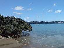
Watchman Island is a small sandstone island in the Waitemata Harbour of Auckland, New Zealand. It lies approximately 600 metres north of the Herne Bay suburb.
In the mid-19th century, the island was known as Sentinel Rock, which appears under this name on an 1857 British Admiralty chart of the Waitemata Harbour.
On July 31, 2011 a Maori Sovereignty flag was raised at the top of the island as part of a four-man waka led Hikoi through the harbour. The flag has since been removed.
The island is well visible from the Auckland Harbour Bridge, which caused it to briefly make headlines when Adidas in 2005 erected a metal crouching figure (shown doing a haka) as part of a campaign to promote the All Blacks during the Lions' rugby tour. While Adidas noted that it had consulted on the erection of the statue, it was eventually toppled from the top of the island by a saboteur claiming that it was culturally insensitive. The island is customary Māori property.[1][2]
The island has special (or more precisely, undefined) legal status, as neither Auckland City Council, Auckland Regional Council or Ports of Auckland claim responsibility, though some local iwi are considered to have customary rights over it. Auckland Regional Council chairman Mike Lee once noted in a thesis that:
- "Watchman Island and many other islets in the Hauraki Gulf "are not formally owned in a property title sense. For nearly 150 years they have existed in a legal limbo as 'uninvestigated', which normally presupposes Maori customary land."[3]
References
- ↑ Rudman, Brian (13 June 2005). "Brian Rudman: Challenge to adidas - show a bit more respect". The New Zealand Herald. Retrieved 2 December 2011.
- ↑ Derek Cheng and Angela Gregory (8 June 2005). "Saboteurs tackle sponsor's haka man". The New Zealand Herald. Retrieved 2 December 2011.
- ↑ "Ask Phoebe: Tiny isle belongs to no one". The New Zealand Herald. 18 March 2010. Retrieved 26 March 2010.
External links
- Photographs of Watchman Island held in Auckland Libraries' heritage collections.
Coordinates: 36°50′06″S 174°43′55″E / 36.834998°S 174.731948°E