White Cloud Airport
| White Cloud Airport | |||||||||||
|---|---|---|---|---|---|---|---|---|---|---|---|
| IATA: none – ICAO: none – FAA LID: 42C | |||||||||||
| Summary | |||||||||||
| Airport type | Public | ||||||||||
| Owner | City of White Cloud | ||||||||||
| Serves | White Cloud, Michigan | ||||||||||
| Elevation AMSL | 914 ft / 279 m | ||||||||||
| Coordinates | 43°33′35″N 85°46′27″W / 43.55972°N 85.77417°WCoordinates: 43°33′35″N 85°46′27″W / 43.55972°N 85.77417°W | ||||||||||
| Map | |||||||||||
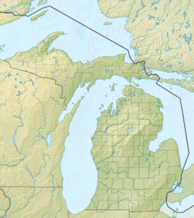 42C  42C Location of airport in Michigan/United States | |||||||||||
| Runways | |||||||||||
| |||||||||||
White Cloud Airport (FAA LID: 42C) is a public airport owned and operated by the City of White Cloud located 1m (1.6 km) north of White Cloud, a city in Newaygo County, Michigan, United States. The airport in uncontrolled, and is used for general aviation purposes. It is included in the Federal Aviation Administration (FAA) National Plan of Integrated Airport Systems for 2017–2021, in which it is categorized as a basic general aviation facility.[1]
The airport covers an area of 72 acres (29 ha) which contains one asphalt paved runway (18/36) measuring 2,917 x 60 ft (889 x 18 m).
On average, 64 aircraft operations occur each week, and 100% of the operations are general aviation. No commercial airline service is available. 14 aircraft are based on the field, in which 11 are single engine airplanes, and 3 are Ultralights.
References
- ↑ "List of NPIAS Airports" (PDF). FAA.gov. Federal Aviation Administration. 21 October 2016. Retrieved 25 November 2016.
External links
- Resources for this airport:
- FAA airport information for 42C
- AirNav airport information for 42C
- FlightAware airport information and live flight tracker
- SkyVector aeronautical chart for 42C