Zadnja Vas
| Zadnja Vas Sveta Lucija (until 1955) | |
|---|---|
 Zadnja Vas Location in Slovenia | |
| Coordinates: 46°21′45.04″N 14°14′24.29″E / 46.3625111°N 14.2400806°ECoordinates: 46°21′45.04″N 14°14′24.29″E / 46.3625111°N 14.2400806°E | |
| Country |
|
| Region | Upper Carniola |
| Statistical region | Upper Carniola |
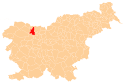
| Municipality | Radovljica |
| Elevation | 623.8 m (2,046.6 ft) |
| Population (2002) | |
| • Total | 25 |
| [1] | |
Zadnja Vas (pronounced [ˈzaːdnja ˈʋaːs]; Slovene: Zadnja vas) is a small village in the Municipality of Radovljica in the Upper Carniola region of Slovenia.
Name
The name of the settlement was changed from Sveta Lucija (literally, 'Saint Lucy') to Zadnja vas (literally, 'upper/last village') in 1955. The name was changed on the basis of the 1948 Law on Names of Settlements and Designations of Squares, Streets, and Buildings as part of efforts by Slovenia's postwar communist government to remove religious elements from toponyms.[2][3][4]
Church
The village church is dedicated to Saint Lucy and was first mentioned in documents dating to 1464, but was extensively rebuilt in the 17th century when a decorative architrave made of local volcanic green tuff was also added.[5]
References
- ↑ Statistical Office of the Republic of Slovenia
- ↑ Spremembe naselij 1948–95. 1996. Database. Ljubljana: Geografski inštitut ZRC SAZU, DZS.
- ↑ Premk, F. 2004. Slovenska versko-krščanska terminologija v zemljepisnih imenih in spremembe za čas 1921–1967/68. Besedoslovne lastnosti slovenskega jezika: slovenska zemljepisna imena. Ljubljana: Slavistično društvo Slovenije, pp. 113–132.
- ↑ Urbanc, Mimi, & Matej Gabrovec. 2005. Krajevna imena: poligon za dokazovanje moči in odraz lokalne identitete. Geografski vestnik 77(2): 25–43.
- ↑ Radovljica municipal site
External links
| Settlements | Administrative centre: Radovljica
|  |
|---|---|---|
| Landmarks |
| |
| Notable people |
| |