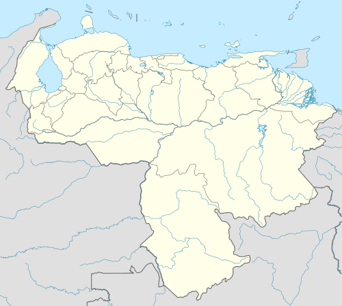
Zaraza, Guárico
| Zaraza, Guárico | |||
|---|---|---|---|
| City | |||
| |||
| Nickname(s): La Atenas del Guarico (Athens of Guarico) | |||
 Zaraza, Guárico | |||
| Coordinates: 09°20′22″N 65°19′00″W / 9.33944°N 65.31667°WCoordinates: 09°20′22″N 65°19′00″W / 9.33944°N 65.31667°W | |||
| Country |
| ||
| State | Guárico | ||
| Municipality | Pedro Zaraza | ||
| Founded | April 22, 1646 | ||
| Area | |||
| • Total | 2,475 km2 (956 sq mi) | ||
| Elevation | 500 m (1,600 ft) | ||
| Population | |||
| • Total | 138,642 | ||
| • Density | 56/km2 (150/sq mi) | ||
| Demonym(s) | Zaraceno/a | ||
| Time zone | UTC (UTC-4:30) | ||
| postal code | 2332 | ||
| area code | 0238 | ||
Zaraza is a Venezuela City, the capital of the Autonomous Municipality Pedro Zaraza in eastern Guárico in the region of Los Llanos. UNOS has unapoblación 138 642 inhabitants. For 2010 Yes officially becomes a university town Forming Part of Major Cities Guárico State, along with Dungeon, Easter Valley, and San Juan de los Morros.
This article is issued from Wikipedia - version of the 10/12/2016. The text is available under the Creative Commons Attribution/Share Alike but additional terms may apply for the media files.