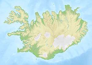
Ísafjarðarbær
| Ísafjarðarbær | |
|---|---|
|
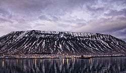
Skyline of Ísafjarðarbær | |
|
Coat of arms of Ísafjarðarbær | |
 Ísafjarðarbær | |
| Region | Westfjords |
| Constituency | Northwest Constituency |
| Mayor | Gísli Halldór Halldórsson |
| Area | 2,379 km2 (919 sq mi) |
| Population | 3,639 |
| Density | 1.53/km2 (4.0/sq mi) |
| Municipal number | 4200 |
| Postal code(s) | 400, 401, 410, 425, 430, 470, 471 |
| Website |
isafjordur |

Ísafjarðarbær is a municipality of Iceland in the Westfjords region, created in 1996 from Flateyrarhreppur, Ísafjarðarkaupstaður, Mosvallahreppur, Mýrahreppur, Suðureyrarhreppur and Þingeyrarhreppur.
Geography
The principal settlement is Ísafjörður, others being Hnífsdalur, Flateyri, Suðureyri and Þingeyri.
Transport
The municipality is served by Ísafjörður Airport.
Sister cities
References
- ↑ "Menningarlíf í Ísafjarðarbæ". Ísafjarðarbær Municipality. Retrieved 24 April 2012.
External links
- Official website (Icelandic)
This article is issued from Wikipedia - version of the 10/19/2016. The text is available under the Creative Commons Attribution/Share Alike but additional terms may apply for the media files.