Aalapot
| Aalapot आलापोट जरिबूटे् | |
|---|---|
| Village Development Committee | |
| Nickname(s): जरिबूटे् | |
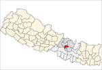
 Aalapot Location in Nepal | |
| Coordinates: 27°45′0″N 85°25′48″E / 27.75000°N 85.43000°ECoordinates: 27°45′0″N 85°25′48″E / 27.75000°N 85.43000°E | |
| Country |
|
| Zone | Bagmati Zone |
| District | Kathmandu District |
| Population (2011) | |
| • Total | 3,159 |
| • Religions | Hindu |
| Time zone | Nepal Time (UTC+5:45) |
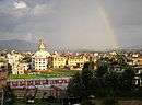
Aalapot is a village development committee in Kathmandu District in the Bagmati Zone of central Nepal. At the time of the 2011 Nepal census it had a population of 3,159 and had 671 houses in it.[1]
Aalapot is located near Sundarijal, Bhadrabas and Gokarna, north east of Kathmandu. Many of the locals of Aalapot and the surrounding villages are compelled to fetch water from the Bagmati River.
References
Headquarter: Kathmandu | |||
 |  | ||
This article is issued from Wikipedia - version of the 3/7/2014. The text is available under the Creative Commons Attribution/Share Alike but additional terms may apply for the media files.