Afrânio
| Afrânio | |
|---|---|
| Municipality | |
| The Municipality of Afrânio | |
|
A square in Extreme, a parish of Afrânio. | |
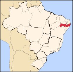
 Afrânio Location in Brazil | |
| Coordinates: 08°30′54″S 41°00′18″W / 8.51500°S 41.00500°WCoordinates: 08°30′54″S 41°00′18″W / 8.51500°S 41.00500°W | |
| Country |
|
| Region | Northeast |
| State |
|
| Founded | December 20, 1963 |
| Government | |
| • Mayor | Carlos Cavalcanti (PTB) |
| Area | |
| • Total | 1,490.6 km2 (575.5 sq mi) |
| Elevation | 522 m (1,713 ft) |
| Population (2009) | |
| • Total | 17,445 |
| • Density | 11.7/km2 (30/sq mi) |
| [1] | |
| Time zone | UTC-3 (UTC-3) |
| HDI (2000) | 0.634 – medium[2] |

Afrânio is a Brazilian municipality in the state of Pernambuco. It is the westernmost municipality of Pernambuco. It is located in the mesoregion of São Francisco Pernambucano . Afrânio has a total area of 1490.6 square kilometers and had an estimated population of 17.445 inhabitants [3] in 2009 according with IBGE.
Geography
- State - Pernambuco
- Region - São Francisco Pernambucano
- Boundaries - Piaui state (N and W); Bahia state (S); Petrolina and Dormentes (E)
- Area - 1490.6 km2
- Elevation - 522 m / 1713 ft
- Hidrography - Pontal River
- Vegetation - Caatinga Hiperxerófila.
- Clima - Semi arid, ( Sertao) - hot and dry
- Yearly average temperature - 24.8 C
- Distance to Recife - 883 km
Economy
The main economic activities in Afrânio are based in general commerce and agribusiness, especially plantations of beans and corn; and creations of sheeps, goats, donkeys and cattle.
Economic Indicators
| Population | GDP x(1000 R$).[4] | GDP pc (R$) | PE |
|---|---|---|---|
| 17.445 | 51.114 | 3.103 | 0.085% |
Economy by Sector 2006
| Primary sector | Secondary sector | Service sector |
|---|---|---|
| 12.24% | 8.18% | 79.58% |
Health Indicators
| HDI (2000) | Hospitals (2007) | Hospitals beds (2007) | Children's Mortality every 1000 (2005) |
|---|---|---|---|
| 0.634 | 1 | 35 | 26.6 |
References
Capital: Recife | ||||||||||||||||||||||||
| Mesoregion Agreste Pernambucano |
|  | ||||||||||||||||||||||
| Mesoregion Mata Pernambucana |
| |||||||||||||||||||||||
| Mesoregion Metropolitana de Recife |
| |||||||||||||||||||||||
| Mesoregion Sao Francisco Pernambucano |
| |||||||||||||||||||||||
| Mesoregion Sertao Pernambucano |
| |||||||||||||||||||||||
This article is issued from Wikipedia - version of the 5/12/2016. The text is available under the Creative Commons Attribution/Share Alike but additional terms may apply for the media files.