Agios Konstantinos, East Attica
| Agios Konstantinos Άγιος Κωνσταντίνος | |
|---|---|
 Agios Konstantinos | |
|
Location within the regional unit 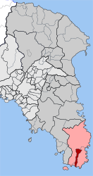 | |
| Coordinates: 37°43′N 24°1′E / 37.717°N 24.017°ECoordinates: 37°43′N 24°1′E / 37.717°N 24.017°E | |
| Country | Greece |
| Administrative region | Attica |
| Regional unit | East Attica |
| Municipality | Lavreotiki |
| • Municipal unit | 10.450 km2 (4.035 sq mi) |
| Elevation | 154 m (505 ft) |
| Population (2011)[1] | |
| • Municipal unit | 728 |
| • Municipal unit density | 70/km2 (180/sq mi) |
| Time zone | EET (UTC+2) |
| • Summer (DST) | EEST (UTC+3) |
| Postal code | 195 00 |
| Vehicle registration | Z |
Agios Konstantinos (Greek: Άγιος Κωνσταντίνος meaning Saint Constantine, before 1954: Καμάριζα - Kamariza[2]) is a village and a former community in East Attica, Greece. Since the 2011 local government reform it is part of the municipality Lavreotiki, of which it is a municipal unit.[3] It was named after Saint Constantine.
Geography
Agios Konstantinos is situated in the hills in the southeastern part of the Attica peninsula, at about 160 m elevation. It is 4 km west of the Aegean Sea coast at Lavrio and 38 km southeast of Athens city centre. The municipal unit has an area of 10.450 km2.[4] There are several mines in the vicinity of Agios Konstantinos and neighboring Lavrio. In antiquity it was known for silver mines, currently minerals including azurite, chalcoalumite, calcite, austinite and adamite are found.
The community Agios Konstantinos also includes the village Esperídes (pop. 69).
Historical population
| Year | Village population | Community population |
|---|---|---|
| 1981 | 428 | - |
| 1991 | 516 | 577 |
| 2001 | 620 | 687 |
| 2011 | 659 | 728 |
See also
References
- ↑ "Απογραφή Πληθυσμού - Κατοικιών 2011. ΜΟΝΙΜΟΣ Πληθυσμός" (in Greek). Hellenic Statistical Authority.
- ↑ Name changes of settlements in Greece
- ↑ Kallikratis law Greece Ministry of Interior (Greek)
- ↑ "Population & housing census 2001 (incl. area and average elevation)" (PDF) (in Greek). National Statistical Service of Greece.
External links
 |
Keratea | Keratea | | |
| |
Lavreotiki | |||
| ||||
| | ||||
| Keratea | Lavreotiki | Lavreotiki |