Akiachak, Alaska
| Akiachak Akiacuaq | |
|---|---|
| Census-designated place | |
 Location of Akiachak, Alaska | |
| Coordinates: 60°53′58″N 161°24′48″W / 60.89944°N 161.41333°W | |
| Country | United States |
| State | Alaska |
| Census Area | Bethel |
| Government | |
| • State senator | Lyman Hoffman (D) |
| • State rep. | Bob Herron (D) |
| Area | |
| • Total | 7.5 sq mi (19.5 km2) |
| • Land | 7.5 sq mi (19.5 km2) |
| • Water | 0 sq mi (0 km2) |
| Elevation | 13 ft (4 m) |
| Population (2010) | |
| • Total | 627 |
| • Density | 83/sq mi (32.1/km2) |
| Time zone | Alaska (AKST) (UTC-9) |
| • Summer (DST) | AKDT (UTC-8) |
| ZIP code | 99551 |
| Area code(s) | 907 |
| FIPS code | 02-00760 |
| GNIS feature ID | 1398011 |
Akiachak (ACK-ee-uh-chuck) (Akiacuaq in Central Yup'ik) is a census-designated place (CDP) in the Bethel Census Area in the U.S. state of Alaska. The population was 627 at the 2010 census.[1]
Geography and climate
Akiachak is located at 60°54′34″N 161°25′53″W / 60.90944°N 161.43139°W (60.909440, -161.43139),[2] Sec. 36, T010N, R069W, Seward Meridian) in the Bethel Recording District.
According to the U.S. Census Bureau, the CDP has a total area of 7.5 square miles (19.5 km2), of which 0.008 square miles (0.02 km2), or 0.11%, is water.[1]
Akiachak is located on the west bank of the Kuskokwim River in the Yukon–Kuskokwim Delta, 18 miles (29 km) northeast of Bethel. The area averages 16 inches (40.64 cm) of precipitation, with snowfall of 50 inches (127.00 cm). Summer temperatures range from 42 to 62 °F (6 to 17 °C). Winter temperatures range from −2 to 19 °F (−19 to −7 °C).
History and culture
The Yup'ik Eskimos used this region as a seasonal subsistence site. Called Akiakchagamiut in the 1890 census, the village had a population of 43 then. A post office was established in 1934. It incorporated as a second-class city on February 7, 1974. The city government was dissolved in 1987, in favor of traditional village council governance.
A federally recognized Alaska Native tribal entity, the Akiachak Native Community, is located here. Akiachak is a Yup'ik Eskimo village with a fishing and subsistence lifestyle. It has a strong traditional community, and was the first city in Alaska to dissolve its city government in favor of the Native village government. The sale, importation and possession of alcohol are banned in the village.
Demographics
As of the census[3] of 2000, there were 585 people, 133 households, and 111 families residing in the CDP. The population density was 86.5 people per square mile (33.4/km2). There were 150 housing units at an average density of 22.2/sq mi (8.6/km2). The racial makeup of the CDP was 3.42% White, 92.31% Native American, and 4.27% from two or more races. 1.20% of the population were Hispanic or Latino of any race.
There were 133 households out of which 63.9% had children under the age of 18 living with them, 59.4% were married couples living together, 15.0% had a female householder with no husband present, and 15.8% were non-families. 14.3% of all households were made up of individuals and 2.3% had someone living alone who was 65 years of age or older. The average household size was 4.40 and the average family size was 4.89.
In the CDP the population was spread out with 44.4% under the age of 18, 9.6% from 18 to 24, 26.5% from 25 to 44, 14.5% from 45 to 64, and 5.0% who were 65 years of age or older. The median age was 22 years. For every 100 females there were 121.6 males. For every 100 females age 18 and over, there were 118.1 males.
The median income for a household in the CDP was $35,833, and the median income for a family was $35,288. Males had a median income of $31,667 versus $18,750 for females. The per capita income for the CDP was $8,321. About 16.2% of families and 21.2% of the population were below the poverty line, including 25.7% of those under age 18 and 34.8% of those age 65 or over.
Currently half of the village is hooked up to a plumbing system. The village is currently working to write a grant in order to receive federal funding to plumb the rest of the village who still use honey buckets and must get their water from the river, rain, or snow. The village would like to purchase an incinerator and use the waste heat for public buildings. Electricity is provided by Akiachak Native Community Electric Co. There is one school located in the community, attended by over 200 students each year and growing. Local hospitals or health clinics include Akiachak Health Clinic. Akiachak Health Clinic is a Primary Health facility - they do not have authorization to prescribe drugs, give birth control, or handle much more than colds, small cuts, or routine strep throat treatment which is pervasive in the community. Most live births, birth control, injury, or serious illness will be referred to the Bethel hospital or patients may be air lifted to Anchorage in serious cases. Akiachak is classified as an isolated village. It is found in EMS Region 7A in the Yukon/Kuskokwim Region. Emergency Services have river and air access. Emergency service is provided by a health aide.
Economy and transportation
The majority of year-round employment in Akiachak is in education and other public services. The Yupiit School District headquarters are located in the community. Residents rely on seasonal employment such as commercial fishing, construction and BLM fire-fighting. 70 residents hold commercial fishing permits, and some work at canneries in Bristol Bay. The community is developing a fish processing facility and freezer. Subsistence activities provide most food sources. Poor fish returns since 1997 have significantly affected the community.
A state-owned 1,649-foot (503 m) long by 40-foot (12 m) wide gravel airstrip and public seaplane facilities provide scheduled and chartered services year-round to Akiachak. Relocation of the Akiachak Airport is planned for the future. Arctic Circle Air Service, Grant Aviation and Hageland Aviation offer passenger flight service. Boats, snowmachines and ATVs are used extensively by locals on the Kuskokwim River. A winter trail exists to Bethel (19 mi). Barges deliver bulk fuel and supplies during the summer.
References
- 1 2 "Geographic Identifiers: 2010 Demographic Profile Data (G001): Akiachak CDP, Alaska". U.S. Census Bureau, American Factfinder. Retrieved September 20, 2013.
- ↑ "US Gazetteer files: 2010, 2000, and 1990". United States Census Bureau. 2011-02-12. Retrieved 2011-04-23.
- ↑ "American FactFinder". United States Census Bureau. Archived from the original on 2013-09-11. Retrieved 2008-01-31.
External links
- Akiachak at the Community Database Online from the Alaska Division of Community and Regional Affairs
- Maps from the Alaska Department of Labor and Workforce Development: 2000, 2010
- New York Times article on Akiachak, Alaska
Coordinates: 60°54′34″N 161°25′53″W / 60.909440°N 161.43139°W
Municipalities and communities of Bethel Census Area, Alaska, United States | ||
|---|---|---|
| Cities | 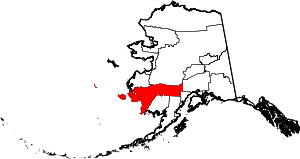 | |
| CDPs | ||
| Unincorporated communities | ||
| Ghost towns | ||
| Neighborhoods | ||