Al-Janiya
| al-Janiya | |
|---|---|
| Other transcription(s) | |
| • Arabic | الجانيه |
 | |
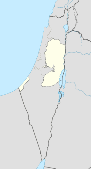 al-Janiya Location of al-Janiya within the Palestinian territories | |
| Coordinates: 31°56′18″N 35°07′19″E / 31.93833°N 35.12194°ECoordinates: 31°56′18″N 35°07′19″E / 31.93833°N 35.12194°E | |
| Palestine grid | 161/149 |
| Governorate | Ramallah & al-Bireh |
| Government | |
| • Type | Village council |
| Population (2006) | |
| • Jurisdiction | 1,170 |
| Name meaning | "to gather fruit"[1] |
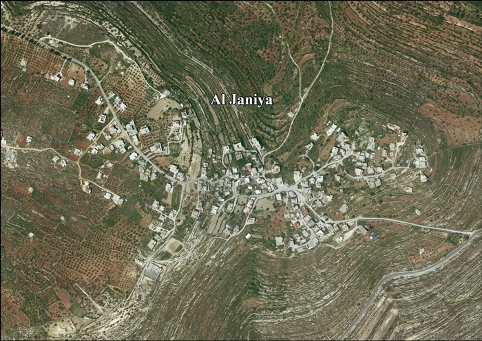
Al-Janiya (Arabic: الجانيه) is a Palestinian village in the Ramallah and al-Bireh Governorate located 8 kilometers northwest of Ramallah in the northern West Bank. According to the Palestinian Central Bureau of Statistics (PCBS), the village had a population of 1,400 inhabitants by late 2014.[2]
History
Shards have been found here from Iron Age II, Hellenistic, Roman and Byzantine era have been found here.[3]
It has been suggested that Al-Janiya was the Crusader site named Megina.[4] Shards have also been found here from the Crusader/Ayyubid and Mamluk eras.[3] There are Arabic and Greek inscriptions in the village mosque, which has been dated to 731 A.H.[3][5][6][7]
Ottoman era
Shards have been found here from the early Ottoman era. [3]
Al-Janiya, together with er-Ras, were the chief towns for the ruling family of Simhan. The chief Sheikh of the Simhan family was Isma'il, who was killed by Ibrahim Pasha in the 1834 uprising. After Isma'il, Hasan es-Sa'id and Mohammah ibn Isma'il became the rulers.[8]
In 1870, Victor Guérin found it to be a village of 400 inhabitants, all Muslims except a few "Grec schismatique". He also suggested that the mosque stood on the site of a previous church.[9]
In 1882, the Palestine Exploration Fund's Survey of Western Palestine (SWP) described it: "A small village on high ground, with two Mukams and a well on the east; on the north is a modern graveyard. Olives exist round."[10]
British era
In the 1922 census of Palestine conducted by the British Mandate authorities, Al-Janiya had a population of 180; 177 Muslims and 3 Orthodox Christians.[11][12] This had increased by the time of the 1931 census to 250, 245 Muslims and 5 Christians, in 60 houses.[13]
In 1945 the population was 300, all Muslims,[14] while the total land area was 7,565 dunams, according to an official land and population survey.[15] Of this, 2,961 were plantations and irrigable land, 2,423 for cereals,[16] while 40 dunams were classified as built-up areas.[17]
1948-1967
In the wake of the 1948 Arab–Israeli War, and after the 1949 Armistice Agreements, Al-Janiya came under Jordanian rule.
Post-1967
After the Six-Day War in 1967, Al-Janiya has been under Israeli occupation.
Farming on local land is now difficult, since Israeli authorities have declared much of it, enclosing olive groves, a 'closed military zone', which Palestinian farmers are allowed to access on average only two days a year, and many of the trees are uprooted by settlers.[2]
In November, 2016, a dozen Israeli settlers attacked 5 Palestinian farmers while they were harvesting their olives. The settlers shouted 'death to Arabs', and were armed with knives and clubs. After beating them up, they returned to an outpost below Neria, Mateh Binyamin.[18]
References
- ↑ Palmer, 1881, p. 229
- 1 2 'Denied land access, Palestinians miss olive harvest,' Ma'an News Agency 29 October 2014.
- 1 2 3 4 Finkelstein et al., 1997, p. 314
- ↑ de Roziére, 1849, pp. 223-224, No. 120; cited in Röhricht, 1893, RRH, p. 50, No 200; cited in Finkelstein et al., 1997, p. 314
- ↑ Wright, 1903, pp. 180–181
- ↑ Peters, 1903, pp. 30-31
- ↑ Peters, 1904, pp. 384–385
- ↑ Macalister and Masterman, 1905, p. 354
- ↑ Guérin, 1875, p. 83
- ↑ Conder and Kitchener, 1882, SWP II, p. 294
- ↑ Barron, 1923, Table VII, Sub-district of Ramallah, p. 16
- ↑ Barron, 1923, Table XIV, p. 45
- ↑ Mills, 1932, p. 49.
- ↑ Department of Statistics, 1945, p. 26
- ↑ Government of Palestine, Department of Statistics. Village Statistics, April, 1945. Quoted in Hadawi, 1970, p. 64
- ↑ Government of Palestine, Department of Statistics. Village Statistics, April, 1945. Quoted in Hadawi, 1970, p. 112
- ↑ Government of Palestine, Department of Statistics. Village Statistics, April, 1945. Quoted in Hadawi, 1970, p. 162
- ↑ A pogrom shakes a Palestinian village strangled by Israeli settlements, By Gideon Levy and Alex Levac, Nov. 11, 2016, Haaretz
Bibliography
- Barron, J. B., ed. (1923). Palestine: Report and General Abstracts of the Census of 1922. Government of Palestine.
- Conder, Claude Reignier; Kitchener, H. H. (1882). The Survey of Western Palestine: Memoirs of the Topography, Orography, Hydrography, and Archaeology. 2. London: Committee of the Palestine Exploration Fund.
- Department of Statistics (1945). Village Statistics, April, 1945. Government of Palestine.
- Finkelstein, Israel; Lederman, Zvi, eds. (1997). Highlands of many cultures. Tel Aviv: Institute of Archaeology of Tel Aviv University Publications Section. ISBN 965-440-007-3.
- Guérin, Victor (1875). Description Géographique Historique et Archéologique de la Palestine (in French). 2: Samarie, pt. 2. Paris: L'Imprimerie Nationale.
- Hadawi, Sami (1970). Village Statistics of 1945: A Classification of Land and Area ownership in Palestine. Palestine Liberation Organization Research Center.
- Mills, E., ed. (1932). Census of Palestine 1931. Population of Villages, Towns and Administrative Areas (PDF). Jerusalem: Government of Palestine.
- Palmer, E. H. (1881). The Survey of Western Palestine: Arabic and English Name Lists Collected During the Survey by Lieutenants Conder and Kitchener, R. E. Transliterated and Explained by E.H. Palmer. Committee of the Palestine Exploration Fund.
- Peters, J. P. (1903). "Palestinian exploration". JBL. 22: 15–31.
- Peters, J. P. (1904). "Visit to Kefr Shiyan, Janieh, and neighbourhoods". Quarterly statement - Palestine Exploration Fund. 36: 377–385.
- de Roziére, ed. (1849). Cartulaire de l'église du Saint Sépulchre de Jérusalem: publié d'après les manuscrits du Vatican (in Latin and French). Paris: Imprimerie nationale.
- Röhricht, Reinhold (1893). (RRH) Regesta regni Hierosolymitani (MXCVII-MCCXCI) (in Latin). Berlin: Libraria Academica Wageriana.
- Stuart Macalister, R. A.; Mastermind, E. W. G. (1905). "The modern inhabitants of Palestine". Quarterly statement - Palestine Exploration Fund. 37: 343–356.
- Wright, T. F. (1904). "Inscription at Janiah". Quarterly statement - Palestine Exploration Fund. 36: 180–181.
External links
- Welcome To al-Janiya
- Survey of Western Palestine, Map 14: IAA, Wikimedia commons
- Al Janiya Village (Fact Sheet), Applied Research Institute - Jerusalem (ARIJ)
- Al Janiya Village Profile, Applied Research Institute - Jerusalem (ARIJ)
- Al Janiya, aerial photo, Applied Research Institute - Jerusalem (ARIJ)
- Locality Development Priorities and Needs in Al Janiya Village, Applied Research Institute - Jerusalem (ARIJ)
| Cities |  | |
|---|---|---|
| Municipalities |
| |
| Village councils |
| |
| Refugee camps | ||