Alba, Missouri
| Alba, Missouri | |
|---|---|
| City | |
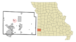 Location within Jasper County and Missouri | |
| Coordinates: 37°14′10″N 94°25′2″W / 37.23611°N 94.41722°WCoordinates: 37°14′10″N 94°25′2″W / 37.23611°N 94.41722°W | |
| Country | United States |
| State | Missouri |
| County | Jasper |
| Area[1] | |
| • Total | 0.33 sq mi (0.85 km2) |
| • Land | 0.33 sq mi (0.85 km2) |
| • Water | 0 sq mi (0 km2) |
| Elevation | 991 ft (302 m) |
| Population (2010)[2] | |
| • Total | 555 |
| • Estimate (2012[3]) | 539 |
| • Density | 1,700/sq mi (650/km2) |
| Time zone | Central (CST) (UTC-6) |
| • Summer (DST) | CDT (UTC-5) |
| ZIP code | 64830 |
| Area code(s) | 417 |
| FIPS code | 29-00496[4] |
| GNIS feature ID | 0713184[5] |
Alba is a city in Jasper County, Missouri, United States. The population was 555 at the 2010 census.
History
Alba was platted in 1882.[6] An early postmaster gave the community his last name.[7] A post office called Alba has been in operation since 1860.[8]
Geography
Alba is located at 37°14′10″N 94°25′2″W / 37.23611°N 94.41722°W (37.236228, -94.417228).[9] According to the United States Census Bureau, the city has a total area of 0.33 square miles (0.85 km2), all of it land.[1]
Demographics
| Historical population | |||
|---|---|---|---|
| Census | Pop. | %± | |
| 1920 | 470 | — | |
| 1930 | 354 | −24.7% | |
| 1940 | 318 | −10.2% | |
| 1950 | 352 | 10.7% | |
| 1960 | 336 | −4.5% | |
| 1970 | 365 | 8.6% | |
| 1980 | 474 | 29.9% | |
| 1990 | 465 | −1.9% | |
| 2000 | 588 | 26.5% | |
| 2010 | 555 | −5.6% | |
| Est. 2015 | 539 | [10] | −2.9% |
Alba is part of the Joplin, Missouri Metropolitan Statistical Area.
2010 census
As of the census[2] of 2010, there were 555 people, 227 households, and 167 families residing in the city. The population density was 1,681.8 inhabitants per square mile (649.3/km2). There were 251 housing units at an average density of 760.6 per square mile (293.7/km2). The racial makeup of the city was 94.4% White, 0.7% African American, 1.8% Native American, and 3.1% from two or more races. Hispanic or Latino of any race were 2.3% of the population.
There were 227 households of which 40.1% had children under the age of 18 living with them, 51.1% were married couples living together, 16.3% had a female householder with no husband present, 6.2% had a male householder with no wife present, and 26.4% were non-families. 24.7% of all households were made up of individuals and 9.7% had someone living alone who was 65 years of age or older. The average household size was 2.44 and the average family size was 2.84.
The median age in the city was 36.1 years. 25.9% of residents were under the age of 18; 7.5% were between the ages of 18 and 24; 28.9% were from 25 to 44; 24.5% were from 45 to 64; and 12.8% were 65 years of age or older. The gender makeup of the city was 47.7% male and 52.3% female.
2000 census
As of the census[4] of 2000, there were 588 people, 184 households, and 142 families residing in the city. The population density was 1,796.2 people per square mile (688.0/km²). There were 202 housing units at an average density of 617.1 per square mile (236.3/km²). The racial makeup of the city was 94.39% White, 0.68% African American, 3.23% Native American, 0.34% Asian, 0.17% from other races, and 1.19% from two or more races. Hispanic or Latino of any race were 0.34% of the population.
There were 184 households out of which 45.1% had children under the age of 18 living with them, 60.9% were married couples living together, 10.9% had a female householder with no husband present, and 22.8% were non-families. 19.0% of all households were made up of individuals and 9.8% had someone living alone who was 65 years of age or older. The average household size was 2.83 and the average family size was 3.23.
In the city the population was spread out with 29.8% under the age of 18, 15.5% from 18 to 24, 28.6% from 25 to 44, 19.4% from 45 to 64, and 6.8% who were 65 years of age or older. The median age was 29 years. For every 100 females there were 90.9 males. For every 100 females age 18 and over, there were 79.6 males.
The median income for a household in the city was $30,333, and the median income for a family was $32,500. Males had a median income of $23,625 versus $16,364 for females. The per capita income for the city was $11,588. About 9.5% of families and 15.2% of the population were below the poverty line, including 18.2% of those under age 18 and 19.4% of those age 65 or over.
Notable people
References
- 1 2 "US Gazetteer files 2010". United States Census Bureau. Archived from the original on 2012-01-24. Retrieved 2012-07-08.
- 1 2 "American FactFinder". United States Census Bureau. Retrieved 2012-07-08.
- ↑ "Population Estimates". United States Census Bureau. Archived from the original on 2013-06-17. Retrieved 2013-05-30.
- 1 2 "American FactFinder". United States Census Bureau. Archived from the original on 2013-09-11. Retrieved 2008-01-31.
- ↑ "US Board on Geographic Names". United States Geological Survey. 2007-10-25. Retrieved 2008-01-31.
- ↑ Eaton, David Wolfe (1916). How Missouri Counties, Towns and Streams Were Named. The State Historical Society of Missouri. p. 178.
- ↑ "Jasper County Place Names, 1928–1945 (archived)". The State Historical Society of Missouri. Retrieved 17 October 2016.
- ↑ "Post Offices". Jim Forte Postal History. Retrieved 17 October 2016.
- ↑ "US Gazetteer files: 2010, 2000, and 1990". United States Census Bureau. 2011-02-12. Retrieved 2011-04-23.
- ↑ "Annual Estimates of the Resident Population for Incorporated Places: April 1, 2010 to July 1, 2015". Retrieved July 2, 2016.
Municipalities and communities of Jasper County, Missouri, United States | ||
|---|---|---|
| Cities | 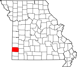 | |
| Villages | ||
| Townships | ||
| Unincorporated communities | ||
| Ghost town | ||
| Footnotes | ‡This populated place also has portions in an adjacent county or counties | |