Alberton, Montana
| Alberton, Montana | |
|---|---|
| Town | |
|
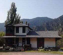
Antique Shop in Alberton, Montana | |
 Location of Alberton, Montana | |
| Coordinates: 47°0′13″N 114°28′41″W / 47.00361°N 114.47806°WCoordinates: 47°0′13″N 114°28′41″W / 47.00361°N 114.47806°W | |
| Country | United States |
| State | Montana |
| County | Mineral |
| Area[1] | |
| • Total | 0.60 sq mi (1.55 km2) |
| • Land | 0.57 sq mi (1.48 km2) |
| • Water | 0.03 sq mi (0.08 km2) |
| Elevation | 3,054 ft (931 m) |
| Population (2010)[2] | |
| • Total | 420 |
| • Estimate (2015)[3] | 424 |
| • Density | 736.8/sq mi (284.5/km2) |
| Time zone | Mountain (MST) (UTC-7) |
| • Summer (DST) | MDT (UTC-6) |
| ZIP code | 59820 |
| Area code(s) | 406 |
| FIPS code | 30-00700 |
| GNIS feature ID | 0801984 |
Alberton is a town in Mineral County, Montana, United States. The population was 420 at the 2010 census. It was named for Albert J. Earling, president of the Chicago, Milwaukee, St. Paul and Pacific Railroad.[4] Alberton was the location of a major chlorine chemical release in 1996. Alberton is the home of Northwest Indian Bible School, a Bible-training institution founded and operated by the Allegheny Wesleyan Methodist Connection (Original Allegheny Conference.)
History
The town celebrates its railroad heritage each year with "Alberton's Railroad Day", held the third Saturday in July. July 18, 2015 marked the 30th anniversary of this community event. There is a home-town parade, petting zoo, railroad car tour, wool spinning circle, western melodrama, family games like Hunt for the Golden Spike and music from local artists. Vendors showcase their artistic talents using local rocks, minerals, and other wildcrafting materials. Educational activities are sponsored by the Alberton Community Foundation).
On April 11, 1996, a Montana Rail Link train carrying chlorine derailed near Alberton.[5][6] Three hundred fifty people were injured by chlorine inhalation. One thousand people were evacuated from Alberton and from Frenchtown. Interstate 90 was shut down for nineteen days. The incident has been described as "the largest chemical spill from a train in United States history."[7]
Geography
.jpg)
Alberton is located at 47°0′13″N 114°28′41″W / 47.00361°N 114.47806°W (47.003546, -114.477977).[8]
According to the United States Census Bureau, the town has a total area of 0.60 square miles (1.55 km2), of which, 0.57 square miles (1.48 km2) is land and 0.03 square miles (0.08 km2) is water.[1]
Climate
Alberton has a cool-summer humid continental climate (Köppen Dfb).
| Climate data for Alberton (1958-2012) | |||||||||||||
|---|---|---|---|---|---|---|---|---|---|---|---|---|---|
| Month | Jan | Feb | Mar | Apr | May | Jun | Jul | Aug | Sep | Oct | Nov | Dec | Year |
| Record high °F (°C) | 57 (14) |
60 (16) |
80 (27) |
87 (31) |
93 (34) |
100 (38) |
105 (41) |
105 (41) |
98 (37) |
87 (31) |
71 (22) |
58 (14) |
105 (41) |
| Average high °F (°C) | 32.9 (0.5) |
40.1 (4.5) |
48.6 (9.2) |
58 (14) |
67.4 (19.7) |
75.3 (24.1) |
86.8 (30.4) |
85.4 (29.7) |
73.5 (23.1) |
58.2 (14.6) |
42.5 (5.8) |
33.3 (0.7) |
58.5 (14.7) |
| Average low °F (°C) | 17.6 (−8) |
21.7 (−5.7) |
25.3 (−3.7) |
31 (−1) |
37.9 (3.3) |
45 (7) |
48.9 (9.4) |
47.6 (8.7) |
40.2 (4.6) |
32.1 (0.1) |
25.3 (−3.7) |
19.5 (−6.9) |
32.7 (0.4) |
| Record low °F (°C) | −28 (−33) |
−20 (−29) |
−7 (−22) |
12 (−11) |
21 (−6) |
29 (−2) |
31 (−1) |
32 (0) |
21 (−6) |
1 (−17) |
−12 (−24) |
−29 (−34) |
−29 (−34) |
| Average precipitation inches (mm) | 1.99 (50.5) |
1.29 (32.8) |
1.56 (39.6) |
1.6 (41) |
1.9 (48) |
2.27 (57.7) |
0.78 (19.8) |
1.03 (26.2) |
1.29 (32.8) |
1.58 (40.1) |
1.77 (45) |
1.46 (37.1) |
18.52 (470.4) |
| Average snowfall inches (cm) | 12.5 (31.8) |
7.8 (19.8) |
7.1 (18) |
1.1 (2.8) |
0.1 (0.3) |
0 (0) |
0 (0) |
0 (0) |
0.1 (0.3) |
0.4 (1) |
5.6 (14.2) |
7.9 (20.1) |
42.6 (108.2) |
| Average precipitation days | 14 | 10 | 13 | 12 | 12 | 12 | 5 | 6 | 8 | 10 | 12 | 13 | 127 |
| Source: WRCC[9] | |||||||||||||
Demographics
| Historical population | |||
|---|---|---|---|
| Census | Pop. | %± | |
| 1930 | 276 | — | |
| 1940 | 283 | 2.5% | |
| 1950 | 326 | 15.2% | |
| 1960 | 356 | 9.2% | |
| 1970 | 363 | 2.0% | |
| 1980 | 368 | 1.4% | |
| 1990 | 354 | −3.8% | |
| 2000 | 374 | 5.6% | |
| 2010 | 420 | 12.3% | |
| Est. 2015 | 424 | [10] | 1.0% |
| U.S. Decennial Census[11] 2015 Estimate[3] | |||
2010 census
As of the census[2] of 2010, there were 420 people, 190 households, and 113 families residing in the town. The population density was 736.8 inhabitants per square mile (284.5/km2). There were 202 housing units at an average density of 354.4 per square mile (136.8/km2). The racial makeup of the town was 96.0% White, 1.0% African American, 0.7% Native American, 0.2% from other races, and 2.1% from two or more races. Hispanic or Latino of any race were 1.9% of the population.
There were 190 households of which 26.3% had children under the age of 18 living with them, 46.3% were married couples living together, 9.5% had a female householder with no husband present, 3.7% had a male householder with no wife present, and 40.5% were non-families. 33.2% of all households were made up of individuals and 15.7% had someone living alone who was 65 years of age or older. The average household size was 2.21 and the average family size was 2.81.
The median age in the town was 43.3 years. 19% of residents were under the age of 18; 7.7% were between the ages of 18 and 24; 25.8% were from 25 to 44; 30.1% were from 45 to 64; and 17.6% were 65 years of age or older. The gender makeup of the town was 53.1% male and 46.9% female.
2000 census
As of the census[12] of 2000, there were 374 people, 152 households, and 108 families residing in the town. The population density was 652.7 people per square mile (253.3/km²). There were 175 housing units at an average density of 305.4 per square mile (118.5/km²). The racial makeup of the town was 97.59% White, 0.27% African American, 1.07% Native American, 0.27% from other races, and 0.80% from two or more races. Hispanic or Latino of any race were 0.53% of the population.
There were 152 households out of which 35.5% had children under the age of 18 living with them, 60.5% were married couples living together, 6.6% had a female householder with no husband present, and 28.3% were non-families. 23.7% of all households were made up of individuals and 3.9% had someone living alone who was 65 years of age or older. The average household size was 2.46 and the average family size was 2.88.
In the town the population was spread out with 27.0% under the age of 18, 5.9% from 18 to 24, 32.1% from 25 to 44, 26.7% from 45 to 64, and 8.3% who were 65 years of age or older. The median age was 36 years. For every 100 females there were 96.8 males. For every 100 females age 18 and over, there were 103.7 males.
The median income for a household in the town was $26,000, and the median income for a family was $26,500. Males had a median income of $24,792 versus $20,000 for females. The per capita income for the town was $13,120. About 19.6% of families and 19.6% of the population were below the poverty line, including 25.2% of those under age 18 and 3.7% of those age 65 or over.
School
Alberton School began as a wooden, one room school house in the early 1900s. In 1916 there was a fire that burned down the original school. In 1920 a new brick building was built, this later became the elementary school building. The brick building is part of the National Register of Historical Places.[13] The current high school building is only 50 ft from the elementary building and is roughly octagonal in shape. Both buildings have two stories and are connected by an underground tunnel. The school's mascot is the Panthers and they have football, volleyball, boys and girls basketball and track and field on campus. The school also participates in wrestling, tennis and golf as part of cooperatives with other schools in the area. The school transferred from 8 man to 6 man football in 2010.
See also
References
- 1 2 "US Gazetteer files 2010". United States Census Bureau. Archived from the original on 2012-01-24. Retrieved 2012-12-18.
- 1 2 "American FactFinder". United States Census Bureau. Retrieved 2012-12-18.
- 1 2 "Population Estimates". United States Census Bureau. Retrieved July 23, 2016.
- ↑ "Origins of Names on Milwaukee". Roundup Record-Tribune & Winnett Times. August 22, 1940. p. 6. Retrieved 27 April 2015.
- ↑ “Railroad Accident Brief Report. LAX 96 FR 010. Derailment and Hazardous Materials Release with Fatality. Montana Rail Link, Alberton, Montana, April 11, 1966.” National Transportation Safety Board, August 18, 1998.
- ↑ “CMCR Campaign: Alberton, Montana Train Spill.” Journal of the Wild Rockies. Accessed May 3, 2015.
- ↑ Kato, Dillon. "Workshop Uses 1996 Alberton Chlorine Spill to Teach Emergency Management.” Missoulian, May 3, 2015.
- ↑ "US Gazetteer files: 2010, 2000, and 1990". United States Census Bureau. 2011-02-12. Retrieved 2011-04-23.
- ↑ "ALBERTON, MT (240075)". Western Regional Climate Center. Retrieved December 4, 2015.
- ↑ "Annual Estimates of the Resident Population for Incorporated Places: April 1, 2010 to July 1, 2015". Retrieved July 2, 2016.
- ↑ "Census of Population and Housing". Census.gov. Archived from the original on May 11, 2015. Retrieved July 23, 2016.
- ↑ "American FactFinder". United States Census Bureau. Archived from the original on 2013-09-11. Retrieved 2008-01-31.
- ↑ Information from a linked document listing Historic Sites in Mineral County. Historical Society - National Register of Historic Places
Municipalities and communities of Mineral County, Montana, United States | ||
|---|---|---|
| Towns | 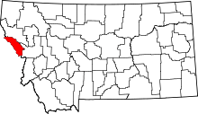 | |
| CDPs | ||
| Unincorporated communities | ||